
Fort Howard in Edgemere in Baltimore County, Maryland — The American Northeast (Mid-Atlantic)
Battery Clagett
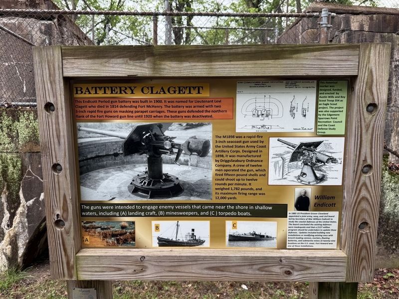
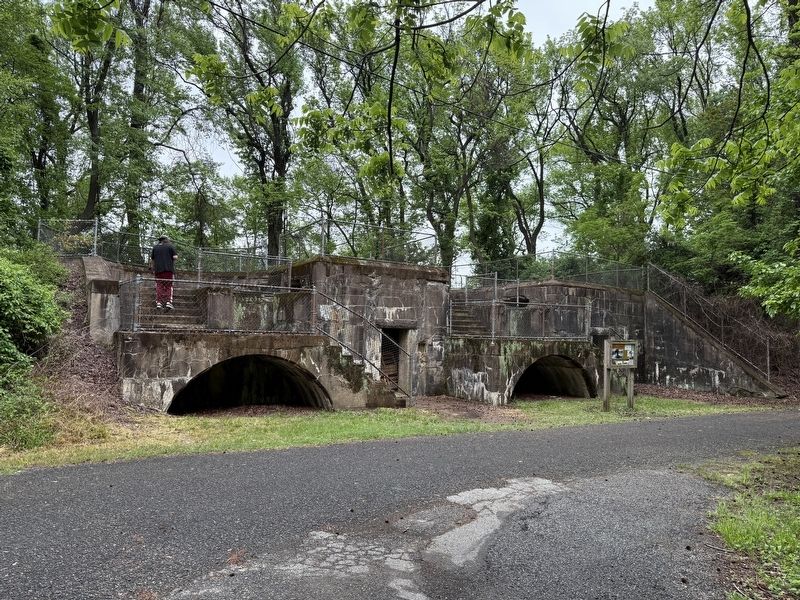
This Endicott Period gun battery was built in 1900. It was named for Lieutenant Levi Clagett who died in 1814 defending Fort McHenry. The battery was armed with two 3-inch rapid fire guns on masking parapet carriages. These guns defended the northern flank of the Fort Howard gun line until 1920 when the battery was deactivated.
The M1898 was a rapid-fire 3-inch seacoast gun used by the United States Army Coast Artillery Corps. Designed in 1898, it was manufactured by DriggsSeabury Ordnance Company. A crew of twelve men operated the gun, which fired fifteen pound shells and could shoot up to twelve rounds per minute. It weighed 1,782 pounds, and its maximum firing range was 12,000 yards.
The guns were intended to engage enemy vessels that came near the shore in shallow waters, including (A) landing craft, (B) minesweepers, and (C) torpedo boats.
William Endicott
In 1885 US President Grover Cleveland appointed a joint army, navy, and civil board led by Secretary of War William Endicott to study the coastal defenses of the United States. The board concluded the existing defenses were inadequate and that a $127 million program should be undertaken to update those defenses. Updates included building new installations or modifying existing ones with breech-loading cannon, mortars, floating batteries, and submarine mines at twenty-nine locations on the U.S. coast. Fort Howard was one of those installations.
Erected by Austin
this page online
Topics and series. This historical marker is listed in these topic lists: Forts and Castles • Waterways & Vessels. In addition, it is included in the Former U.S. Presidents: #22 and #24 Grover Cleveland series list. A significant historical year for this entry is 1900.
Location. 39° 11.916′ N, 76° 26.412′ W. Marker is in Edgemere, Maryland, in Baltimore County. It is in Fort Howard. It can be reached from Patsco Street east of Fort Howard Park Road, on the right when traveling east. Touch for map. Marker is in this post office area: Fort Howard MD 21052, United States of America. Touch for directions.

Regionally, this marker is in the Baltimore Metro Region and in Central Maryland. It is also in the American Mid-Atlantic, in the Chesapeake Bay Region, and on the Eastern Seaboard. Globally, it is in the North Atlantic Region, North America, the Western Hemisphere, the Western World, and the Anglosphere. Historically, it finds itself in what was once one of the original
Other nearby markers. At least 8 other markers are within walking distance of this marker: Civilian Contractors at Fort Howard (within shouting distance of this marker); Fire Control Towers (within shouting distance of this marker); Duc Huc (about 300 feet away, measured in a direct line); Harbor Defense: Controlled Mines and the Mine Casemate (about 500 feet away); Power House (about 600 feet away); Battery Key (about 600 feet away); Life at Fort Howard 1920-1940 - The 12th Infantry (about 800 feet away); Fort Howard During World War I (about 800 feet away). Touch for a list and map of all markers in Edgemere.
Another marker is no longer nearby. Battery Clagett (was a few steps from this marker but has been replaced with another marker now near it).
Related marker. Click here for another marker that is related to this marker. This marker has replaced the linked marker.
Credits. This page was last revised on May 5, 2025. It was originally submitted on May 5, 2025, by Devry Becker Jones of Washington, District of Columbia. This page has been viewed 134 times since then and 20 times this year. Photos: 1, 2. submitted on May 5, 2025, by Devry Becker Jones of Washington, District of Columbia.
