
Council Bluffs in Pottawattamie County, Iowa — The American Midwest (Upper Plains)
Power...Place...Partnerships...People
Photographed by McGhiever, November 16, 2024
1. Power...Place...Partnerships...People Marker
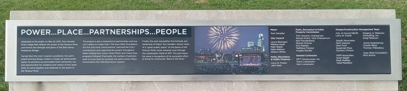
Dedicated to the public on May 22, 2013, Tom Hanafan River's Edge Park reflects the power of the Missouri River and mirrors the strength and grace of the Bob Kerrey Pedestrian Bridge.
Carved from the river's riparian woodlands, the park's award-winning design creates a simple yet grand public space. Its elements accommodate both community use and opportunities for residents and visitors of two great cities to come together and celebrate on the banks of the Missouri River.
The project is also a testament to partnerships and one city's ability to create them. The Iowa West Foundation, the first and most crucial partner, matched the City's contributions and supported the project throughout. Major funding from Iowa's Great Places and Vision Iowa programs followed. Eventually, the number of partners grew to more than six hundred; the park's Donor Plaza memorializes this individual donor support.
Finally, this park exemplifies the fortitude and leadership of Mayor Tom Hanafan, whose vision of a "green public space" on the banks of the Missouri River never wavered, even through the catastrophic flood of 2011. This park
this page online
Mayor
Tom Hanafan
City Council
Lynne Branigan · Melissa Head · Matt Walsh · Nate Watson · Sharon White
Parks, Recreation & Public Property
Larry N. Foster · John Batt
Parks, Recreation & Public Property Commission
Tom Howard, Chairperson · Steven Krohn, Vice-Chairperson · Ken Freudenberg · Sharon Kramer · Kris Madsen · Matthew Preston · Angela Stoufer
General Contractor
MFT Construction, Inc.
Travis Lienemann · Vern Lienemann
Design/Construction Management Team
City of Council Bluffs
Larry N. Foster
Sasaki Associates
Mark Dawson · Gina Ford · Susannah Ross · Zachary Chrisco
HGM Associates
Scott Reelfs · Mark Muffley · Todd Maiellaro
Gregory A. Peterson Consulting, Inc.
Greg Peterson
Alvine Engineering
Charlie Werp · Thomas Thibodeau
Iowa West Foundation
Rich Sorich
Topics. This historical marker is listed in these topic lists: Charity & Public Work • Disasters • Parks & Recreational Areas. A significant historical year for this entry is 2013.
Location. 41° 15.795′ N, 95° 55.062′ W. Marker
Photographed by McGhiever, November 16, 2024
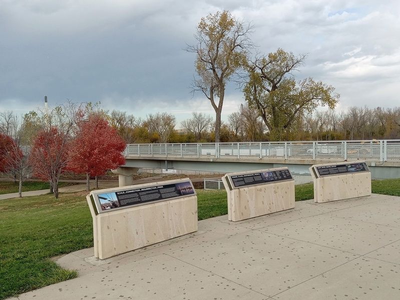
2. Power...Place...Partnerships...People Marker (center) in Tom Hanafan River's Edge Park

Regionally, this marker is in Western Iowa, in Loess Hills, and in Greater Omaha. It is also in the American Midwest, in the Lewis & Clark Corridor, and in the Corn Belt. Globally, it is in North America, the Western Hemisphere, the Western World, and the Anglosphere. Historically, it finds itself in what was once the territory of the Mississippian Culture and also the Louisiana Purchase.
Other nearby markers. At least 8 other markers are within walking distance of this marker: Scale…Connection…Resurrection…Pride (here, next to this marker); A River of Change (approx. 0.3 miles away in Nebraska); Missouri River Flood (approx. 0.3 miles away in Nebraska); Labor (approx. 0.3 miles away in Nebraska); Missouri River Flooding (approx. 0.3 miles away in Nebraska); Captain William Clark and Private Reuben Field (approx. 0.3 miles away in Nebraska); Westwardly by the Waters (approx. 0.3 miles away in Nebraska); Union Walk (approx. 0.3 miles away in Nebraska).
Credits. This page was last revised on May 6, 2025. It was originally submitted on May 6, 2025, by McGhiever of Minneapolis, Minnesota. This page has been viewed 141 times since then and 20 times this year. Photos: 1, 2. submitted on May 6, 2025, by McGhiever of Minneapolis, Minnesota.
