Adams Township near Cambridge in Guernsey County, Ohio — The American Midwest (Great Lakes)
“S” Bridge
Old National Road
| — | Built about 1828 | — |
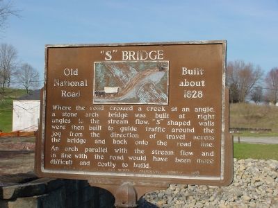
Photographed by J. J. Prats, April 10, 2006
1. "S" Bridge Marker
Erected 1954 by Ohio Society of Professional Engineers.
Topics and series. This historical marker is listed in this topic list: Bridges & Viaducts. In addition, it is included in the The Historic National Road series list. A significant historical year for this entry is 1828.
Location. Marker is missing. It was located near 40° 0.629′ N, 81° 39.466′ W. Marker was near Cambridge, Ohio, in Guernsey County. It was in Adams Township. It was at the intersection of Glenn Highway (U.S. 40) and Peters Creek Road (County Route 416), on the left on Glenn Highway. Marker is at S Bridge Park. Touch for map. Marker was at or near this postal address: 4633 Glenn Hwy, Cambridge OH 43725, United States of America. Touch for directions.

Regionally, this marker was in the
this page online
Other nearby markers. At least 8 other markers are within 4 miles of this location, measured as the crow flies: Peter's Creek "S" Bridge (within shouting distance of this marker); S Bridge Renovation (within shouting distance of this marker); Peters Creek S-Bridge (within shouting distance of this marker); Peters Creek Mile Marker (within shouting distance of this marker); Cambridge (approx. 3.1 miles away); Old Covered Bridge (approx. 3.4 miles away); The Tingle Tavern (approx. 3.6 miles away); a different marker also named Cambridge (approx. 3.6 miles away). Touch for a list and map of all markers in Cambridge.
Also see . . . S-Bridges. Ohio History Central website entry (Submitted on July 4, 2022, by Larry Gertner of New York, New York.)
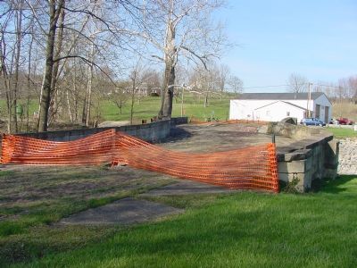
Photographed by J. J. Prats, April 10, 2006
2. The "S" Bridge
The roadway at the eastern side of the arch has collapsed.
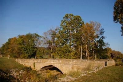
Photographed by Christopher Busta-Peck, September 23, 2007
3. Peter's Creek Bridge as it is today
The historic marker is on the far left.
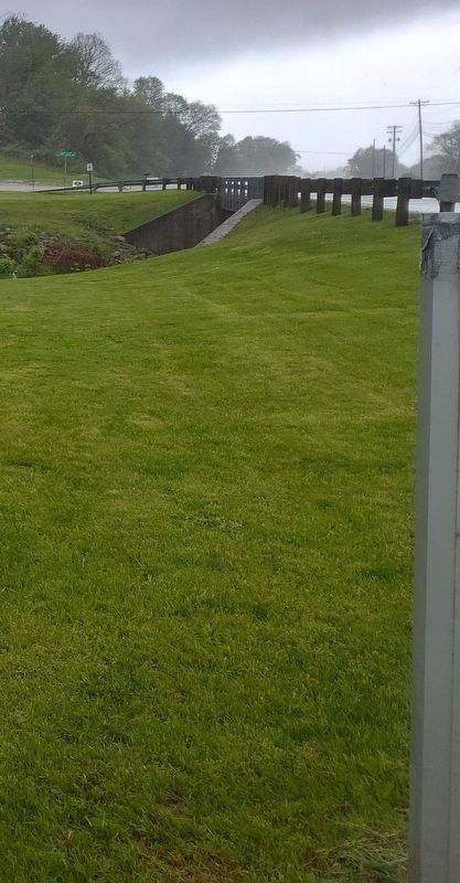
Photographed by Craig Doda, May 3, 2025
4. “S” Bridge Marker's former location
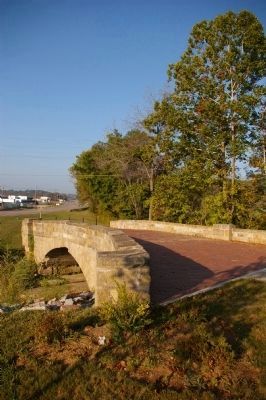
Photographed by Christopher Busta-Peck, September 23, 2007
5. The bridge, as seen from the east, looking west

Photographed by Christopher Busta-Peck, September 23, 2007
6. South face of Peter's Creek Bridge
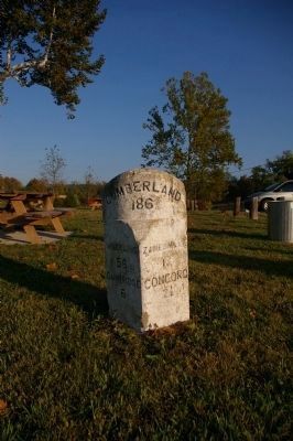
Photographed by Christopher Busta-Peck, September 23, 2007
7. National Road milestone, immediately east of the bridge
The milestone indicates that it is 186 miles to Cumberland, Maryland. Traveling west, is is 18 miles to Zanesville and 2 1/2 miles to Concord. Traveling east, it is 56 miles to Wheeling and 6 miles to Cambridge.
Credits. This page was last revised on May 9, 2025. It was originally submitted on April 20, 2006, by J. J. Prats of Powell, Ohio. This page has been viewed 2,788 times since then and 64 times this year. Last updated on May 7, 2025, by Craig Doda of Napoleon, Ohio. Photos: 1, 2. submitted on April 20, 2006, by J. J. Prats of Powell, Ohio. 3. submitted on February 19, 2008, by Christopher Busta-Peck of Shaker Heights, Ohio. 4. submitted on May 7, 2025, by Craig Doda of Napoleon, Ohio. 5, 6, 7. submitted on February 19, 2008, by Christopher Busta-Peck of Shaker Heights, Ohio. • Devry Becker Jones was the editor who published this page.
