Near Schenectady in Schenectady County, New York — The American Northeast (Mid-Atlantic)
Erie Canal Lock 8
Photographed by Steve Stoessel, May 7, 2025
1. Erie Canal Lock 8 Marker
New York State Canal System National Historic Landmark 2016
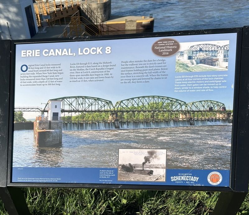
Original Erie Canal locks measured 90 feet long and 15 foot wide to fit canal boats around 60 feet long and seven feet wide. When New York State began building the expanded Barge Canal, new locks measured more than 320 feet long and 45 feet wide with a depth of 12 feet of water to accommodate boats up to 300 feet long.
Locks E8 through E15, along the Mohawk River, featured a dam based on a design found on the Moldau, the Czech Republic's longest river. Here at Lock 8, construction of the three-span movable dam began in 1908. At 510 feet wide, it can raise and lower boats by as much as 15 feet, when activated.
People often mistake the dam for a bridge, but the walkway you see is strictly used for maintenance. Beneath the dam's trusses are steel frames holding giant steel plates. Below the surface, stretching the full width of the river floor is a concrete sill. When the frames are swung open and lowered by chains to sit on the sill, they form a dam.
Thank you to the Schenectady County Historical Society, Historical Marker Database and the Historic American Engineering Record No. NY-383.
[ Photo Captions ]
- Locks E8 through E15 include two-story concrete cabins at all four corners of the lock chamber. These keep electric motors and switchgear safe from water. Dam gates can be moved up or down, similar to a window shade, to help control the volume of water and rate of flow.
- A steam shovel at work at the site of Lock 8 looking north at Scotia, N.Y.
Erected 2025
this page online
Topics and series. This historical marker is listed in this topic list: Waterways & Vessels. In addition, it is included in the Erie Canal series list. A significant historical year for this entry is 1908.
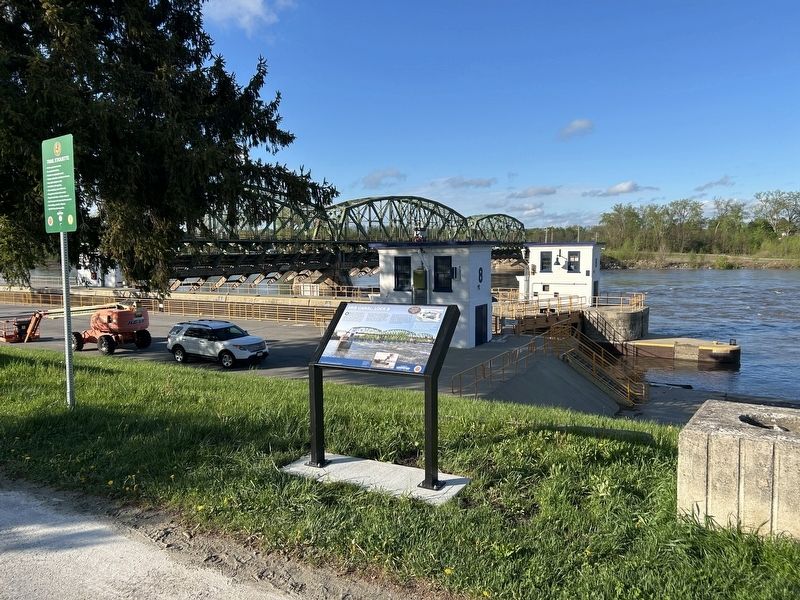
Location. 42° 49.723′ N, 73° 59.479′ W. Marker is near Schenectady, New York, in Schenectady County. It is on Empire State Trail half a mile north of Schemerhorn Road, on the right when traveling north. The marker is in front of Lock 8 at the end of Rice Road. It is beside the bikepath. Touch for map. Marker is in this post office area: Schenectady NY 12302, United States of America. Touch for directions.

Regionally, this marker is in Upstate New York, in the Capital District, and in the Albany Metropolitan Area. It is also in the American Northeast and in the Mid-Atlantic. Globally, it is in North America, the Western Hemisphere, the Western World, and the Anglosphere. Historically, it finds itself in what was once New Netherland and also one of the original Thirteen Colonies.
Other nearby markers. At least 8 other markers are within 2 miles of this marker, measured as the crow flies: The Movable Dam at Lock 8
Photographed by Steve Stoessel, May 7, 2025
2. Erie Canal Lock 8 Marker
Another marker is no longer nearby. Enlarged Erie Canal Lock 23 (was approx. half a mile away).
Also see . . . New York State Canal System (Wikipedia). (Submitted on May 8, 2025, by Steve Stoessel of Niskayuna, New York.)
Credits. This page was last revised on May 8, 2025. It was originally submitted on May 7, 2025, by Steve Stoessel of Niskayuna, New York. This page has been viewed 386 times since then and 89 times this year. Photos: 1. submitted on May 7, 2025, by Steve Stoessel of Niskayuna, New York. 2. submitted on May 8, 2025, by Steve Stoessel of Niskayuna, New York.
