Old Lyme in Lower Connecticut River Valley Region, Connecticut — The American Northeast (New England)
British Raid 1814
Battle Site Essex
Photographed by Conrad Ward, October 19, 2024
1. British Raid 1814 Marker
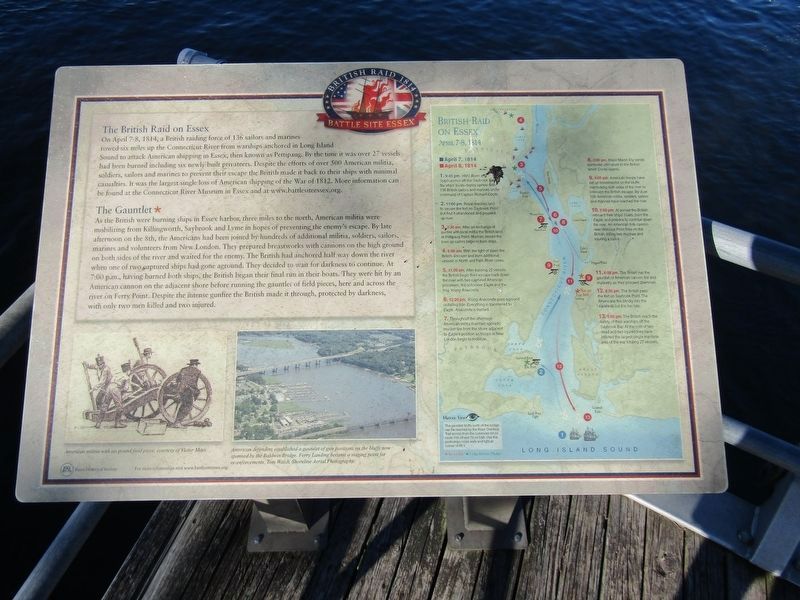
The British Raid on Essex
On April 7-8, 1814, a British raiding force of 136 sailors and marines rowed six miles up the Connecticut River from warships anchored in Long Island Sound to attack American shipping in Essex, then known as Pettipaug. By the time it was over 27 vessels had been burned including six newly built privateers. Despite the efforts of over 500 American militia, soldiers, sailors and marines to prevent their escape the British made it back to their ships with minimal casualties. It was the largest single loss of American shipping of the War of 1812. More information can be found at the Connecticut River Museum in Essex and at www.battlesiteessex.org.
The Gauntlet*
As the British were burning ships in Essex harbor, three miles to the north, American militia were mobilizing from Killingworth, Saybrook and Lyme in hopes of preventing the enemy's escape. By late afternoon on the 8th, the Americans had been joined by hundreds of additional militia, soldiers, sailors, marines and volunteers from New London. They prepared breastworks with cannons on the high ground on both sides of the river and
this page online
British Raid on Essex
April 7, 1814 April 8, 1814
1. 9:45 pm. HMS Borer and Sylph anchor off the Saybrook Bar. Six ships' boats deploy upriver with 136 British sailors and marines under command of Captain Richard Coote.
2. 11:00 pm. Royal marines land to secure the fort on Saybrook Point but find it abandoned and proceed up river.
3. 3:30 am. After an exchange of gunfire with local militia the British land at Pettipaug Point. Marines secure the town as sailors begin to burn ships.
4. 6:00 am. With the light of dawn the British discover and burn additional vessels in North and Falls River coves.Photographed by Conrad Ward, October 19, 20242. British Raid 1814 Marker
5. 11:00 am. After burning 25 vessels the British begin their escape back down the river with two captured American privateers, the schooner Eagle and the brig Young Anaconda.
6. 12:30 pm. Young Anaconda goes aground on falling tide. Everything is transferred to Eagle. Anaconda is burned.
7. Throughout the afternoon American militia maintain sporadic musket fire from the shore adjacent to Eagle's position as troops in New London begin to mobilize.
8. 2:00 pm. Major Marsh Ely sends surrender ultimatum to the British which Coote rejects.
9. 4:00 pm. American troops have set up breastworks on the bluffs overlooking both sides of the river to intercept the British escape. By dusk 500 American militia, soldiers, sailors and marines have reached the river.
10. 7:00 pm. At sunset the British reboard their ships' boats, burn the Eagle, and prepare to continue down the river. An American 6-lb cannon near Watrous Point fires on the British, killing two marines and injuring a sailor.
11. 8:00 pm. The British run the gauntlet of American cannon fire and musketry as they proceed downriver.
12. 8:30 pm. The British pass the fort on Saybrook Point. The Americans fire blindly into the darkness but it is too late.
13. 9:00 pm. The British reach the safety of their warships off the Saybrook Bar. At the cost of two dead and two injured they have inflicted the largest single maritime loss of the war totaling 27 vessels.
[Captions:]
American militia with six pound field piece, courtesy of Victor Mays.
American defenders established a gauntlet of gun positions on the bluffs now spanned by the Baldwin Bridge. Ferry Landing became a staging point for re-enforcements, Tom Walsh, Shoreline Aerial Photography.
Erected by Essex Historical Society.
Topics. This historical marker is listed in these topic lists: War of 1812 • Waterways & Vessels. A significant historical date for this entry is April 7, 1814.
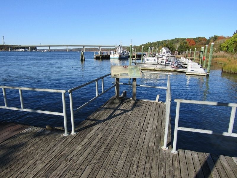
Location. 41° 18.707′ N, 72° 20.784′ W. Marker is in Old Lyme in Lower Connecticut River Valley Region, Connecticut. It can be reached from Ferry Road east of Shore Road (Connecticut Route 156), on the right when traveling south. The marker stands at Ferry Landing State Park. Touch for map. Marker is at or near this postal address: 398 Ferry Rd, Old Lyme CT 06371, United States of America. Touch for directions.

Regionally, this marker is on the Connecticut Shoreline, in Greater New London, in Mystic and the Eastern Shore, and in the Thames River Valley. It is also in the American Northeast, in New England, and on the Eastern Seaboard. Globally, it is in the North Atlantic Region, North America, the Western Hemisphere, the Western World, and the Anglosphere. Historically, it finds itself in what was once New London County and also one of the original Thirteen Colonies.
Other nearby markers. At least 8 other markers are within walking distance of this marker: Connecticut River (about 700 feet away, measured in a direct line); Anadromous Fish (approx. 0.2 miles away); Osprey (approx. 0.2 miles away); Dr. Roger Tory Peterson Wildlife Area at Great Island (approx. 0.2 miles away); New Raymond E. Baldwin Bridge (approx. 0.6 miles away); Raymond E. Baldwin Bridge (approx. 0.6 miles away); American Legion Post 113 Memorial (approx. ¾ mile away); Votes For Women (approx. ¾ mile away). Touch for a list and map of all markers in Old Lyme.
Credits. This page was last revised on May 19, 2026. It was originally submitted on March 16, 2025, by Conrad Ward of Guilford, Connecticut. This page has been viewed 150 times since then and 34 times this year. Last updated on May 8, 2025, by Conrad Ward of Guilford, Connecticut. Photos: 1, 2. submitted on March 16, 2025, by Conrad Ward of Guilford, Connecticut. • Devry Becker Jones was the editor who published this page.
