Hells Gate in Death Valley National Park in Inyo County, California — The American West (Pacific Coastal)
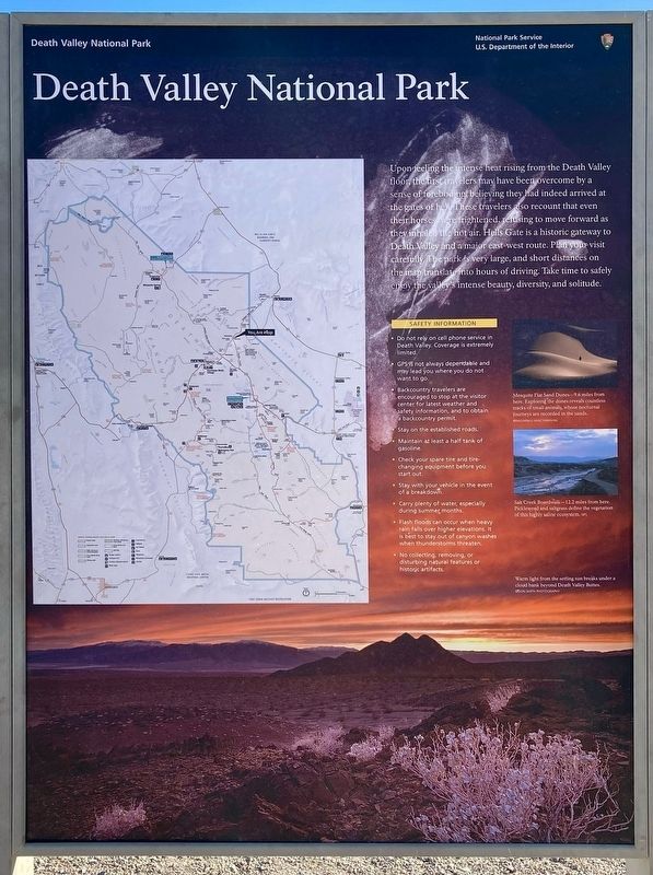
Death Valley National Park
Photographed by Craig Baker, April 5, 2025
1. Death Valley National Park Marker
Upon feeling the intense heat rising from the Death Valley floor, the first travelers may have been overcome by a sense of foreboding believing they had indeed arrived at the gates of hell. These travelers also recount that even their horses were frightened, refusing to move forward as they inhaled the hot air.
Hells Gate is a historic gateway to Death Valley and a major east-west route.
Plan your visit carefully. The park is very large, and short distances on the map translate into hours of driving. Take time to safely enjoy the valley's intense beauty, diversity, and solitude.
photo captions:
· Mesquite Flat Sand Dunes - 9.6 miles from here.
Exploring the dunes reveals countless tracks of small animals, whose nocturnal journeys are recorded in the sands.
· Salt Creek Boardwalk — 12.2 miles from here.
Pickleweed and saltgrass define the vegetation of this highly saline ecosystem.
Safety Information
• Do not rely on cell phone service in Death Valley. Coverage is extremely limited.
• GPS is not always dependable and may lead you where you do not want to go.
• Backcountry
this page online
• Stay on the established roads.
• Maintain at least a half tank of gasoline.
• Check your spare tire and tire-changing equipment before you start out.
• Stay with your vehicle in the event of a breakdown.
• Carry plenty of water, especially during summer months.
• Flash floods can occur when heavy rain falls over higher elevations. It is best to stay out of canyon washes when thunderstorms threaten.
• No collecting, removing, or disturbing natural features or historic artifacts.
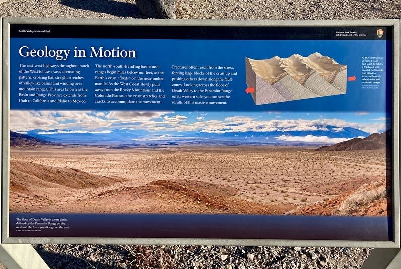
Geology in Motion
The east-west highways throughout much of the West follow a vast, alternating pattern, crossing flat, straight stretches of valley-like basins and winding over mountain ranges. This area known as the Basin and Range Province extends from Utah to California and Idaho to Mexico.
The north-south-trending basins and ranges begin miles below our feet, as the Earth's crust "floats" on the near-molten mantle. As the West Coast slowly pulls away from the Rocky Mountains and
Photographed by Craig Baker, April 5, 2025
2. Geology In Motion Marker
Fractures often result from the stress, forcing large blocks of the crust up and pushing others down along the fault zones. Looking across the floor of Death Valley to the Panamint Range on its western side, you can see the results of this massive movement.
Erected by National Park Service - U.S. Department of the Interior.
Topics. This historical marker is listed in these topic lists: Exploration • Parks & Recreational Areas.
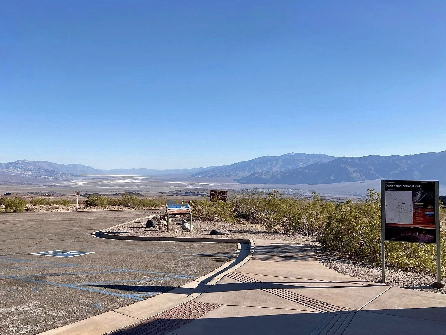
Location. 36° 43.443′ N, 116° 58.692′ W. Marker is in Death Valley National Park, California, in Inyo County. It is in Hells Gate. It is at the intersection of Daylight Pass Road and Beatty Road, on the left when traveling north on Daylight Pass Road. Touch for map. Marker is in this post office area: Death Valley CA 92328, United States of America. Touch for directions.

Regionally, this marker is in California’s Sierra Nevada. It is also in the American Mountain West. Globally, it is in North America, on the Ring of Fire, in the Pacific Rim, in
Photographed by Craig Baker, April 5, 2025
3. Death Valley and Markers
Other nearby markers. At least 8 other markers are within 11 miles of this marker, measured as the crow flies: A different marker also named Keane Wonder Mine (approx. 5.4 miles away); Transportation Traces (approx. 6.4 miles away); Old Stovepipe Wells (approx. 7.2 miles away); McLean Spring (approx. 8.6 miles away); Devil’s Cornfield (approx. 9.1 miles away); Leadfield (approx. 9.7 miles away); a different marker also named Leadfield (approx. 9.7 miles away); Petroglyphs (approx. 10.2 miles away). Touch for a list and map of all markers in Death Valley National Park.
Other markers no longer nearby. Keane Wonder Mine (was approx. 5.4 miles away but has been reported to have been replaced with another marker now near it); Wagon Wheel History (was approx. 6.4 miles away).
Credits. This page was last revised on August 5, 2025. It was originally submitted on May 11, 2025, by Craig Baker of Sylmar, California. This page has been viewed 675 times since then and 59 times this year. Photos: 1, 2, 3. submitted on May 11, 2025, by Craig Baker of Sylmar, California.
