Hayesville in Clay County, North Carolina — The American South (South Atlantic)
Cherokee Winter House
(go-la ga-la-tso-de)
Photographed by Mark Parker, May 10, 2025
1. Cherokee Winter House Marker
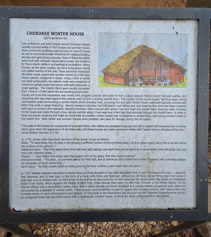
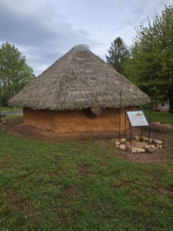
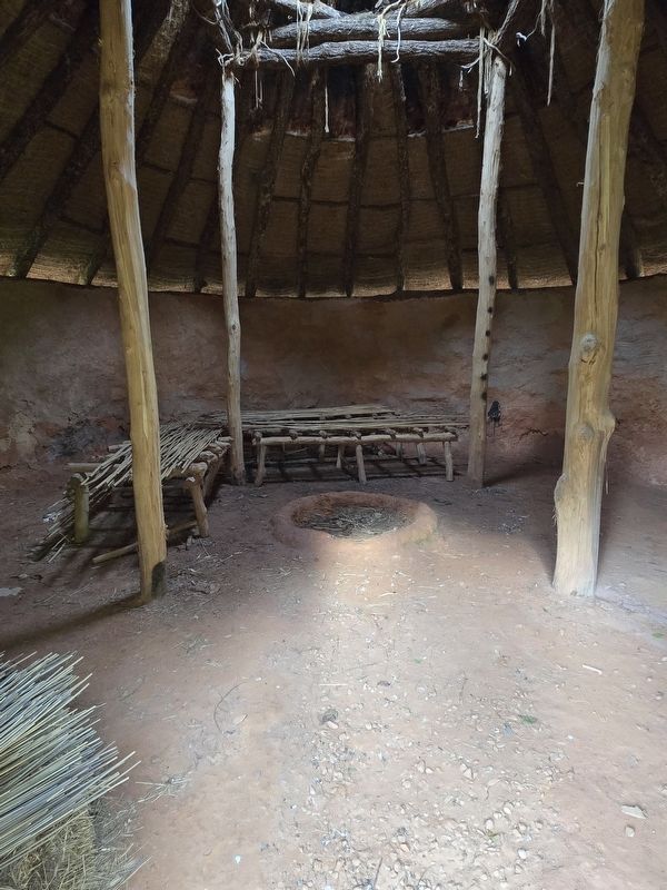
Late prehistoric and early historic period Cherokee villages typically included winter or "hot" houses and summer houses, large community buildings such as town or council houses as well as numerous smaller structures for religious/healing, storage and agricultural purposes. Most of these structures were built with vertically placed wood posts; the evidence for this is clearly visible in archaeological excavations. Winter houses, as the name implies, provided living space during the coldest months of the year. These structures were typically either round, square with rounded corners or, in the early historic period, octagonal in shape. Using a form of wattle and daub construction, the exterior walls were comprised of numerous upright posts interwoven with split rivercanes or small saplings. The interior floors were usually excavated from 1 foot to 1.5 feet below the surrounding ground level. Clayey soil from this excavation was mixed with chopped grasses and water to form a daub used to thickly plaster the wall wattles. Any remaining dirt was piled against the exterior wall to form a sloping backfill berm. The interior
this page online
"The walls of the houses are constructed of a wooden frame, then lathed and plastered inside and out with a reddish well tempered day or mortar, which gives them the appearance of red brick walls; and these houses are neatly covered or roofed with Cypress bark or shingles of that tree," wrote William
Photographed by Mark Parker, May 10, 2025
2. Marker next to the Cherokee Winter House
In 1775, James Adair described elements of the winter house as follows:
Walls: "To raise these, they fix deep in the ground, a sufficient number of strong forked posts... all of an equal height, about five or six feet above the surface of the ground..."
Wattle and daub: "Then they weave them thick with their split saplings, and daub them all over about six or seven inches thick with tough clay, well mixt with withered grass..."
Thatch: "...they thatch the house with the longest sort of dry grass, that their land produces."
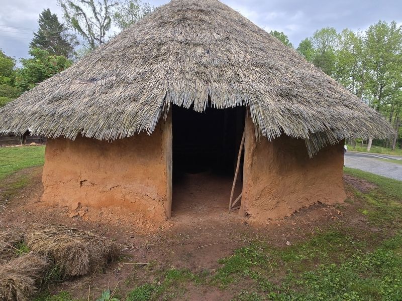
Entrance corridor: "The door... is commonly about four feet high, and so narrow as not to admit two to enter it abreast, with a winding passage for the space of six or seven feet..."
Earth berm: "As they usually build on rising ground, the floor is often a yard lower than the earth...".
In 1757, William DeBrahm described a winter house at Chota (located on the Little Tennessee River in east Tennessee) this way: "...about 30 feet Diameter, and 15 feet high, in the form of a Cone, with Poles and thatched, without any Air-hole, except for a small Door about 3 feet high and 18 Inches wide.
Photographed by Mark Parker, May 10, 2025
3. Front entrance to Cherokee Winter House
Topics. This historical marker is listed in these topic lists: Indigenous Peoples and Communities • Settlements & Settlers. A significant historical year for this entry is 1757.
Location. 35° 2.661′ N, 83° 49.159′ W. Marker is in Hayesville, North Carolina, in Clay County. It is on Business U.S. 64 south of Davis Loop, on the right when traveling south. The marker is at the Cherokee Homestead
Photographed by Mark Parker, May 10, 2025
4. Cherokee Winter House Interior

Regionally, this marker is in North Carolina’s Mountains. It is also in the American South, specifically in the Upper South, in Appalachia, and specifically in Southern Appalachia. Globally, it is in North America, the Western Hemisphere, the Western World, and the Anglosphere. Historically, it finds itself in what was once the original Cherokee Nation, the territory of the Mississippian Culture, one of the original Thirteen Colonies, one of the Confederate States of America, and the Antebellum South.
Other nearby markers. At least 8 other markers are within walking distance of this marker: Cherokee Culture (a few steps from this marker); Cherokee Summer House / Corn Cribs / Dugout Canoe (a few steps from this marker); Cherokee Communities of the Upper Hiwassee River Valley (a few steps from this marker); Three Sisters Garden (a few steps from this marker); Clay County Heritage (a few steps from this marker); Hayesville City Hall Rehabilitated As Small Classroom
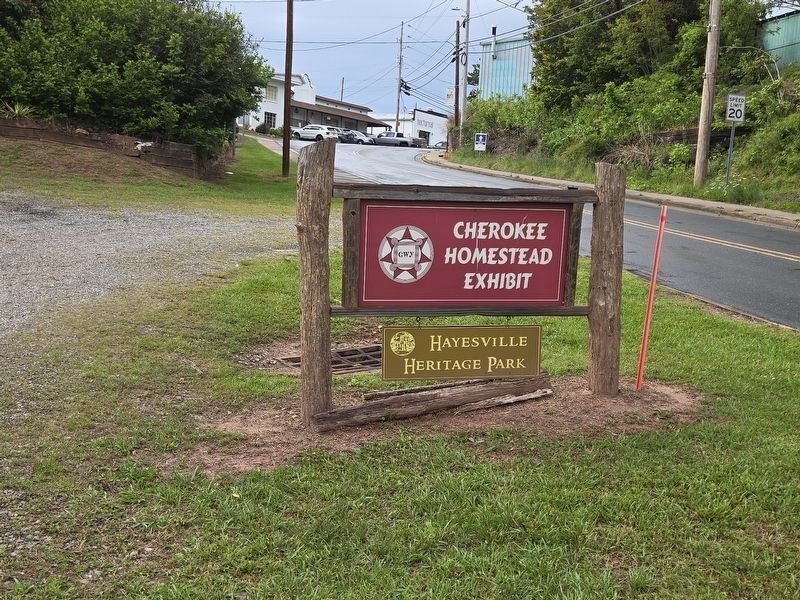
Photographed by Mark Parker, May 10, 2025
5. Entrance to Cherokee Homestead Exhibit off US Business 64
Credits. This page was last revised on May 13, 2025. It was originally submitted on May 12, 2025, by Mark Parker of Hickory, North Carolina. This page has been viewed 228 times since then and 67 times this year. Photos: 1, 2, 3, 4, 5. submitted on May 12, 2025, by Mark Parker of Hickory, North Carolina. • Devry Becker Jones was the editor who published this page.
