Cape Henlopen State Park in Lewes in Sussex County, Delaware — The American Northeast (Mid-Atlantic)
Herring Point
From War to Natural Beauty
Photographed by Pete Skillman, May 13, 2025
1. Herring Point Marker
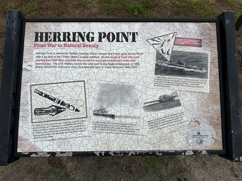
Herring Point is named for Battery Herring, which housed two 6-inch guns during World War II as part of the United States coastal defense. At the close of that war and during the Cold War, the site was used for top secret military tests and operations. The US military turned the land over to the State of Delaware in 1983, giving visitors the chance to enjoy this beautiful spot in Cape Henlopen State Park.
By 1944, the army was testing a "proximity fuze" at Battery Herring. A fuze is a mechanical or electrical device that causes a military explosive to detonate. When attached to an artillery shell, a proximity fuse emitted radio waves that reflected off a target and exploded the shell when it came within a pre-set range.
In 1946, Battery Herring was a testing site for the U.S. Navy's Bumblebee ramjet rocket, a forerunner of surface-to-air anti-aircraft missiles. As many as 83 rockets were launched from this area to test their capabilities.
Battery Herring was originally covered in sand to protect it from attack. The 6-inch gun shown in this photo of nearby Battery Hunter is the same type of weapon that was placed
this page online
In 1963, Battery Herring was one of 11 sites used to spy on Soviet submarines during the Cold War. A cable stretching 104 miles out to sea and equipped with 40 hydrophones, or underwater microphones, monitored sounds used to detect and determine submarine positions.
(Caption):
Insignia of the Mobile Inshore Undersea Warfare Unit 205 that was stationed here during the Cold War.
Erected by Delaware State Parks.
Topics and series. This historical marker is listed in these topic lists: Forts and Castles • War, Cold • War, World II. In addition, it is included in the Delaware State Parks series list. A significant historical year for this entry is 1983.
Location. 38° 45.943′ N, 75° 4.979′ W. Marker is in Lewes, Delaware, in Sussex County. It is in Cape Henlopen State Park. It can be reached from Dune Road. Touch for map. Marker is at or near this postal address: Dune Rd, Lewes DE 19958, United States of America. Touch for directions.

Regionally, this marker is on Delaware’s Beaches. It is also in the American Mid-Atlantic, on the Delmarva Peninsula, and on the Eastern Seaboard. Globally, it is in the North
Photographed by Pete Skillman, May 13, 2025
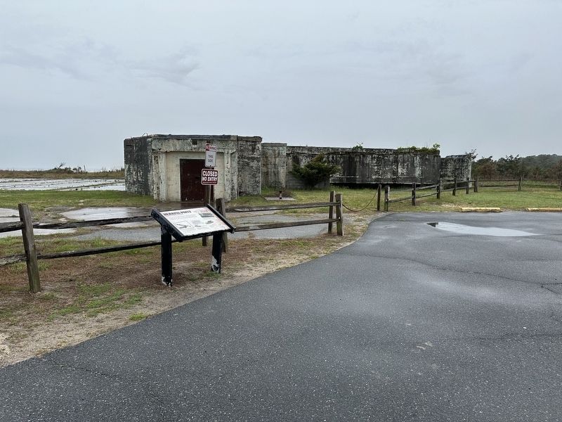
2. Herring Point Marker - wide view
Other nearby markers. At least 8 other markers are within walking distance of this marker: Howard Schroeder (about 600 feet away, measured in a direct line); Reclaiming the Cape (approx. half a mile away); The Cape Henlopen Lighthouse (approx. 0.8 miles away); The Great Dune (approx. 0.8 miles away); 16-inch Gun (approx. 0.9 miles away); 8-inch Gun (approx. 0.9 miles away); Proof Steel (approx. 0.9 miles away); 6-inch Gun (approx. 0.9 miles away). Touch for a list and map of all markers in Lewes.
Another marker is no longer nearby. The U.S. Navy at Cape Henlopen (was approx. 0.4 miles away but has been permanently removed).
Credits. This page was last revised on April 1, 2026. It was originally submitted on May 14, 2025, by Pete Skillman of Wilmington, Delaware. This page has been viewed 301 times since then and 93 times this year. Photos: 1, 2. submitted on May 14, 2025, by Pete Skillman of Wilmington, Delaware.
