Parowan in Iron County, Utah — The American Mountains (Southwest)
Center Creek Hydroelectric Power Plant
Photographed by James Hulse, April 6, 2025
1. Center Creek Hydroelectric Power Plant Marker
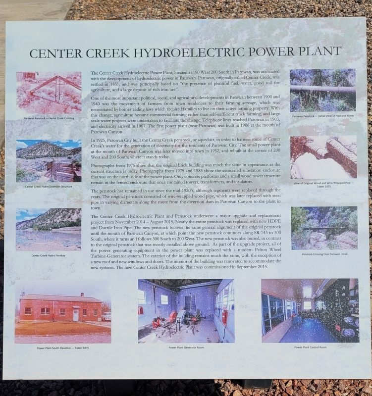
One of the most important political, social, and agricultural developments in Parowan between 1900 and 1940 was the movement of farmers from town residences to their farming acreage, which was necessitated by homesteading laws which required families to live on their active farming property. With this change, agriculture became commercial farming rather than self-sufficient truck farming, and large scale water projects were undertaken to facilitate the change. Telephone lines reached Parowan in 1903, and electricity arrived in 1907. The first power plant (near Parowan) was built in 1906 at the mouth of Parowan Canyon.
In 1925, Parowan City built the Center Creek penstock, or aqueduct, in order to harness some of Center Creek's water for the generation of electricity
this page online
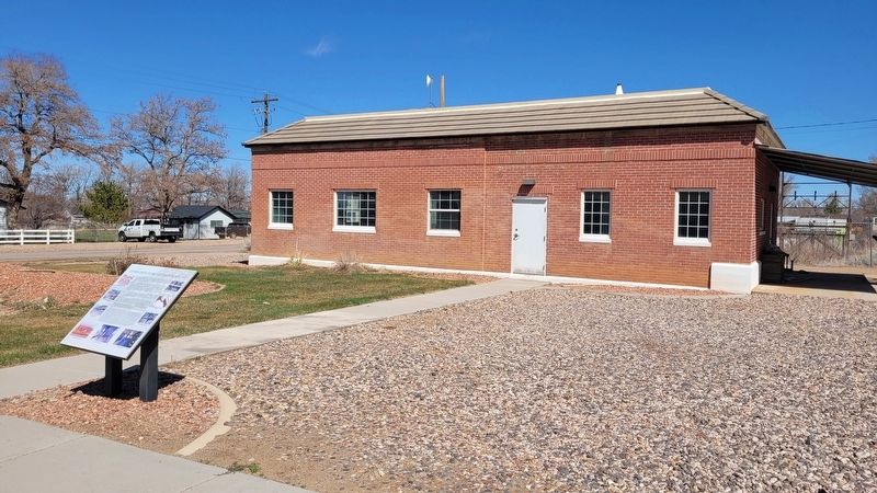
Photographs from 1975 show that the original brick building was much the same in appearance as the current structure is today. Photographs from 1975 and 1983 show the associated substation enclosure that was on the north side of the power plant. Only concrete platforms and a small wood tower structure remain in the fenced enclosure that once contained towers, transformers, and insulators.
The penstock has remained in use since the mid-1920's, although segments were replaced through the years. The original penstock consisted of wire-wrapped wood pipe, which was later replaced with steel pipe in varying diameters along the route from the diversion dam in Parowan Canyon to the plant in town.
The Center Creek Hydroelectric Plant and Penstock underwent a major upgrade and replacement project from November 2014 - August 2015. Nearly the entire penstock was replaced with new HDPE and Ductile Iron Pipe. The new penstock follows the same
Photographed by James Hulse, April 6, 2025
2. The view of the Center Creek Hydroelectric Power Plant and Marker from the street
Captions
(Photo #1) Parowan Penstock-Aerial Creek Crossing
(Photo #2) Center Creek Hydro Diversion Structure
(Photo #3) Center Creek Hydro Forebay
(Photo #4) Power Plant South Elevation-Taken 1975
(Photo #5) Power Plant Generator Room
(Photo #6) Parowan Penstock - Detail View of Pipe and Rivets
(Photo #7) View of Original Wood and Wire Wrapped Pipe Taken 1975
(Photo #8) Penstock Crossing Over Parowan Creek
(Photo #9) Power Plant Control Room
Topics. This historical marker is listed in these topic lists: Agriculture • Industry & Commerce. A significant historical date for this entry is August 20, 2015.
Location. 37° 50.34′ N, 112° 49.897′ W. Marker is in Parowan, Utah, in Iron County. It is at the intersection of West 200 South (State Road 143) and 2nd W St, on the right when traveling west on West 200 South. The marker is located in front of the building. Touch for map. Marker is at or near this postal address: 198 W 200 S, Parowan UT 84761, United States of America. Touch for directions.

Regionally, this marker is in Utah’s Color Country. It is also in the American Mountain West and on the Colorado Plateau. Globally, it is in North America, the Rocky Mountains, the Western Hemisphere, the Western World, and the Anglosphere. Historically, it finds itself in what was once New Spain and also Mexico’s Alta California.
Other nearby markers. At least 8 other markers are within walking distance of this marker: Parowan Adobe Fort (a few steps from this marker); First Iron County Log School House (about 300 feet away, measured in a direct line); Pioneer Industrial Center (about 300 feet away); Parowan Cotton Factory (about 400 feet away); Jesse N. Smith Home (approx. 0.2 miles away); a different marker also named Jesse N. Smith Home (approx. 0.2 miles away); Old Comedy Hall (approx. 0.2 miles away); D.U.P. Relic Hall (approx. 0.2 miles away). Touch for a list and map of all markers in Parowan.
Credits. This page was last revised on May 14, 2025. It was originally submitted on May 14, 2025, by James Hulse of Medina, Texas. This page has been viewed 131 times since then and 24 times this year. Photos: 1, 2. submitted on May 14, 2025, by James Hulse of Medina, Texas.
