
Bryce Canyon City in Garfield County, Utah — The American Mountains (Southwest)
Historic Tropic Ditch

Photographed by James Hulse, April 5, 2025
1. Historic Tropic Ditch Marker
A testament to the courage and perseverance of the early Mormon settlers who built a home where they could raise their families and sustain their lives in this remote part of Southern Utah.
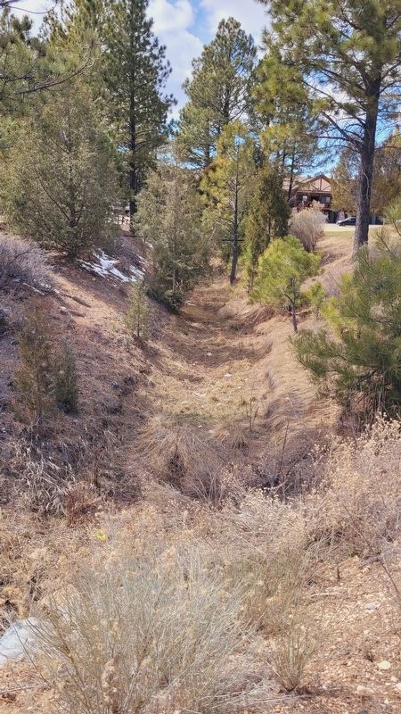
The Historic Tropic Ditch delivers life-giving water, flowing from the East Fork of the Sevier River in Utah's Great Basin drainage, over the Paunsaugunt Plateau, and dropping 1,500 feet to the Paria River in the Colorado River drainage. This ditch was dug by hand over a 10 mile course before dumping over the rim of what is now Bryce Canyon National Park.
With the formation of the East Fork Irrigation Company in 1889, new interest was generated to expand potential farm land to the north of the small communities of Cannonville and Henrieville. Stock was issued in the new company and basic survey equipment and tools for digging the canal were purchased.
The survey of the canal was completed in early July of 1889 and actual digging began in September of the same year.
A survey was commenced in the Spring of 1889 to lay out a new town. It included sixteen blocks with four lots per block each measuring about 14 acre. The lots
this page online
They completed excavation in the early Spring of 1892. It was a great accomplishment for a group of hardy pioneers who were dedicated to making the harsh surroundings blossom and allow a community to thrive.
Captions
(Photo #1) Above: Water dumping over the rim of Bryce Canyon.
(Photo #2) Left: using teams, scrapers and shear manpower, the dirt was removed, boulders were loaded on sledges and hauled out of the canal, and leveling was completed to allow the water to flow to the plateau rim.
(Photo #3) Right upper: men, teams and Fresno Scrapers clearing the dirt and boulders for the new ditch.
(Photo #4) Right middle: the town of Tropic, founded 1893.
(Photo #5) Left below: water flows for 10 miles across the plateau until it dumps over the rim and drops 1,500 feet to Water Canyon below. It then is captured and continues to the fields of the East Valley of Tropic.
(Photo #6) Right: for over 100 years the water from the East Fork of the Sevier River has nourished the farms on the plateau, the farms of Tropic, as well as provided for the residents and livestock of the region.
(Photo #7) Right: waterfall water in Water Canyon accessed by the Mosey Cave Trail.
Topics.

Photographed by James Hulse, April 5, 2025
2. The view of the Tropic Ditch and Marker
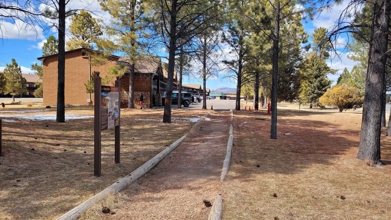
Location. 37° 40.251′ N, 112° 9.452′ W. Marker is in Bryce Canyon City, Utah, in Garfield County. It is on Main Street (State Road 63) 0.1 miles south of Center Street, on the right when traveling south. The marker is located along the trail near the hotel. Touch for map. Marker is in this post office area: Bryce UT 84764, United States of America. Touch for directions.

Regionally, this marker is in Canyon Country and specifically in Color Country. It is also in the American Mountain West, in Colorado Plateau, and at the Four Corners. Globally, it is in North America, the Western Hemisphere, the Western World, and the Anglosphere. Historically, it finds itself in what was once New Spain and also Mexico’s Alta California.

Other nearby markers. At least 8 other markers are within 3 miles of this marker, measured as the crow flies: Tragedy and Triumph (approx. 1.9 miles away); Bryce Airport (approx. 1.9 miles away); American Original (approx. 1.9 miles away);
Photographed by James Hulse, April 5, 2025
3. The view of the Tropic Ditch
Photographed by James Hulse, April 5, 2025
4. The view of the Historic Tropic Ditch Marker along the trail
Credits. This page was last revised on May 14, 2025. It was originally submitted on May 14, 2025, by James Hulse of Medina, Texas. This page has been viewed 478 times since then and 88 times this year. Photos: 1, 2, 3, 4. submitted on May 14, 2025, by James Hulse of Medina, Texas.
