Wilmington in New Hanover County, North Carolina — The American South (South Atlantic)
Aircraft Recovery
Eyes In The Sky
| — | U.S.S. North Carolina | — |
Photographed by Brandon D Cross
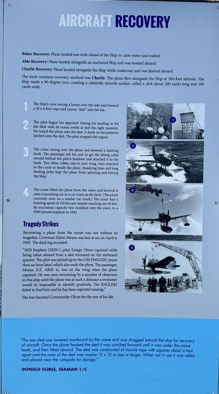
1. Aircraft Recovery Marker
Baker Recovery: Plane landed one mile ahead of the Ship in calm water and waited
Able Recovery: Plane landed alongside an anchored Ship and was hoisted aboard
Charlie Recovery: Plane landed alongside the Ship while underway and was hoisted aboard
The most common recovery method was Charlie. The plane flew alongside the Ship at 300-foot altitude. The Ship made a 90-degree turn creating a relatively smooth surface called a slick about 200 yards long and 100 yards wide.
1 The Ship's crew swung a boom over the side and lowered a 10 x 6-foot rope and canvas "sled" into the sea.
2 The pilot began his approach timing his landing to hit the slick with its ocean swells at just the right moment. He taxied the plane onto the sled. A hook on the pontoon latched onto the sled. The pilot stopped the engine.
3 The crane swung over the plane and lowered a hoisting hook. The passenger left his seat to get the lifting cable stowed behind the pilot's headrest and attached it to the hook. Two other cables, one in each wing, were attached to the crane to steady the plane. Steadying lines and long fending poles kept the plane from spinning and hitting the ship.
4 The crane lifted the plane from the water and lowered it onto a launching car or a car truck on the deck. (The plane currently rests on a similar car truck.) The crane had a hoisting speed of 110 feet per minute reaching out 40 feet. Its maximum capacity was modified over the years, to a 9300-pound seaplane in 1945.
Tragedy Strikes
Recovering a plane from the ocean was not without its tragedies. Crewman Eldon Means was lost at sea on April 6,1945. The deck log recorded:
"1628 Seaplane OS2N-1, pilot Ensign Oliver capsized while being taken aboard from a sled streamed on the starboard quarter. The pilot was picked up by the USS English, [more than
this page online
The loss haunted Commander Oliver for the rest of his life.
"The sea sled was lowered overboard by the crane and was dragged behind the ship for recovery of aircraft. Once the plane hooked the sled it was winched forward until it was under the crane hook, and then lifted aboard. The sled was constructed of manila rope with squares about a foot apart and the area of the sled was maybe 12 x 12 in size or larger. When not in use it was rolled and placed near the catapults for storage."
Donald Scible, Seamon 1/C
Erected by Friends of the Battleship North Carolina.
Topics. This historical marker is listed in these topic lists: Air & Space • War, World II • Waterways & Vessels. A significant historical date for this entry is April 6, 1945.
Location. 34° 14.197′ N, 77° 57.203′ W. Marker is in Wilmington,

Photographed by Brandon D Cross
2. Aircraft Recovery Marker (right center)

Regionally, this marker is in North Carolina’s Coastal Plain and on the Cape Fear Coast. It is also in the American South, specifically in the Upper South, in the Tidewater, and on the Eastern Seaboard. Globally, it is in the North Atlantic Region, North America, the Western Hemisphere, the Western World, and the Anglosphere. Historically, it finds itself in what was once the territory of the Mississippian Culture, one of the original Thirteen Colonies, one of the Confederate States of America, and the Antebellum South.
Other nearby markers. At least 8 other markers are within walking distance of this marker: Launching Aircraft At Sea (here, next to this marker); Kingfishers Aboard North Carolina (here, next to this marker); Search and Rescue Missions
via Naval History and Heritage Command, 1944
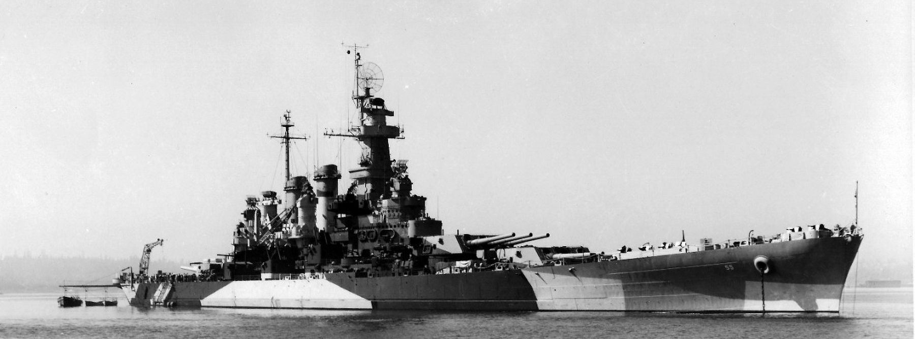
3. USS North Carolina (BB 55), 1941 - 1961
Naval History and Heritage Command website entry
Click for more information.
Click for more information.
Also see . . . How did WW2 battleships and cruisers launch and collect their floatplanes? Were there any limitation. (Submitted on May 14, 2025, by Brandon D Cross of Flagler Beach, Florida.)
Credits. This page was last revised on May 24, 2025. It was originally submitted on May 14, 2025, by Brandon D Cross of Flagler Beach, Florida. This page has been viewed 169 times since then and 30 times this year. Photos: 1, 2. submitted on May 14, 2025, by Brandon D Cross of Flagler Beach, Florida. 3. submitted on May 24, 2025, by Larry Gertner of New York, New York. • Bernard Fisher was the editor who published this page.
