
Sault Ste. Marie in Algoma District, Ontario — Central Canada (North America)
The Sault Canal
⎯⎯⎯
Le canal du Sault
Photographed by Cosmos Mariner, June 11, 2024
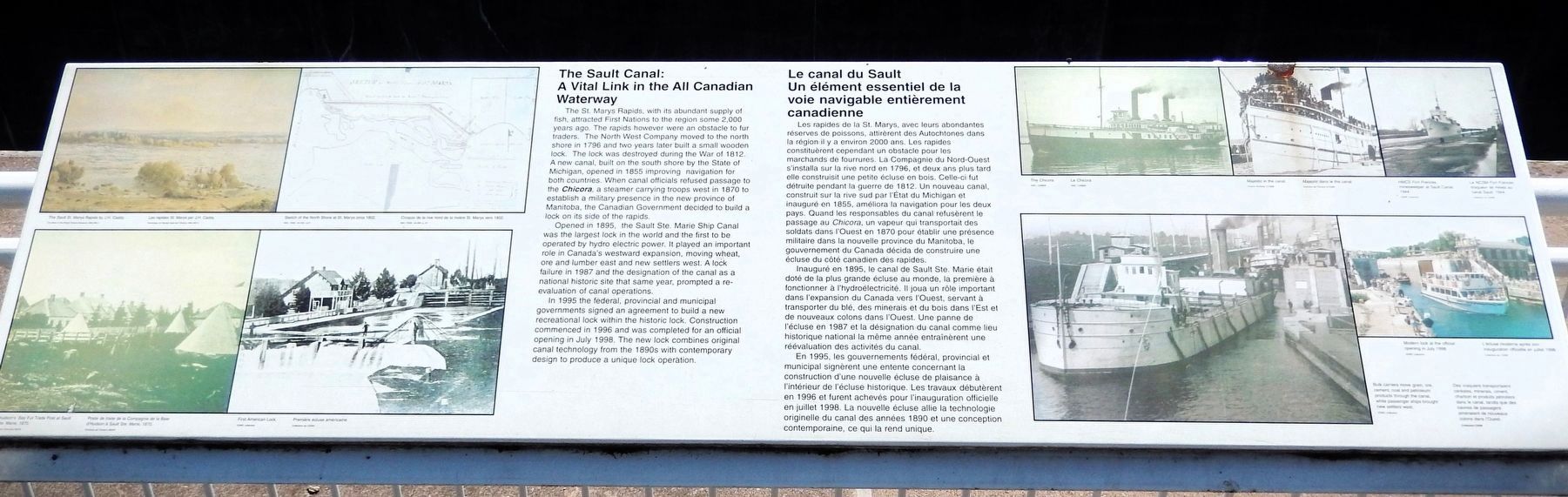
1. The Sault Canal / Le canal du Sault Marker

A Vital Link in the All Canadian Waterway
The St. Marys Rapids, with its abundant supply of fish, attracted First Nations to the region some 2,000 years ago. The rapids however were an obstacle to fur traders. The North West Company moved to the north shore in 1796 and two years later built a small wooden lock. The lock was destroyed during the War of 1812. A new canal, built on the south shore by the State of Michigan, opened in 1855 improving navigation for both countries. When canal officials refused passage to the Chicora, a steamer carrying troops west in 1870 to establish a military presence in the new province of Manitoba, the Canadian Government decided to build a lock on its side of the rapids.
Opened in 1895, the Sault Ste. Marie Ship Canal was the largest lock in the world and the first to be operated by hydroelectric power. It played an important role in Canada's westward expansion, moving wheat, ore and lumber east and new settlers west. A lock failure in 1987 and the designation of the canal as a national historic site that same year, prompted a reevaluation of canal operations.
In 1995 the
this page online
Un élément essentiel de la voie navigable entièrement canadienne
Les rapides de la St. Marys, avec leurs abondantes réserves de poissons, attirèrent des Autochtones dans la région il y a environ 2000 ans. Les rapides constituèrent cependant un obstacle pour les marchands de fourrures. La Compagnie du Nord-Ouest s'installa sur la rive nord en 1796, et deux ans plus tard elle construisit une petite écluse en bois. Celle-ci fut détruite pendant la guerre de 1812. Un nouveau canal, construit sur la rive sud par l'État du Michigan et inauguré en 1855, améliora la navigation pour les deux pays. Quand les responsables du canal refusèrent le passage au Chicora, un vapeur qui transportait des soldats dans l'Ouest en 1870 pour établir une présence militaire dans la nouvelle province du Manitoba, le gouvernement
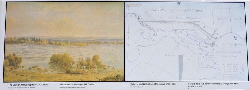
2. Marker detail: Sault St. Marys Rapids & North Shore
[left] The Sault St. Marys Rapids by J.H. Caddy. (Courtesy of the Royal Ontario Museum, 965.249.3)
[right] Sketch of the North Shore at St. Marys circa 1802. (NAC, RG81, Vol. 363, p.37) • • • [gauche] Les rapides St. Marys par J.H. Caddy. (Hommage du Musée royal de l’Ontario, 965.249.3)
[droit] Croquis de la rive nord de la rivière St. Marys vers 1802. (ANC, RG81, Vol. 363, p.37)
[right] Sketch of the North Shore at St. Marys circa 1802. (NAC, RG81, Vol. 363, p.37)
[droit] Croquis de la rive nord de la rivière St. Marys vers 1802. (ANC, RG81, Vol. 363, p.37)
Inauguré en 1895, le canal de Sault Ste. Marie était doté de la plus grande écluse au monde, la première à fonctionner à l'hydroélectricité. Il joua un rôle important dans l'expansion du Canada vers l'Ouest, servant à transporter du blé, des minerais et du bois dans l'Est et de nouveaux colons dans l'Ouest. Une panne de l'écluse en 1987 et la désignation du canal comme lieu historique national la même année entraînèrent une réévaluation des activités du canal.
En 1995, les gouvernements fédéral, provincial et municipal signèrent une entente concernant la construction d'une nouvelle écluse de plaisance à l'intérieur de l'écluse historique. Les travaux débutèrent en 1996 et furent achevés pour l'inauguration officielle en juillet 1998. La nouvelle écluse allie la technologie originelle du canal des années 1890 et une conception contemporaine, ce qui la rend unique.
Topics. This historical marker is listed in these topic lists: Industry & Commerce • Settlements & Settlers • War of 1812 • Waterways & Vessels. A significant historical year for this entry is 1895.
Location. 46° 30.781′ N,
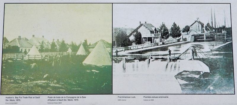
3. Marker detail: Hudson’s Bay Post & First American Lock
[left] Hudson's Bay Fur Trade Post at Sault Ste. Marie, 1870. (Ontario Archives S8245)
[right] First American Lock (SSMC Collection) • • • [gauche] Poste de traite de la Compagnie de la Baie d'Hudson à Sault Ste. Marie, 1870. (Archives de l’Ontario S8245)
[droit] Première écluse américaine. (Collection du CSSM)
[right] First American Lock (SSMC Collection)
[droit] Première écluse américaine. (Collection du CSSM)

Regionally, this marker is in the Sault Ste. Marie and Algoma Area and in Northern Ontario. It is also in Central Canada. Globally, it is in North America, in the Great North Woods, on the Great Lakes, on Lake Superior’s North Shore, in the Western Hemisphere, in the Western World, and in the Anglosphere. Historically, it finds itself in what was once a British colony, the Viceroyalty of New France, the Haudenosaunee (Iroquois) Confederacy, and Rupert’s Land.
Other nearby markers. At least 8 other markers are within walking distance of this marker: Sault Ste. Marie Ship Canal (here, next to this marker); The All Canadian Waterway (1895-1959) / La voie navigable entièrement canadienne (1895-1959)
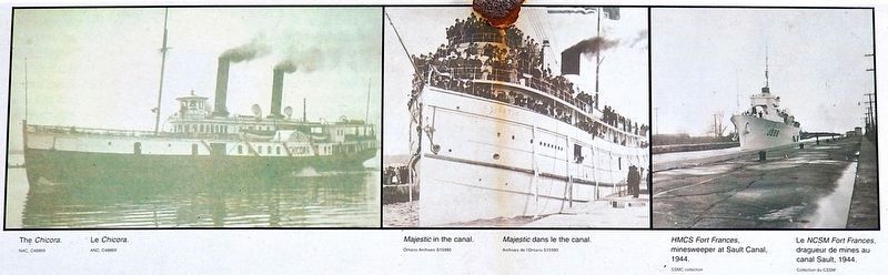
4. Marker detail: Chicora, Majestic & Fort Frances
[left] The Chicora. (NAC, C48869)
[center] Majestic in the canal. (Ontario Archives S15980)
[right] HMCS Fort Frances, minesweeper at Sault Canal, 1944. (SSMC Collection) • • • [gauche] Le Chicora. (ANC, C48869)
[centre] Majestic dans le canal. (Archives de l’Ontario S15980)
[droit] Le NCSM Fort Frances, dragueur de mines au canal Sault, 1944. (Collection du CSSM)
[center] Majestic in the canal. (Ontario Archives S15980)
[right] HMCS Fort Frances, minesweeper at Sault Canal, 1944. (SSMC Collection)
[centre] Majestic dans le canal. (Archives de l’Ontario S15980)
[droit] Le NCSM Fort Frances, dragueur de mines au canal Sault, 1944. (Collection du CSSM)
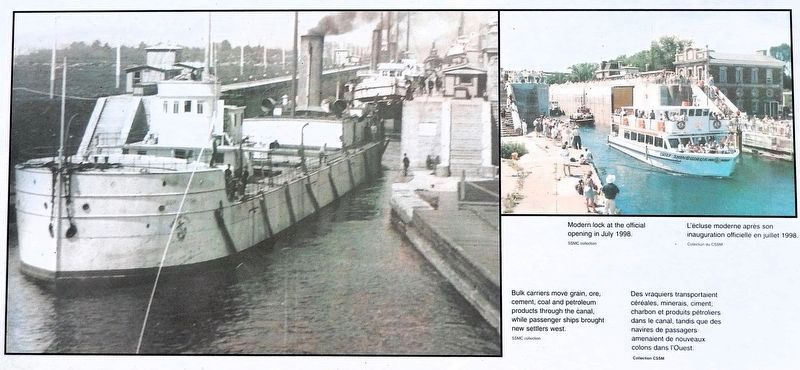
5. Marker detail: Bulk Carriers & Modern Lock
[left] Bulk carriers move grain, ore, cement, coal and petroleum products through the canal, while passenger ships brought new settlers west. (SSMC Collection)
[right] Modern lock at the official opening in July 1998. (SSMC collection) • • • [gauche] Des vraquiers transportaient céréales, minerais, ciment, charbon et produits pétroliers dans le canal, tandis que des navires de passagers amenaient de nouveaux colons dans l'Ouest. (Collection CSSM)
[droit] L'écluse moderne après son inauguration officielle en juillet 1998. (Collection CSSM)
[right] Modern lock at the official opening in July 1998. (SSMC collection)
[droit] L'écluse moderne après son inauguration officielle en juillet 1998. (Collection CSSM)

Photographed by Cosmos Mariner, June 11, 2024
6. The Sault Canal / Le canal du Sault Marker
Looking south across the canal; the south side of St. Marys Island is in the background.
Credits. This page was last revised on May 17, 2025. It was originally submitted on May 14, 2025, by Cosmos Mariner of Cape Canaveral, Florida. This page has been viewed 145 times since then and 18 times this year. Photos: 1, 2, 3, 4, 5, 6. submitted on May 16, 2025, by Cosmos Mariner of Cape Canaveral, Florida.
