
Netley in Hampshire, England, United Kingdom — Northwestern Europe (the British Isles)
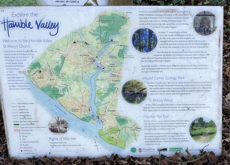
Explore the Hamble Valley
Photographed by Ray Gurganus, April 3, 2025
1. Explore the Hamble Valley Marker
Welcome to the Hamble Valley St Mary's Church
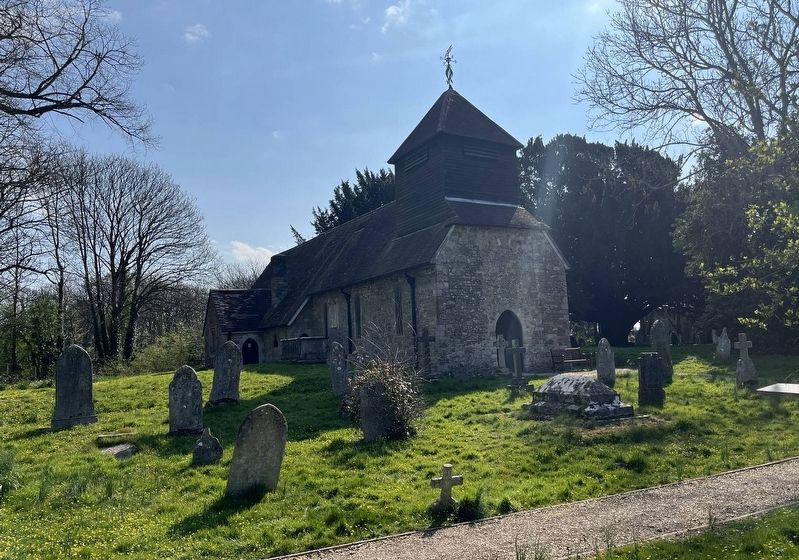
St. Mary's church was built around 1230 by the Cistercian monks of St. Andrew's Priory at Hamble le Rice. The Church lies in the old Parish of Hound which included Hamble, Sholling, Bursledon and Old Netley. The name, Hound or 'Hune', derives from a plant called 'Hoarhound' which grew profusely in the area. Today Hound includes the village of Netley Abbey, Butlocks Heath and Old Netley.
The church was purchased from the together with the priory by William of Wykeham, the Bishop of Winchester in 1391 to help finance his new college in Winchester which he founded to promote the education of parochial clergy. A portrait of William of Wykeham hangs in the church. In 1768, Hound church made national news with the following mention in 'The London Magazine':
'On Sunday 17 instant, the gallery of Hound Church near Hamble, Hants, fell down in the time of the divine service, when many of the congregation were assembled therein; by which several persons had the misfortune to have some of their bones broke, and others were very much bruised, but happily no life was lost. It was occasioned,
this page online
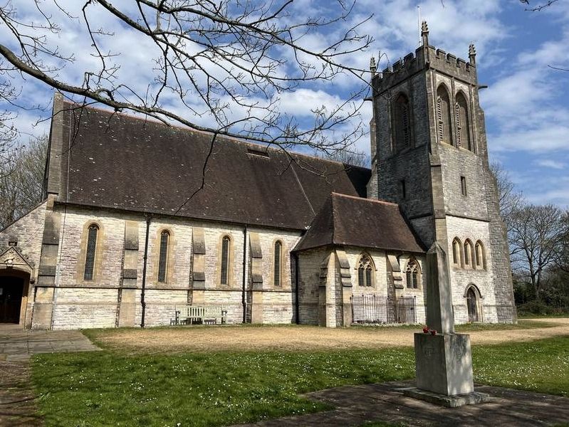
There have been few alterations to the church since it was first built and enlargement was aided by the building of a new parish church in Netley in 1886 called St. Edward's. The building of St Edwards became necessary when the village grew profusely after the building of Royal Victoria Hospital.
The lych gate was built in 1949 from stones salvaged from the Church of St Mary in Southampton which was bombed in 1940. The yew tree in the church yard is four to six hundred years old and the largest in the Eastleigh area.
Hound Corner Ecology Park
If you follow the path to your right as you are reading this panel, you will arrive Hound Corner Ecology Park. The park was developed with the help of local volunteers from what was derelict land, originally used for storage of road materials. The site was transformed in 1986 and was designed designed to encourage wildlife. Today the site contains an established wildflower meadow, a pond which is home to smooth newts a butterfly garden.
St. Mary's Wood
St Mary's Wood is seated on Hound Way to the left of St Mary's and is owned by Hampshire
Photographed by Ray Gurganus, April 3, 2025
2. St Mary's Church
Hamble Rail Trail
From Hound Corner you can access the Hamble Rail Trail by walking south along Hound Road. The trail is a pleasant, relatively easy 4.5 mile walk linking Humble Common, Royal Victoria County Park and the Solent Way to provide a circular route.
The Rail Trail runs adjacent to a disused railway track which was built towards the end of the WWI to transport aircraft from Manchester to Hamble. A siding was also constructed to serve the famous flying boat factory in Hamble; however the war ended before it could be put put into use.
Erected by Hampshire County Council.
Topics. This historical marker is listed in these topic lists: Parks & Recreational Areas • Religion & Religious Structures. A significant historical year for this entry is 1230.
Location. 50° 52.581′ N, 1° 20.132′ W. Marker is in Netley, England, in Hampshire. It is at the intersection of Hound Road on Hound Road. Near the intersection with Hound Way. Touch for map. Marker
Photographed by Ray Gurganus, April 3, 2025
3. St Edward's Church

Regionally, this marker is in the Greater South East. Globally, it is on the Atlantic Ocean, in the North Atlantic Region, in Europe, in Atlantic Europe, on one of the British Isles, in the Western World, and in the Anglosphere. Historically, it finds itself in what was once the Roman Empire.
Other nearby markers. At least 8 other markers are within 6 kilometers of this marker, measured as the crow flies: The Chapter House: Readings and Rules (approx. 1.6 kilometers away); Welcome to Netley Abbey (approx. 1.6 kilometers away); From Abbey to Mansion House (approx. 1.6 kilometers away); The Romance of Netley (approx. 1.6 kilometers away); The Church: Praise and Prayer (approx. 1.6 kilometers away); Telegraph Woods (approx. 5.2 kilometers away); Watergate (approx. 5.4 kilometers away); Jane Austen (approx. 5.4 kilometers away). Touch for a list and map of all markers in Netley.
Credits. This page was last revised on May 28, 2025. It was originally submitted on May 15, 2025, by Ray Gurganus of Washington, District of Columbia. This page has been viewed 139 times since then and 39 times this year. Photos: 1, 2, 3. submitted on May 15, 2025, by Ray Gurganus of Washington, District of Columbia. • Bill Pfingsten was the editor who published this page.
