
City Center in Chattanooga in Hamilton County, Tennessee — The American South (East South Central)
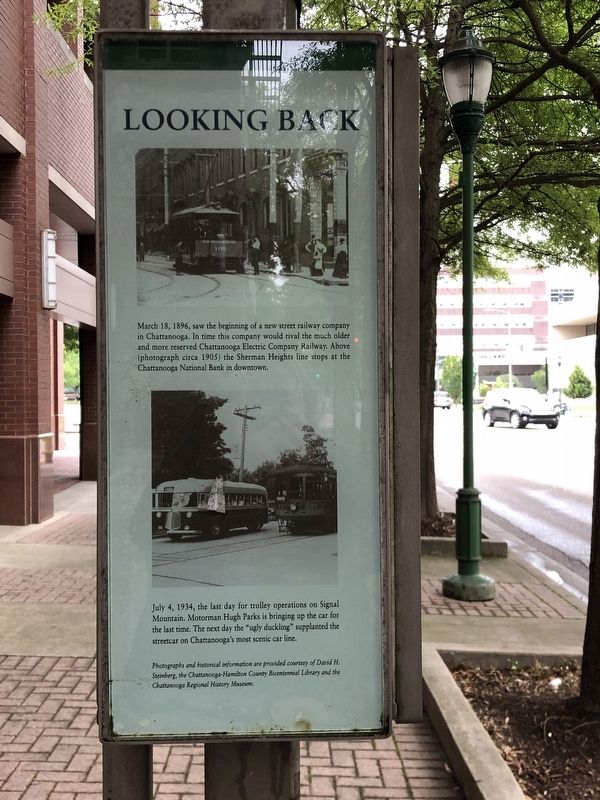
Looking Back
Photographed by Duane and Tracy Marsteller, May 10, 2025
1. Looking Back Marker
July 4, 1934, the last day for trolley operations on Signal Mountain. Motorman Hugh Parks is bringing up the car for the last time. The next day the “ugly duckling” supplanted the streetcar on Chattanooga's most scenic car line.
Photographs and historical information are provided courtesy of David Steinberg, the Chattanooga-Hamilton County Bicentennial Library and the Chattanooga Regional History Museum
Topics. This historical marker is listed in this topic list: Railroads & Streetcars. A significant historical date for this entry is March 18, 1896.
Location. 35° 2.707′ N, 85° 18.618′ W. Marker is in Chattanooga, Tennessee, in Hamilton County. It is in City Center. It is at the intersection of Broad Street and West 10th Street, on the right when traveling north on Broad Street. Marker is in the Chattanooga Area Regional Transportation
this page online

Regionally, this marker is in the American South, specifically in the Upper South, in Appalachia, and specifically in Southern Appalachia. Globally, it is in North America, the Western Hemisphere, the Western World, and the Anglosphere. Historically, it finds itself in what was once the original Cherokee Nation, the territory of the Mississippian Culture, one of the Confederate States of America, and the Antebellum South.
Other nearby markers. At least 8 other markers are within walking distance of this marker: A different marker also named Looking Back (within shouting distance of this marker); Crutchfield House (within shouting distance of this marker); The Chattanooga Rotary Club (within shouting distance of this marker); Military History of Chattanooga (within shouting distance of this marker); The Union Depot (about 300 feet away, measured in a direct line); Site of Crutchfield House (about 400 feet away); Read House (about 500 feet away);

Photographed by Duane and Tracy Marsteller, May 10, 2025
2. Looking Back Marker
Another marker is no longer nearby. First Union Occupation of the City (was about 400 feet away but has been confirmed missing).

Arthur G. Stivers; via Chattanooga Public Library (Public Domain), circa 1905
3. Streetcar scene
Street car on Market Street, looking north from 9th Street (now Martin Luther King Boulevard). Voight Brothers druggists on the right at 840 Market Street and the dome on D. B. Loveman department store is visible in the middle.
Credits. This page was last revised on May 17, 2025. It was originally submitted on May 16, 2025, by Duane and Tracy Marsteller of Murfreesboro, Tennessee. This page has been viewed 158 times since then and 34 times this year. Photos: 1, 2. submitted on May 16, 2025, by Duane and Tracy Marsteller of Murfreesboro, Tennessee. 3. submitted on May 17, 2025, by Duane and Tracy Marsteller of Murfreesboro, Tennessee.
