
Sault Ste. Marie in Algoma District, Ontario — Central Canada (North America)
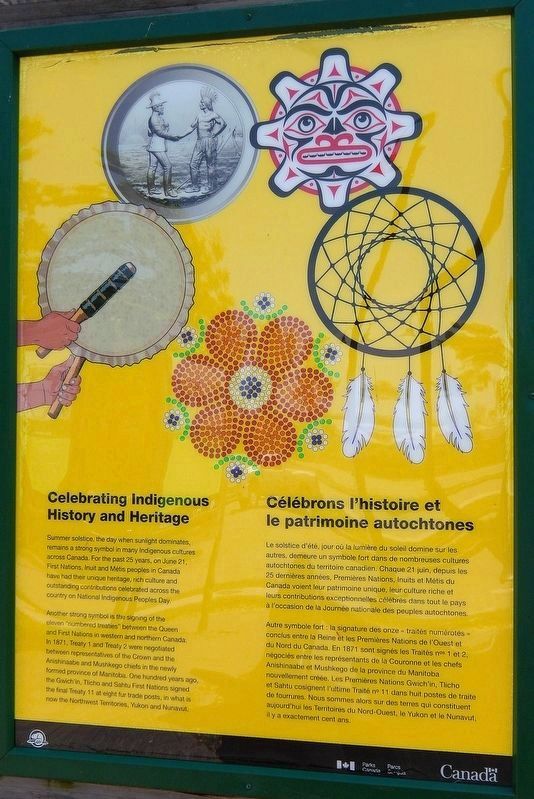
Celebrating Indigenous History and Heritage
⎯⎯⎯
Célébrons l'histoire et le patrimoine autochtones
Photographed by Cosmos Mariner, June 11, 2024
1. Celebrating Indigenous History and Heritage Marker

Another strong symbol is the signing of the eleven "numbered treaties" between the Queen and First Nations in western and northern Canada. In 1871, Treaty 1 and Treaty 2 were negotiated between representatives of the Crown and the Anishinaabe and Mushkego chiefs in the newly formed province of Manitoba. One hundred years ago, the Gwich'in, Tlicho and Sahtu First Nations signed the final Treaty 11 at eight fur trade posts, in what is now the Northwest Territories, Yukon and Nunavut.
Autre symbole fort : la signature des onze « traités numérotés » conclus entre la Reine et les Premières Nations de l'Ouest et du Nord du Canada. En 1871 sont signés les Traités nos 1 et 2, négociés entre les représentants de la Couronne et les chefs Anishinaabe et Mushkego de la province du Manitoba nouvellement créée. Les Premières Nations Gwich'in, Tlicho et Sahtu cosignent l'ultime Traité no 11 dans huit postes de traite de fourrures. Nous sommes alors sur des terres qui constituent aujourd'hui les Territoires du Nord-Ouest, le Yukon et le
this page online
Erected by Parks Canada / Parcs Canada.
Topics. This historical marker is listed in this topic list: Indigenous Peoples and Communities. A significant historical year for this entry is 1871.
Location. 46° 30.796′ N, 84° 21.027′ W. Marker is in Sault Ste. Marie, Ontario, in Algoma District. It can be reached from Canal Drive 0.7 kilometers south of Huron Street, on the left when traveling west. The marker is located along the interpretive walkway at the Sault Ste. Marie Canal National Historic Site. Touch for map. Marker is at or near this postal address: 1 Canal Drive, Sault Ste Marie ON P6A 6W4, Canada. Touch for directions.

Regionally, this marker is in the Sault Ste. Marie and Algoma Area and in Northern Ontario. It is also in Central Canada. Globally, it is in North America, in the Great North Woods, on the Great Lakes, on Lake Superior’s North Shore, in the Western Hemisphere, in the Western World, and in the Anglosphere. Historically, it finds itself in what was once a British colony, the Viceroyalty of New France, the Haudenosaunee (Iroquois) Confederacy, and Rupert’s
Photographed by Cosmos Mariner, June 11, 2024
2. Celebrating Indigenous History and Heritage Marker
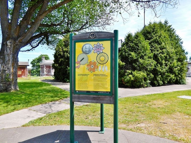
Looking southeast; the Sault Ste. Marie Canal Powerhouse is partially visible in the left background. The Sault Ste. Marie Canal is just beyond this image to the right.
Other nearby markers. At least 8 other markers are within walking distance of this marker: Equality and Multiculturalism / Égalité et multiculturalisme (here, next to this marker); The Métis in Sault Ste. Marie / Les Métis de Sault Ste. Marie (here, next to this marker); Sault Ste. Marie Canal / Canal de Sault Ste. Marie (here, next to this marker); Baawaating — the Place of the Rapids / Baawaating — le lieu des rapides (here, next to this marker); D-Day/Jour J (here, next to this marker); The Canal at war, 1914 / Le canal en guerre, 1914 (a few steps from this marker); The Sault's Industrial Heritage / Le patrimoine industriel du Sault (a few steps from this marker); Waterfront / Les Rives (a few steps from this marker). Touch for a list and map of all markers in Sault Ste. Marie.
Also see . . . Numbered Treaties (Wikipedia).
Excerpt: The Numbered Treaties (or Post-Confederation Treaties) are a series of eleven treaties signed between the First Nations, one of three groups of Indigenous Peoples in Canada, and the reigning monarch of Canada (Victoria, Edward VII or George V) from 1871 to 1921. These agreements were created to allow the Government of Canada to pursue settlement and resource extraction in the affected regions, which includes the entirety of modern-day Alberta, Manitoba, and Saskatchewan, as well as parts of modern-day British Columbia, Ontario, the Northwest Territories, Nunavut, and Yukon. These treaties expanded the Dominion of Canada resulting in the displacement of Indigenous populations for large tracts of land in exchange for promises made to the indigenous people of the area. These terms were dependent on individual negotiations and so specific terms differed with each treaty.(Submitted on May 18, 2025, by Cosmos Mariner of Cape Canaveral, Florida.)
These treaties came in two waves—Numbers 1 through 7 from 1871 to 1877 and Numbers 8 through 11 from 1899 to 1921. Today, these agreements are upheld by the Government of Canada, administered by Canadian Aboriginal law and overseen by the Minister of Crown–Indigenous Relations. They are often criticized and are a leading issue within the fight for First Nation rights.
Credits. This page was last revised on July 15, 2025. It was originally submitted on May 16, 2025, by Cosmos Mariner of Cape Canaveral, Florida. This page has been viewed 128 times since then and 18 times this year. Photos: 1, 2. submitted on May 18, 2025, by Cosmos Mariner of Cape Canaveral, Florida.
