Sault Ste. Marie in Algoma District, Ontario — Central Canada (North America)
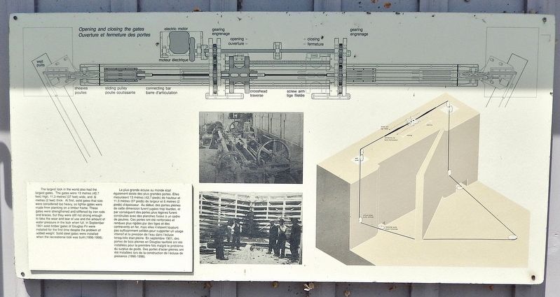
Opening and Closing the Gates
⎯⎯⎯
Ouverture et fermeture des portes
Photographed by Cosmos Mariner, June 11, 2024
1. Opening and Closing the Gates / Ouverture et fermeture des portes Marker

this page online
Topics. This historical marker is listed in these topic lists: Architecture • Waterways & Vessels. A significant historical month for this entry is September 1901.
Location. 46° 30.78′ N, 84° 20.993′ W. Marker is in Sault Ste. Marie, Ontario, in Algoma District. It can be reached from Canal Drive 0.7 kilometers south of Huron Street, on the left when traveling west. The marker is located along the interpretive walkway at the Sault Ste. Marie Canal National Historic Site. Touch for map. Marker is at or near this postal address: 1 Canal Drive, Sault Ste Marie ON P6A 6W4, Canada. Touch for directions.

Regionally, this marker is in the Sault Ste. Marie and Algoma Area and in Northern
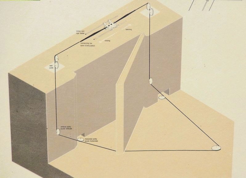
2. Marker detail: Gate Diagram / Diagramme de porte
Other nearby markers. At least 8 other markers are within walking distance of this marker: Canal Under Construction, 1894 / Le canal en construction, 1894 (within shouting distance of this marker); Waterfront / Les Rives (within shouting distance of this marker); The Sault's Industrial Heritage / Le patrimoine industriel du Sault (within shouting distance of this marker); A National Historic Site at the Sault / Un lieu historique national au Sault (within shouting distance of this marker); The All Canadian Waterway (1895-1959) / La voie navigable entièrement canadienne (1895-1959) (within shouting distance of this marker); The Sault Canal / Le canal du Sault (within shouting distance of this marker); Equality and Multiculturalism / Égalité et multiculturalisme

Photographed by Cosmos Mariner, June 11, 2024
3. Opening and Closing the Gates / Ouverture et fermeture des portes Marker
The marker is mounted on the canal house, overlooking the east gate.
Also see . . . Sault Ste. Marie Canal (Wikipedia).
Excerpt: National Historic Site in Sault Ste. Marie, Ontario, and part of the national park system managed by Parks Canada. It includes a lock to bypass the rapids on the St. Marys River. The construction of the canal and lock was completed in 1895. At that time it was the largest lock and first electrically operated lock in the world. The canal is about 1 mile long and originally the lock portion was 899 feet long and 59 feet wide. Due to a wall failure in 1987, the historic lock was shut down indefinitely. A new lock, built within the old lock, was opened in 1998 and is 253 feet long, 51 feet wide, 44 feet deep, with a 9.8 feet draft. The canal is used for recreational and tour boats; major shipping traffic uses the U.S. locks. Most of the original machinery used to operate the lock is still in place.(Submitted on May 19, 2025, by Cosmos Mariner of Cape Canaveral, Florida.)
Photographed by Cosmos Mariner, June 11, 2024
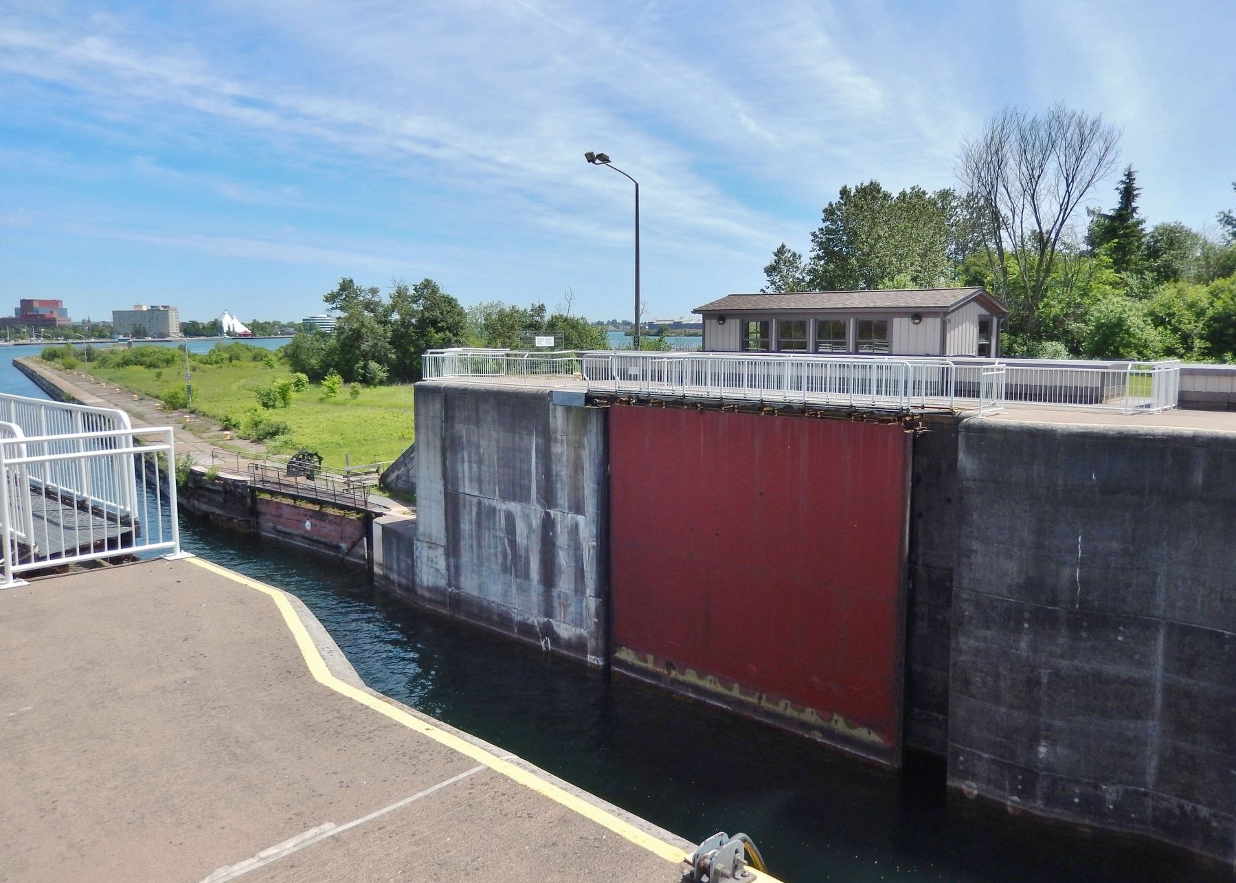
4. The east canal gate (open)
Looking southeast from near the marker.
Credits. This page was last revised on May 19, 2025. It was originally submitted on May 16, 2025, by Cosmos Mariner of Cape Canaveral, Florida. This page has been viewed 91 times since then and 13 times this year. Photos: 1, 2, 3, 4. submitted on May 19, 2025, by Cosmos Mariner of Cape Canaveral, Florida.
