Sault Ste. Marie in Algoma District, Ontario — Central Canada (North America)
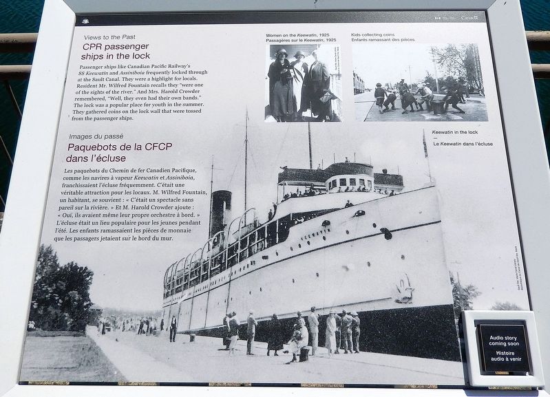
CPR Passenger Ships in the Lock
Views to the Past
⎯⎯⎯
Paquebots de la CFCP dans l'écluse
Images du passé
Photographed by Cosmos Mariner, June 11, 2024
1. CPR Passenger Ships in the Lock / Paquebots de la CFCP dans l'écluse Marker

[image captions]
• Women on the Keewatin, 1925
• Kids collecting coins
• Keewatin in the lock
[légendes d'images]
• Passagères sur le
this page online
• Enfants ramassant des pieces
• Le Keewatin dans l’écluse
Erected by Parks Canada / Parcs Canada.
Topics. This historical marker is listed in these topic lists: Industry & Commerce • Waterways & Vessels.
Location. 46° 30.782′ N, 84° 21.184′ W. Marker is in Sault Ste. Marie, Ontario, in Algoma District. It can be reached from Canal Drive 0.7 kilometers south of Huron Street, on the left when traveling west. The marker is located along the interpretive walkway at the Sault Ste. Marie Canal National Historic Site. Touch for map. Marker is at or near this postal address: 1 Canal Drive, Sault Ste Marie ON P6A 6W4, Canada. Touch for directions.

Regionally, this marker is in the Sault Ste. Marie and Algoma Area and in Northern Ontario. It is also in Central Canada. Globally, it is in North America, in the Great North Woods, on the Great Lakes, on Lake Superior’s North Shore, in the Western Hemisphere, in the Western World, and in the Anglosphere. Historically, it finds itself in what was once a British colony, the Viceroyalty of New France, the
Photographed by Cosmos Mariner, June 11, 2024
2. CPR Passenger Ships in the Lock / Paquebots de la CFCP dans l'écluse Marker
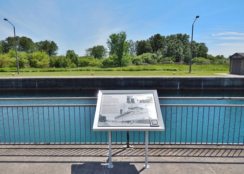
Looking south across the canal; the south side of St. Marys Island is in the background.
Other nearby markers. At least 8 other markers are within walking distance of this marker: Canadian Veterans Memorial (about 120 meters away, measured in a direct line); 1622 (about 120 meters away); The "Chicora" Incident (about 120 meters away); An Accident at the Canal / Un accident dans le canal (about 150 meters away); The Canal at war, 1914 / Le canal en guerre, 1914 (about 180 meters away); Sault Ste. Marie Ship Canal (about 180 meters away); The Sault Canal / Le canal du Sault (about 180 meters away); D-Day/Jour J (about 180 meters away). Touch for a list and map of all markers in Sault Ste. Marie.
Also see . . . SS Keewatin (Wikipedia).
Excerpt: SS Keewatin is a passenger liner which once travelled between Port Arthur/Fort William (now Thunder Bay) on Lake Superior and Port McNicoll on Georgian Bay (Lake Huron) in Ontario, Canada. She carried passengers between these ports for the Canadian Pacific Railway's Great Lakes steamship service. Keewatin also carried packaged freight goods for the railway at these ports.(Submitted on May 17, 2025, by Cosmos Mariner of Cape Canaveral, Florida.)
Keewatin was originally designed to supplement the Great Lakes link in the Canadian Pacific Railway's continental route. Together with her sister ship Assiniboia, she joined three others, Manitoba, Athabaska, and Alberta. She served this purpose by linking the Railroad's Owen Sound depot to Fort William Port Arthur on Lake Superior. The ships took two and a half days to make the trip each way, including half a day traversing the Soo Locks.
Keewatin arrived at Kingston, Ontario on 26 October 2023 while under tow by tugboats. The ship was placed in a dry dock and received a heritage designation. On 17 May 2024, Keewatin was opened for public tours.
Credits. This page was last revised on May 17, 2025. It was originally submitted on May 16, 2025, by Cosmos Mariner of Cape Canaveral, Florida. This page has been viewed 110 times since then and 18 times this year. Photos: 1, 2. submitted on May 17, 2025, by Cosmos Mariner of Cape Canaveral, Florida.
