Sault Ste. Marie in Algoma District, Ontario — Central Canada (North America)
The Dam in Action!
⎯⎯⎯
Le barrage à l'œuvre!

Photographed by Cosmos Mariner, June 11, 2024
1. The Dam in Action! / Le barrage à l'œuvre! Marker

On the day of the 1909 accident, the T-shaped handle broke and workers hitched a team of horses to the dam to complete the swinging.
View a working model of the Emergency Swing Dam in our visitor center!
En 1909, le jour de l'accident, la poignée en T s'est brisée et les ouvriers ont dû attacher un
this page online
Voyez un modèle animé du barrage tournant de secours dans notre centre d'accueil!
Topics. This historical marker is listed in these topic lists: Architecture • Bridges & Viaducts • Disasters • Waterways & Vessels. A significant historical date for this entry is June 9, 1909.
Location. 46° 30.797′ N, 84° 21.397′ W. Marker is in Sault Ste. Marie, Ontario, in Algoma District. It is on Canal Drive 1.1 kilometers west of Huron Street, on the left when traveling west. The marker is located near the Emergency Swing Bridge Dam at the Sault Ste. Marie Canal National Historic Site. Touch for map. Marker is at or near this postal address: 1 Canal Drive, Sault Ste Marie ON P6A 6W4, Canada. Touch for directions.

Regionally, this marker is in the Sault Ste. Marie and Algoma Area and in Northern Ontario. It is also in Central Canada. Globally, it is in North America, in the Great North Woods, on the Great Lakes, on Lake Superior’s North Shore, in the Western Hemisphere, in the Western World, and in the Anglosphere. Historically, it finds itself in what was once a British

Photographed by Cosmos Mariner, June 11, 2024
2. Marker detail: Damaged Lower Lock Gate
Other nearby markers. At least 8 other markers are within walking distance of this marker: What a Rush! / Urgence! (here, next to this marker); Why Preserve This Big Hunk of Steel? / Pourquoi préserver cette énorme structure d'acier? (here, next to this marker); The Last Emergency Swing Dam in the World! / Le dernier barrage tournant de secours au monde! (a few steps from this marker); Emergency Swing Bridge Dam / Barrage tournant de secours (about 90 meters away, measured in a direct line); The "Chicora" Incident (about 150 meters away); Canadian Veterans Memorial (about 150 meters away); CPR Passenger Ships in the Lock / Paquebots de la CFCP dans l'écluse (approx. 0.3 kilometers away); 1622 (approx. 0.4 kilometers away). Touch for a list and map of all markers in Sault Ste. Marie.
Also see . . . Disaster at the Canadian Soo, June 9, 1909.
Excerpt: June 9, 1909 dawned uneventful enough but a mid-afternoon accident in the Canadian Lock caused by an American ship disregarding lockage instructions brought traffic to a(Submitted on May 19, 2025, by Cosmos Mariner of Cape Canaveral, Florida.)standstill and closed the entire area to maritime traffic for twelve days. That it was only closed twelve days and that no lives had been lost in the day’s chain of events was judged to be nothing short of a miracle…Photographed by Cosmos Mariner, June 11, 20243. The Dam in Action! / Le barrage à l'œuvre! MarkerLooking north; Canal Drive crosses in the background.

Photographed by Cosmos Mariner, June 11, 2024
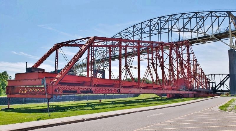
4. Emergency Swing Bridge Dam (east elevation)
Looking west along Canal Drive from near the marker. The swing bridge is resting in standby position, parallel to the canal. The Sault Ste. Marie International Bridge (high in the background) carries vehicle traffic over the canal. There is also a railroad bridge crossing the canal in the distant background.

Photographed by Cosmos Mariner, June 11, 2024
5. Emergency Swing Bridge Dam Wickets
These massive steel “wickets” are dragged along with the emergency bridge when it swings across the canal, dropping into the water to slow the flow.
Photographed by Cosmos Mariner, June 11, 2024
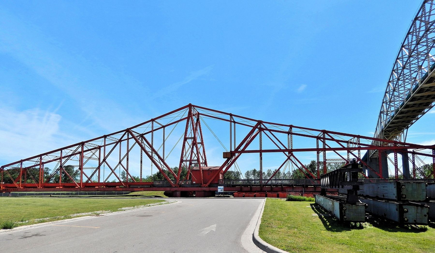
6. Emergency Swing Bridge Dam (north elevation)
The Sault Ste. Marie International Bridge is overhead on the right.
Credits. This page was last revised on May 19, 2025. It was originally submitted on May 16, 2025, by Cosmos Mariner of Cape Canaveral, Florida. This page has been viewed 113 times since then and 23 times this year. Photos: 1, 2, 3, 4, 5. submitted on May 18, 2025, by Cosmos Mariner of Cape Canaveral, Florida. 6. submitted on May 19, 2025, by Cosmos Mariner of Cape Canaveral, Florida.
