Ballston in Arlington in Arlington County, Virginia — The American South (Mid-Atlantic)
Robert Ball Sr. Family Burial Ground
Photographed by Devry Becker Jones (CC0), May 16, 2025
1. Robert Ball Sr. Family Burial Ground Marker
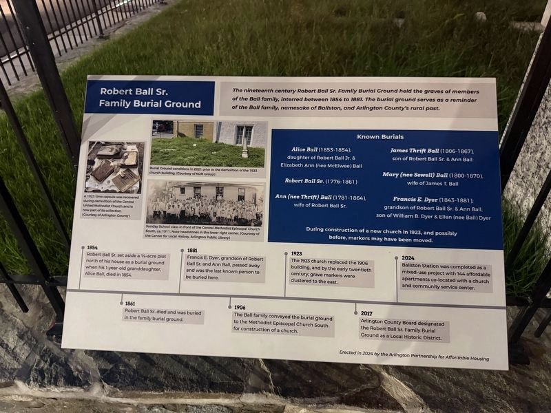
The nineteenth century Robert Ball Sr. Family Burial Ground held the graves of members of the Ball family, interred between 1854 to 1881. The burial ground serves as a reminder of the Ball family, namesake of Ballston, and Arlington County's rural past.
During construction of a new church in 1923, and possibly before, markers may have been moved.
[Timeline:]
1854: Robert Ball Sr. set aside a ¼-acre plot north of his house as a burial ground when his 1-year-old granddaughter, Alice Ball, died in 1854.
1861: Robert Ball Sr. died and was buried in the family burial ground.
1881: Francis E. Dyer, grandson of Robert Ball Sr. and Ann Ball, passed away and was the lastknown person to be buried here.
Click or scan to see
this page online
1906: The Ball family conveyed the burial ground to the Methodist Episcopal Church South for construction of a church.
1923: The 1923 church replaced the 1906 building, and by the early twentieth century, grave markers were clustered to the east.
2017: Arlington County Board designated the Robert Ball Sr. Family Burial Ground as a Local Historic District.
2024: Ballston was completed as a mixed-use project with 144 affordable apartments co-located with a church and community service center.
[Captions:]
A 1923 time capsule was recovered during demolition of the Central United Methodist Church and is now part of its collection. (Courtesy of Arlington County)
Burial Ground conditions in 2021 prior to the demolition of the 1923 church building. (Courtesy of KCM Group)
Sunday School class in front of the Central Methodist Episcopal Church South, ca. 1911. Note headstones in the lower right corner. (Courtesy of the Center for Local History, Arlington Public Library)
Erected 2024 by The Arlington Partnership for Affordable Housing.
Topics and series. This historical marker
Photographed by Devry Becker Jones (CC0), May 16, 2025
2. Robert Ball Sr. Family Burial Ground Marker
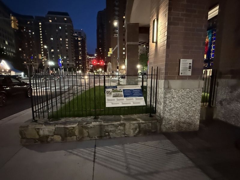
Location. 38° 52.954′ N, 77° 6.633′ W. Marker is in Arlington, Virginia, in Arlington County. It is in Ballston. It is on North Stafford Street north of Fairfax Drive (Virginia Route 237), on the right when traveling south. Touch for map. Marker is at or near this postal address: 4201 Fairfax Drive, Arlington VA 22201, United States of America. Touch for directions.

Regionally, this marker is in the Washington Metropolitan Area and in Northern Virginia. It is also in the American South, specifically in the Upper South, in the Mid-Atlantic, and on the Eastern Seaboard. Globally, it is in the North Atlantic Region, North America, the Western Hemisphere, the Western World, and the Anglosphere. Historically, it finds itself in what was once the territory of the Mississippian Culture, one of the original Thirteen Colonies, one of the Confederate States of America, and the Antebellum South.
Other nearby markers. At least
Also see . . . Robert Ball Sr. Family Burial Ground Profile on the Arlington County site.
Date: c. 1854(Submitted on May 16, 2025, by Devry Becker Jones of Washington, District of Columbia.)
Historic Designation: Local Historic District, February 28, 2017
Current Use of Property: Cemetery
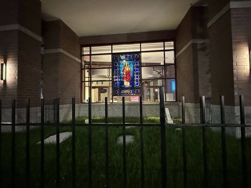
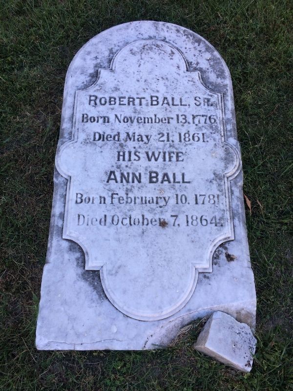
The Ball family first platted the ¼-acre graveyard in 1865 when the neighborhood consisted almost entirely of farmland; however, the first known interment occurred in 1854. The size of the burial ground decreased due to the conveyance of the property to the Central United Methodist Church, who built the present-day church on part of the land in 1923. In the twentieth century, Ballston experienced a period of dense urban development that nowsurrounds the burial ground. A section of the original graveyard parcel remains open green space. The cemetery measures 502 square feet.Photographed by J. Makali Bruton, October 3, 20174. One of the gravestones from the small Ball Family graveyard.
Significant Features: The Robert Ball Sr. Family Burial Ground represents the character and development of the Ballston neighborhood in the early- to mid-nineteenth century. The burial ground, established by Robert Ball Sr., represents the antebellum rural nature of the community and contains the interred remains of some of the County’s earliest settlers. Family graveyards illustrate the self-sufficiency of these rural landowners and the early American tradition of such burial plots.
The Ball family’s ownership of a tavern and property at the intersection of Wilson Boulevard and North Glebe Road, and their general prominence in the civic affairs of the County, resulted in the naming of the intersection as Ball’s Cross Roads and the eventual naming of the community as Ballston.
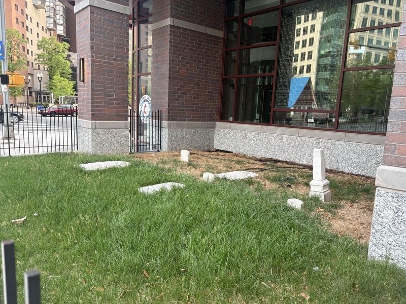
Photographed by Scott Rozzelle, April 14, 2026
5. Robert Ball Sr. Family Grave Markers
Credits. This page was last revised on April 20, 2026. It was originally submitted on May 16, 2025, by Devry Becker Jones of Washington, District of Columbia. This page has been viewed 270 times since then and 68 times this year. Photos: 1, 2, 3. submitted on May 16, 2025, by Devry Becker Jones of Washington, District of Columbia. 4. submitted on October 4, 2017, by J. Makali Bruton of Washington, District of Columbia. 5. submitted on April 16, 2026, by David Rozzelle of Knoxville, Tennessee.
Editor’s want-list for this marker. Clear, daylight photos of the marker, context and burial ground. • Can you help?
