Milledgeville in Baldwin County, Georgia — The American South (South Atlantic)
De Soto in Georgia
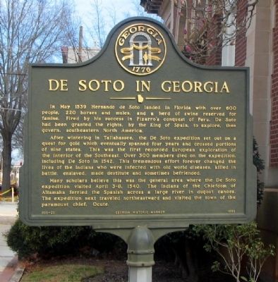
Photographed by David Seibert, February 19, 2005
1. DeSoto in Georgia Marker
In May 1539 Hernando de Soto landed in Florida with over 600 people, 220 horses and mules, and a herd reserved for famine. Fired by his success in Pizarro's conquest of Peru, De Soto had been granted the rights, by the King of Spain, to explore, then govern, southeastern North America.
After wintering in Tallahassee, the De Soto expedition set out on a quest for gold which eventually spanned four years and crossed portions of nine states. This was the first recorded European exploration of the interior of the Southeast. Over 300 members died on the expedition, including De Soto in 1542. This tremendous effort forever changed the lives of the Indians who were infected with old world diseases, killed in battle, enslaved, made destitute and sometimes befriended.
Many scholars believe that this was the general area where the De Soto expedition visited April 3-8, 1540. The Indians of the Chiefdom of Altamaha ferried the Spanish across a large river in dugout canoes. The expedition next traveled northeastward and visited the town of the paramount chief, Ocute.
Erected 1990 by Georgia Department of Natural Resources.
this page online
Topics and series. This historical marker is listed in these topic lists: Exploration • Indigenous Peoples and Communities. In addition, it is included in the Georgia Historical Society series list. A significant historical year for this entry is 1539.
Location. 33° 4.84′ N, 83° 13.754′ W. Marker is in Milledgeville, Georgia, in Baldwin County. It is at the intersection of West Hancock Street (Georgia Route 24) and S. Wilkinson Street, on the right when traveling east on West Hancock Street. The marker is located in front of the Milledgeville-Baldwin County Convention and Visitors Bureau. Touch for map. Marker is at or near this postal address: 200 West Hancock Street, Milledgeville GA 31061, United States of America. Touch for directions.

Regionally, this marker is in the Antebellum Trail and in the Piedmont. It is also in the American South and specifically in the Deep South. Globally, it is in North America, the Western Hemisphere, the Western World, and the Anglosphere. Historically, it finds itself in what was once the territory of the Mississippian Culture, one of the original Thirteen Colonies,

Photographed by Mark Hilton, April 30, 2017
2. De Soto in Georgia Marker near the Milledgeville-Baldwin County Visitors Bureau.
Other nearby markers. At least 8 other markers are within walking distance of this marker: Baldwin County Veterans Memorial (within shouting distance of this marker); The Great Seal of Georgia (within shouting distance of this marker); The Allen Strain (within shouting distance of this marker); Great Seal of Georgia and the Unfinished Acts of the Legislature, 1864 (within shouting distance of this marker); Birthplace of Charles Holmes Herty (within shouting distance of this marker); Dr. Charles Holmes Herty (within shouting distance of this marker); Georgia State Penitentiary (about 300 feet away, measured in a direct line); Tomlinson Fort House (about 500 feet away). Touch for a list and map of all markers in Milledgeville.
Related markers. Click here for a list of markers that are related to this marker. To better understand the relationship, study each marker in the order shown.
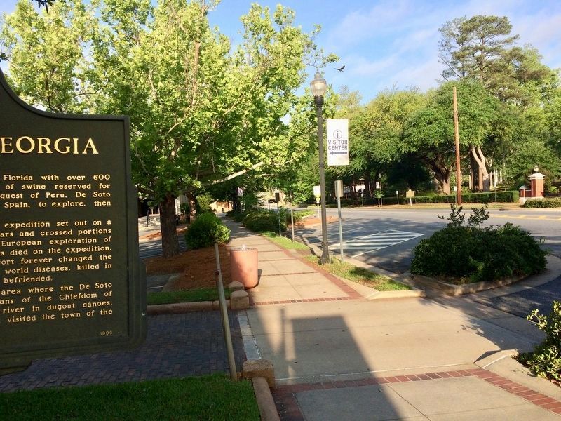
Photographed by Mark Hilton, April 30, 2017
3. View from marker west on East Hancock Street towards Georgia College.
Credits. This page was last revised on September 23, 2024. It was originally submitted on October 10, 2008, by David Seibert of Sandy Springs, Georgia. This page has been viewed 2,885 times since then and 141 times this year. Last updated on February 8, 2010, by David Seibert of Sandy Springs, Georgia. Photos: 1. submitted on October 10, 2008, by David Seibert of Sandy Springs, Georgia. 2, 3. submitted on April 30, 2017, by Mark Hilton of Montgomery, Alabama. • Kevin W. was the editor who published this page.
