Washington Heights in Manhattan in New York County, New York — The American Northeast (Mid-Atlantic)
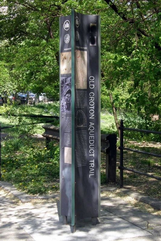
Old Croton Aqueduct Trail
Photographed by Larry Gertner, May 2, 2025
1. Old Croton Aqueduct Trail Marker
Aqueduct History
Built between 1837 and 1842, the Croton Aqueduct profoundly changed New York City by providing abundant clean water from the Croton River in northern Westchester County. Local wells, springs and ponds had gradually become polluted from lack of sewers and the unchecked growth of industry. Investing in a new water supply became a priority after a devastating Cholera Epidemic in 1832 and the Great Fire of 1835.
The aqueduct, designed by John B. Jervis, was one of the most ambitious public works projects ever undertaken in the United States and a magnificent example of 19th century engineering. The system used gravity alone to carry water through an enclosed masonry structure for 41 miles through varied terrain, and over streams, roads and rivers. Construction of the aqueduct allowed New York City to grow and prosper, and it remained in use until 1955, when it was taken out of service. As indoor plumbing became commonplace, water use increased, and this system became known as the “old” Croton Aqueduct when the New Croton Aqueduct was built in the late 1880s. Later, the water supply system was supplemented by the Catskill System (1915) and the Delaware System (1944). The section of the old Croton Aqueduct in the Bronx, and the High Bridge over the Harlem River, are National Historic Landmarks.
Highbridge Park
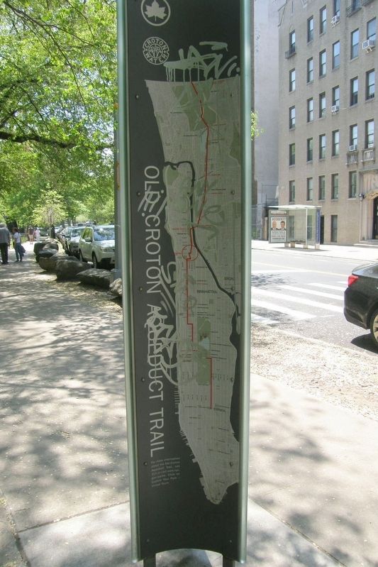
The aqueduct passed through this area as it carried water from Westchester County to Manhattan. The route of this aqueduct jogs to the west of this location, instead of running directly north-south, to avoid steep slopes. South of 151st Street, the route of the aqueduct runs straight along Amsterdam Avenue on flatter and softer ground.
Depending on the terrain, the path of the aqueduct was either level with the ground, set up on embankments, tunneled under the ground or rock, or carried
this page online
Erected by NYC Parks.
Topics and series. This historical marker is listed in these topic lists: Architecture • Bridges & Viaducts • Industry & Commerce • Parks & Recreational Areas. In addition, it is included in the NYC Parks series list. A significant historical year for this entry is 1837.
Location. 40° 49.962′ N, 73° 56.373′ W. Marker is in Manhattan, New York, in New York County. It is in Washington Heights. It is at the intersection of Edgecombe Avenue and East 158th Street, on the right when traveling east on Edgecombe Avenue. Touch for map. Marker is at or near this postal address: 525 Edgecombe Ave, New York NY 10032, United States of America. Touch for directions.

Regionally, this marker is in New York City. It is also in the American Northeast, in the Mid-Atlantic, and on the Eastern Seaboard. Globally, it is in the North Atlantic Region, North America, the Western Hemisphere, the Western World, and the Anglosphere. Historically, it finds itself in what was once New Netherland
Photographed by Larry Gertner, May 2, 2025
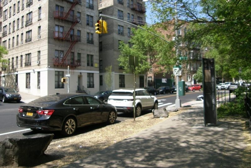
2. Old Croton Aqueduct Trail marker site
Edgecombe Avenue and West 158th Street
Other nearby markers. At least 8 other markers are within walking distance of this marker: The John T. Brush Stairway (a few steps from this marker); a different marker also named John T. Brush Stairway (within shouting distance of this marker); The Green Book (about 400 feet away, measured in a direct line); Edward Kennedy "Duke" Ellington Residence (about 500 feet away); 555 Edgecombe Av (about 500 feet away); Polo Grounds (about 600 feet away); Regina Andrews (about 600 feet away); Morris-Jumel Mansion (about 700 feet away). Touch for a list and map of all markers in Manhattan.
Also see . . .
1. Croton Aqueduct. Wikipedia entry (Submitted on May 18, 2025, by Larry Gertner of New York, New York.)
2. Old Croton Aqueduct Trail. NYC Parks website entry (Submitted on May 18, 2025, by Larry Gertner of New York, New York.)
3. Old Croton Aqueduct State Historic Park. New York State Parks, Recreation and Historic Preservation website entry (Submitted on May 18, 2025, by Larry Gertner of New York, New York.)

Photographed by Larry Gertner, May 2, 2025
3. Old Croton Aqueduct Trail Marker, panel 1

Photographed by Larry Gertner, May 2, 2025
4. Old Croton Aqueduct Trail Marker, panel 2
Photographed by Larry Gertner, May 2, 2025
5. Old Croton Aqueduct Trail Marker, panel 3

via Wikipedia, 1859
6. High Bridge crossing the Harlem River, 1859
Credits. This page was last revised on July 11, 2025. It was originally submitted on May 18, 2025, by Larry Gertner of New York, New York. This page has been viewed 200 times since then and 25 times this year. Photos: 1, 2, 3, 4, 5, 6. submitted on May 18, 2025, by Larry Gertner of New York, New York.
