Southampton City Centre , England, United Kingdom — Northwestern Europe (the British Isles)
Blue Anchor Lane
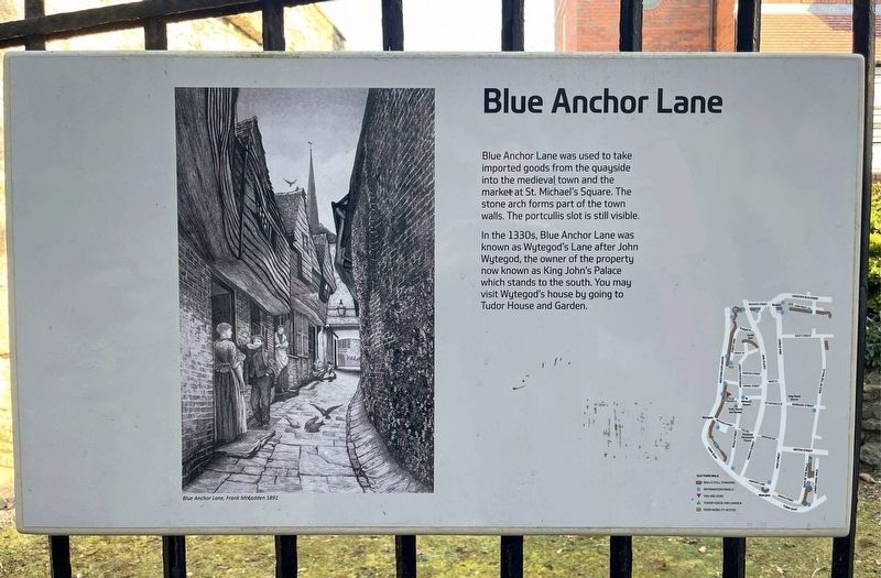
Photographed by Ray Gurganus, April 1, 2025
1. Blue Anchor Lane Marker
In the 1330s, Blue Anchor Lane was known as Wytegod's Lane after John Wytegod, the owner of the property now known as King John's Palace which stands to the south. You may visit Wytegod's house by going to Tudor House and Garden.
Topics. This historical marker is listed in these topic lists: Industry & Commerce • Roads & Vehicles.
Location. 50° 53.979′ N, 1° 24.414′ W. Marker is in Southampton, England. It is in Southampton City Centre. It is on Blue Anchor Lane. Touch for map. Marker is in this post office area: Southampton, England SO14 2DX, United Kingdom. Touch for directions.

Regionally, this marker is in England’s Hampshire Ports. Globally, it is on the Atlantic Ocean, in the North Atlantic Region, in Europe, in Atlantic Europe, on one of the British Isles, in the Western World, and in the Anglosphere. Historically, it finds
this page online
Other nearby markers. At least 8 other markers are within walking distance of this marker: Replica of a 14th Century Cargo Ship (within shouting distance of this marker); Southampton's Medieval West Quay c.1450 (within shouting distance of this marker); Westgate (within shouting distance of this marker); St Michael's Square (about 90 meters away, measured in a direct line); Walter Taylor (about 90 meters away); a different marker also named Westgate (about 120 meters away); St. Michael's Church (about 150 meters away); Cuckoo Lane (about 150 meters away). Touch for a list and map of all markers in Southampton.

Photographed by Ray Gurganus, April 1, 2025
2. Blue Anchor Lane and Marker
Credits. This page was last revised on May 18, 2025. It was originally submitted on May 18, 2025, by Ray Gurganus of Washington, District of Columbia. This page has been viewed 93 times since then and 20 times this year. Photos: 1, 2. submitted on May 18, 2025, by Ray Gurganus of Washington, District of Columbia. • Andrew Ruppenstein was the editor who published this page.
