Southampton City Centre , England, United Kingdom — Northwestern Europe (the British Isles)
The Medieval Mayors' Wine Vaults
Photographed by Ray Gurganus, April 1, 2025
1. The Medieval Mayors' Wine Vaults Marker
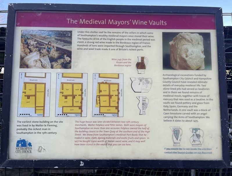
The earliest stone building on the site was lived in by Walter le Fleming, probably the richest man in Southampton in the 13th century.
The huge house was later divided between two 15th century merchants, Walter Fetplace and Peter James. Both were mayors of Southampton on more than one occasion. Fetplace owned the half of the building closest to the Town Quay at the southern end of the High Street. We know from Southampton's medieval Port Books that he traded in wine, cloth, dyeing materials and exotic fruits and spices. In 1417 he bought £400 worth of Italian sweet wine, and it may well have been stored in the vaults that you can see here.
Archaeological excavations funded by Southampton City Council and Hampshire County Council
this page online
Erected by Southampton City Council.
Topics. This historical marker is listed in these topic lists: Anthropology & Archaeology • Industry & Commerce. A significant historical year for this entry is 1475.
Location. 50° 53.845′ N, 1° 24.251′ W. Marker is in Southampton, England. It is in Southampton City Centre. It is on High Street, on the left when traveling north. Touch for map. Marker is in this post office area: Southampton, England SO14 2GJ, United Kingdom. Touch for directions.

Regionally, this marker is in the Hampshire Ports. Globally, it is on the Atlantic Ocean, in the North Atlantic Region, in Europe, in Atlantic Europe, on one of the British Isles, in the Western World, and in the Anglosphere. Historically, it finds itself in what was once the Roman Empire.
Other nearby markers. At least 8 other markers are within walking distance of this marker: Watergate (within shouting distance of this marker); Jane Austen (within shouting distance of this marker); Nos. 52-56 French Street (about 150 meters away, measured in a direct line); Migration in Southampton (about 210 meters away); Mayflower Pilgrims Memorial (about 210 meters away); Mayflower Memorial (about 210 meters away); Cuckoo Lane (about 210 meters away); Westgate (approx. 0.2 kilometers away). Touch for a list and map of all markers in Southampton.
Credits. This page was last revised on June 4, 2025. It was originally submitted on May 18, 2025, by Ray Gurganus of Washington, District of Columbia. This page has been viewed 194 times since then and 60 times this year. Photo 1. submitted on May 18, 2025, by Ray Gurganus of Washington, District of Columbia. • Andrew Ruppenstein was the editor who published this page.
Editor’s want-list for this marker. photo of the marker within its surroundings • Can you help?
