Wareham in Dorset, England, United Kingdom — Northwestern Europe (the British Isles)
Wareham Wanderings and Wonderings
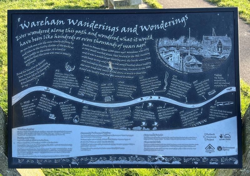
Photographed by Ray Gurganus, April 2, 2025
1. Wareham Wanderings and Wonderings Marker
As you look out over the river slowly drifting by and listen to the lively chatter of the ducks as they paddle in the water, it is hard to imagine that the scene was once so totally different!
Back in Roman times (2000 years ago) Wareham was only & very small market place. Fast forward to the the century and it was a much larger thriving port, the banks were alive with boats to-ing and fro-ing and people bustled about loading and unloading the goods the boats carried. However in the 1800s the river trade had really slowed down, so much so that the quay was hardly used and as almost a swamp!
Read the timeline to discover how Wareham's fascinating history has led to it changing dramatically from age to age.
• 1-99AD - Wareham was a small market place with a port where the quay is now.
• 700s - St Aldhelm (the first Bishop of Sherborne) took a boat from Wareham on his journey to Rome.
• 876 - Guthrum (King of the Danish Vikings) invaded and captured Wareham. He setup his headquarters in the nunnery
this page online
• 878 - Guthrum was defeated by King Alfred the Great at the gruesome Battle of Edington.
• 879 - Wareham was a successful port and a high status Saxon town. Salt was purified at Arne and exported along the river.
• 1066 - The town's population was 1,400. The first South bridge was built with 7 arches. The main exports were salt, leather, potter's clay and corn, and the main import was wine.
• 1200-1210 - Businesses and store houses were built on the Quay.
• 1216 - Wareham was caught up in the war between King John of England and the barons. The estuary began silting up so traders and sailors started to leave.
• 1248 - Pool received its first charter as a port, and Wareham became a small medieval market centre.
• 1347 - 3 ships carrying 59 men sailed from Wareham to support King Edward III's siege of Calais.
• 1665 - Purbeck was found to have the best clay in the country for making clay pipes. Tobacco pipe clay is shipped from Wareham.
• 1700s - 10,000 tons of tobacco pipe clay were exported from Wareham on sailing barges.
• 1771 - Josiah Wedgewood signed a contract
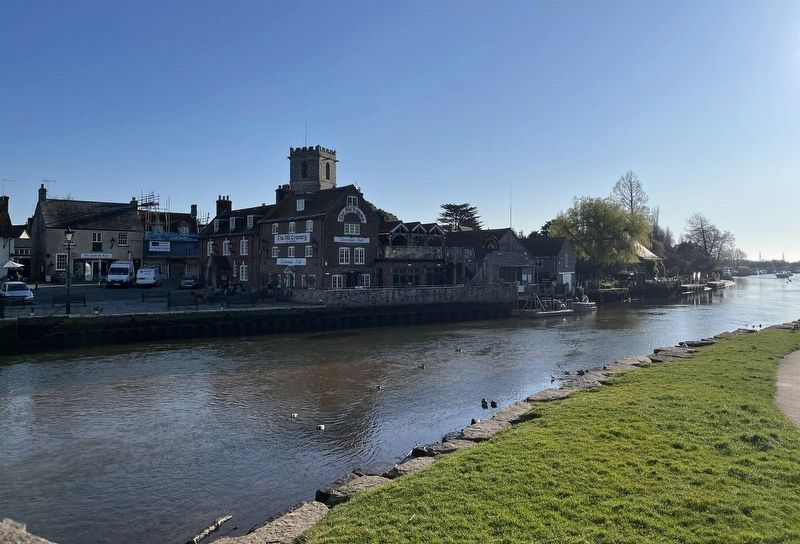
Photographed by Ray Gurganus, April 2, 2025
2. Wareham and the River Frome
• 1777 - The old Norman South bridge was rebuilt in Purbeck stone. It was a single track bridge with 5 arches.
• 1885 - Swanage railway was built. This caused the river trade to decline rapidly.
• 1927 - All river trade had ceased. The South bridge was rebuilt again with 3 arches.
• Today - The quay towpath, and river are used and enjoyed by all.
Erected by Purbeck District Council.
Topics. This historical marker is listed in these topic lists: Industry & Commerce • Waterways & Vessels.
Location. 50° 41.013′ N, 2° 6.561′ W. Marker is in Wareham, England, in Dorset. It is on B3075. Touch for map. Marker is at or near this postal address: 3149 B3075, Wareham, England BH20 4LP, United Kingdom. Touch for directions.

Regionally, this marker is in South West England. Globally, it is on the Atlantic Ocean, in the North Atlantic Region, in Europe, in Atlantic Europe, on one of the British Isles, in the Western World, and in the Anglosphere. Historically, it finds itself in what was once the Roman Empire.
Other nearby markers. At least 8 other markers are within 10 kilometers of this marker, measured as the crow flies: Welcome to Wareham (approx. 1.1 kilometers away); Lifeboat Service (approx. 9.1 kilometers away); The Kuwait Arena (approx. 9.4 kilometers away); Tank Infantry Mark IV (approx. 9.4 kilometers away); FV603B Armoured Personnel Carrier (approx. 9.5 kilometers away); Royal Tank Regiment Memorial Statue (approx. 9.5 kilometers away); Household Cavalry and Royal Armoured Corps Memorial (approx. 9.5 kilometers away); The Lawrence of Arabia Trail (approx. 9.5 kilometers away).
Credits. This page was last revised on June 4, 2025. It was originally submitted on May 18, 2025, by Ray Gurganus of Washington, District of Columbia. This page has been viewed 92 times since then and 11 times this year. Photos: 1, 2. submitted on May 18, 2025, by Ray Gurganus of Washington, District of Columbia. • Andrew Ruppenstein was the editor who published this page.
Editor’s want-list for this marker. photo of the marker within its surroundings • Can you help?
