Birmingham in Jefferson County, Alabama — The American South (East South Central)
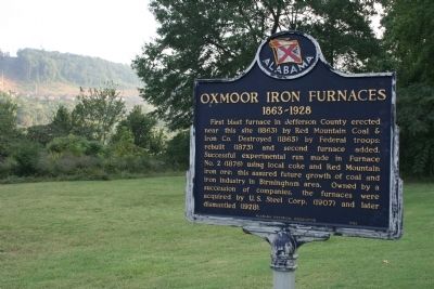
Oxmoor Iron Furnaces
1863 - 1928
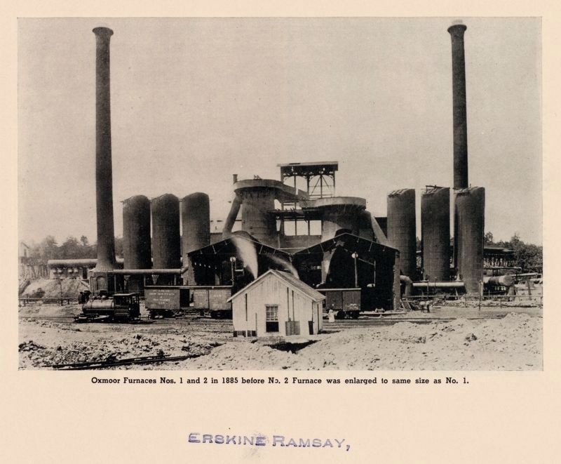
First blast furnace in Jefferson County erected near this site (1863) by Red Mountain Coal and Iron Co. Destroyed (1865) by Federal troops: rebuilt (1873) and second furnace added. Successful experimental run made in Furnace No. 2 (1876) using local coke and Red Mountain iron ore: this assured future growth of coal and iron industry in Birmingham area. Owned by a succession of companies, the furnaces were acquired by U.S. Steel Corp. (1907) and later dismantled (1928).
Erected 1989 by Alabama Historical Association.
Topics and series. This historical marker is listed in these topic lists: Industry & Commerce • War, US Civil. In addition, it is included in the Alabama Historical Association series list.
Location. 33° 25.806′ N, 86° 50.904′ W. Marker is in Birmingham, Alabama, in Jefferson County. Marker is at the intersection of Shannon Oxmoor Road and Shades Creek Circle, on the right when traveling west on Shannon Oxmoor Road. Touch for map. Marker is in this post office area: Birmingham AL 35226, United States of America. Touch for directions.
Other nearby markers. At least 8 other markers are within 3 miles of this marker, measured as the crow flies. Shades Crest Road Historical District (approx. 0.6 miles away); a different marker also named Shades Crest Road Historical District (approx. 1.3 miles away); Lover’s Leap (approx. 1.4 miles away); Hale - Joseph Home (approx. 1.4 miles away); Bluff Park Elementary School / Hoover Community Education (approx. 1.4 miles away); The Park Avenue Historical District (approx. 2 miles away); Overseer’s House (approx. 2.3 miles away); Monte D'Oro (approx. 3 miles away).
Also see . . . Oxmoor Furnaces. Bhamwiki website entry (Submitted on January 9, 2022, by Larry Gertner of New York, New York.)
Credits. This page was last revised on January 9, 2022. It was originally submitted on February 8, 2010, by Timothy Carr of Birmingham, Alabama. This page has been viewed 2,664 times since then and 58 times this year. Photos: 1. submitted on February 8, 2010, by Timothy Carr of Birmingham, Alabama. 2. submitted on January 9, 2022, by Larry Gertner of New York, New York. • Craig Swain was the editor who published this page.

