Near Panaca in Lincoln County, Nevada — The American Mountains (Southwest)
Miller's Point
⎯⎯⎯
Cathedral Gorge
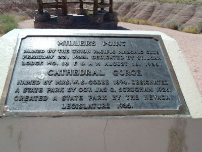
Photographed by Bill Kirchner, August 31, 2005
1. Miller's Point Marker
Topics. This historical marker is listed in this topic list: Natural Features. A significant historical month for this entry is February 1898.
Location. 37° 49.764′ N, 114° 24.797′ W. Marker is near Panaca, Nevada, in Lincoln County. It can be reached from State Highway 93, on the right when traveling south. Marker is in Cathedral Gorge State Park about 3 miles north of Panaca, NV. Touch for map. Marker is in this post office area: Panaca NV 89042, United States of America. Touch for directions.

Regionally, this marker is in Nevada’s Mojave Desert. It is also in the American Southwest and in the Mountain West. Globally, it is in North America, the Western Hemisphere, the Western World, and the Anglosphere. Historically, it finds itself in what was once New Spain and also Mexico’s Alta California.
Other nearby markers. At
this page online
Photographed by Bill Kirchner, August 31, 2005
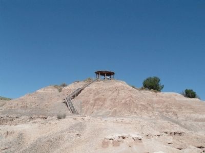
2. Miller's Point
Marker is next to gazebo at top of trail.
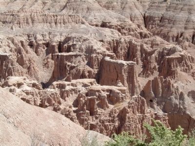
Photographed by Bill Kirchner, August 31, 2005
3. Cathedral Gorge as viewed from Miller's Point
Credits. This page was last revised on October 27, 2020. It was originally submitted on February 8, 2010, by Bill Kirchner of Tucson, Arizona. This page has been viewed 1,084 times since then and 12 times this year. Photos: 1, 2, 3. submitted on February 8, 2010, by Bill Kirchner of Tucson, Arizona. • Syd Whittle was the editor who published this page.
