
Pakenham in Mississippi Mills in Lanark County, Ontario — Central Canada (North America)
Pakenham Community Hall
Pakenham's Museum on the Streets
| — | Mississippi Mills Celebrates Canada 150 | — |
Photographed by William Fischer, Jr., May 13, 2025
1. Pakenham Community Hall Marker
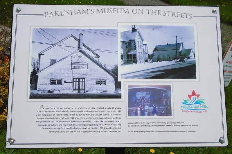
A large frame hall was located on this property where the cenotaph stands. Originally built as the Roman Catholic church, it was moved from MacFarlane Street to this site in 1896 when the present St. Peter Celestine's was built at Renfrew and Dalkeith Streets. It served as the agricultural exhibition hall until 1948 when the township took it over and renovated it as the community hall. As the centre of Pakenham's social life, it hosted dances, variety shows, banquets, agricultural and flower exhibits, meetings and private parties. When the existing Stewart Community Centre on MacFarlane Street was built in 1978 it soon became the community's hub, and the old hall property became the home of the cenotaph.
Made possible with the support of the Municipality of Mississippi Mills and the Mainstreet Association of Almonte Pakenham (MAAP) in memory of the late Rob Brennan.
Special thanks to Margie Argue for her enormous contribution to the Village of Pakenham.
Erected by Municipality of Mississippi Mills and the Mainstreet Association of Almonte Pakenham (MAAP).
Topics. This historical marker is listed in these
this page online
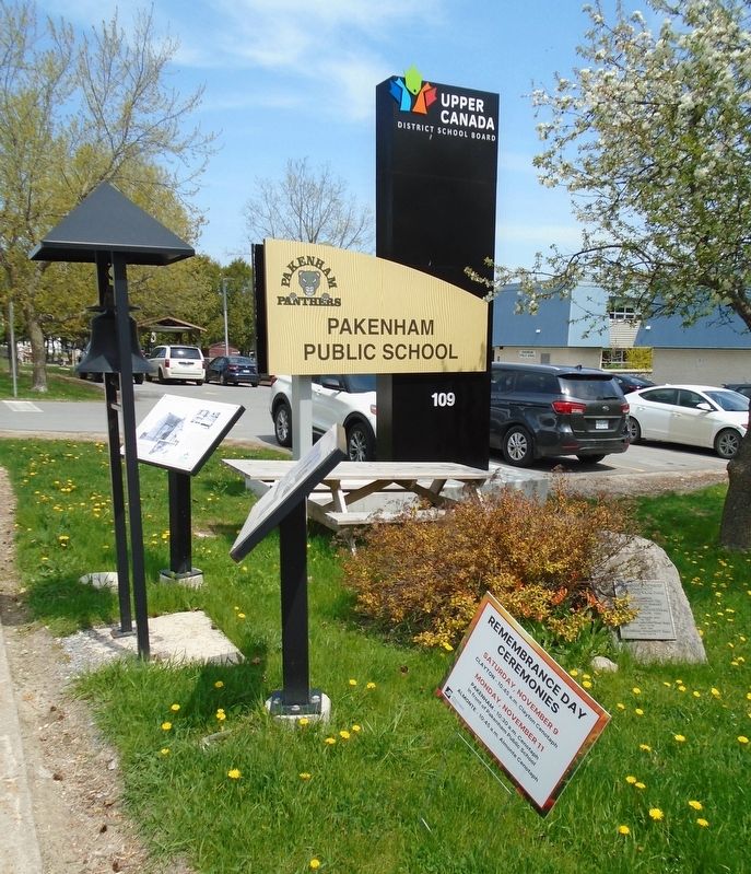
Location. 45° 19.812′ N, 76° 17.448′ W. Marker is in Mississippi Mills, Ontario, in Lanark County. It is in Pakenham. It is on County Highway 29 just south of Jeanie Street, on the right when traveling north. Marker is southwest of the Pakenham Public School. Touch for map. Marker is at or near this postal address: 2601 County Road 29, Mississippi Mills ON K0A 2X0, Canada. Touch for directions.

Regionally, this marker is in the Haliburton Highlands to Ottawa Valley and in Eastern Ontario. It is also in Central Canada. Globally, it is in North America, the Western Hemisphere, the Western World, and the Anglosphere. Historically, it finds itself in what was once a British colony, the Viceroyalty of New France, the Haudenosaunee (Iroquois) Confederacy, and Rupert’s Land.
Other nearby markers. At least 8 other markers are within walking distance of this marker: Pakenham Village School (here, next to this marker); Pakenham Township Community Horticultural Park (here, next
Photographed by William Fischer, Jr., May 13, 2025
2. Pakenham Community Hall Marker
Credits. This page was last revised on May 19, 2025. It was originally submitted on May 19, 2025, by William Fischer, Jr. of Reynoldsburg, Ohio. This page has been viewed 103 times since then and 15 times this year. Photos: 1, 2. submitted on May 19, 2025, by William Fischer, Jr. of Reynoldsburg, Ohio.
