
Pakenham in Mississippi Mills in Lanark County, Ontario — Central Canada (North America)
Pakenham's Early Growth
Pakenham's Museum on the Streets
| — | Mississippi Mills Celebrates Canada 150 | — |
Photographed by William Fischer, Jr., May 13, 2025
1. Pakenham's Early Growth Marker
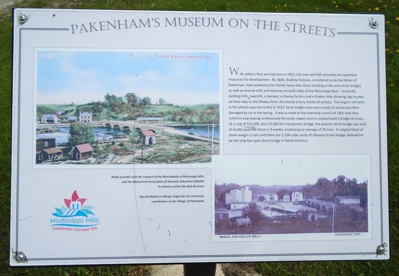
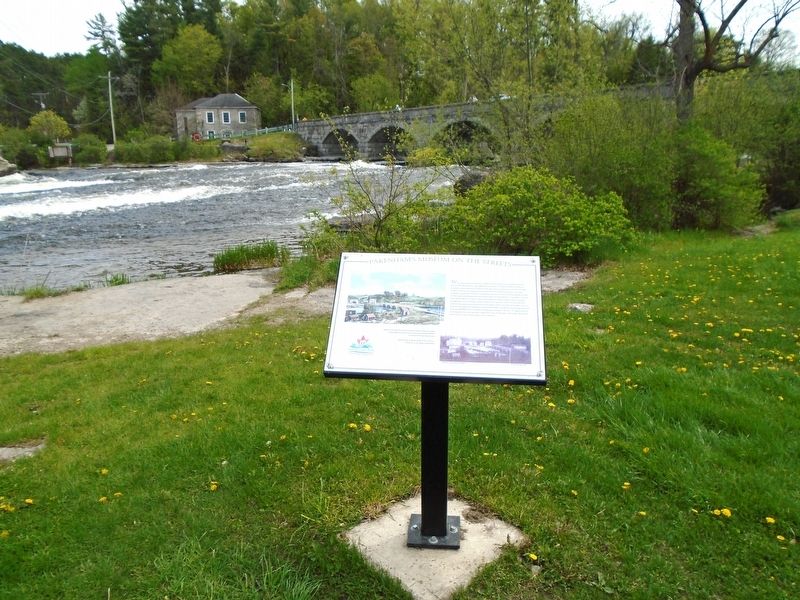
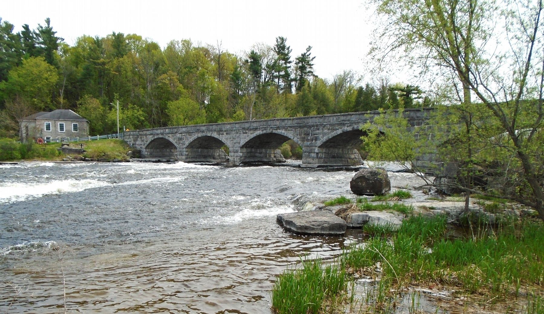
With settlers first arriving here in 1823, the river and falls provided all-important resources for development. By 1840, Andrew Dickson, considered to be the father of Pakenham, had established his family home (the stone building at the end of the bridge) as well as several mills and factories on both sides of the Mississippi River. Gristmills, carding mills, sawmills, a tannery, a cheese factory and a timber slide allowing logs to pass on their way to the Ottawa River all created a busy centre of activity. The largest mill seen in the photos was lost to fire in 1915. Early bridges here were made of wood and often damaged by ice in the spring. It was a credit to the township council of 1901 that they voted to stop paying continuously for costly repairs and to instead build a bridge of stone. At a cost of $13,000, plus $2,400 for a temporary bridge, the present stone bridge was built of locally quarried stone in 9 weeks, employing an average of 70 men. Its largest block of stone weighs 5 tons and there are 2,100 cubic yards of masonry in the bridge, believed to be the only five span stone bridge in North America.
Made possible with the support of the Municipality of Mississippi Mills and the Mainstreet Association of Almonte Pakenham (MAAP) in memory of the late Rob Brennan.
Special thanks to Margie Argue for her enormous contribution to the Village of Pakenham.
Erected by Municipality
this page online
Topics. This historical marker is listed in these topic lists: Bridges & Viaducts • Industry & Commerce • Settlements & Settlers • Waterways & Vessels. A significant historical year for this entry is 1823.
Location. 45° 20.165′ N, 76° 17.25′ W. Marker is in Mississippi Mills, Ontario, in Lanark County. It is in Pakenham. It is at the intersection of County Highway 29 and the Five Span Stone Bridge (County Highway 20), on the right when traveling north on County Highway 29. Marker is in Five Span Bridge Park, on the west shore adjacent to the bridge. Touch for map. Marker is in this post office area: Mississippi Mills ON K0A 2X0, Canada. Touch for directions.

Regionally, this marker is in the Haliburton Highlands to Ottawa Valley and in Eastern Ontario. It is also in Central Canada. Globally, it is in North America, the Western Hemisphere, the Western World, and the Anglosphere. Historically, it finds itself in what was once a British colony, the Viceroyalty of New France, the Haudenosaunee (Iroquois) Confederacy, and Rupert’s
Photographed by William Fischer, Jr., May 13, 2025
2. Pakenham's Early Growth Marker
Other nearby markers. At least 8 other markers are within walking distance of this marker: Pakenham 5 Arched Stone Bridge (within shouting distance of this marker); Pakenham Bridge and Restoration (about 90 meters away, measured in a direct line); Five-Span Stone Bridge (about 90 meters away); Packenham Industry and Commerce (about 90 meters away); John Peter Levi (approx. 0.3 kilometers away); Pakenham (approx. 0.3 kilometers away); 1840s General Store & Bakery (approx. 0.3 kilometers away); St. Peter Celestine Church (approx. 0.4 kilometers away). Touch for a list and map of all markers in Mississippi Mills.
Photographed by William Fischer, Jr., May 13, 2025
3. Five-Span Stone Bridge
Credits. This page was last revised on May 20, 2025. It was originally submitted on May 20, 2025, by William Fischer, Jr. of Reynoldsburg, Ohio. This page has been viewed 144 times since then and 46 times this year. Photos: 1, 2, 3. submitted on May 20, 2025, by William Fischer, Jr. of Reynoldsburg, Ohio.
