
Pakenham in Mississippi Mills in Lanark County, Ontario — Central Canada (North America)
Packenham Industry and Commerce
Pakenham's Museum on the Streets
| — | Mississippi Mills Celebrates Canada 150 | — |
Photographed by William Fischer, Jr., May 13, 2025
1. Packenham Industry and Commerce Marker
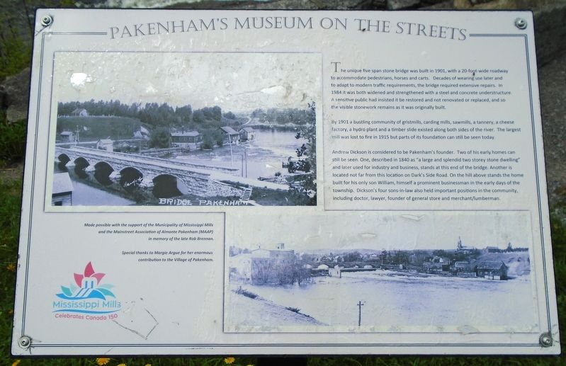
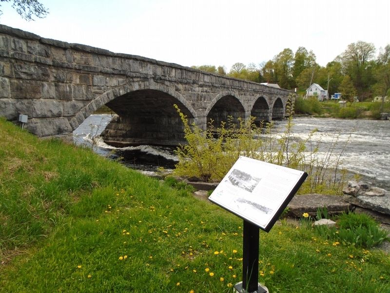
The unique five span stone bridge was built in 1901, with a 20-foot wide roadway to accommodate pedestrians, horses and carts. Decades of wearing use later and to adapt to modern traffic requirements, the bridge required extensive repairs. In 1984 it was both widened and strengthened with a steel and concrete understructure. A sensitive public had insisted it be restored and not renovated or replaced, and so the visible stonework remains as it was originally built.
By 1901 a bustling community of gristmills, carding mills, sawmills, a tannery, a cheese factory, a hydro plant and a timber slide existed along both sides of the river. The largest mill was lost to fire in 1915 but parts of its foundation can still be seen today.
Andrew Dickson is considered to be Pakenham's founder. Two of his early homes can still be seen. One, described in 1840 as "a large and splendid two storey stone dwelling" and later used for industry and business, stands at this end of the bridge. Another in located not far from this location on Dark's Side Road. On the hill above stands the home built for his only son William, himself a prominent
this page online
Made possible with the support of the Municipality of Mississippi Mills and the Mainstreet Association of Almonte Pakenham (MAAP) in memory of the late Rob Brennan.
Special thanks to Margie Argue for her enormous contribution to the Village of Pakenham.
Erected by Municipality of Mississippi Mills and the Mainstreet Association of Almonte Pakenham (MAAP).
Topics. This historical marker is listed in these topic lists: Bridges & Viaducts • Industry & Commerce • Settlements & Settlers • Waterways & Vessels. A significant historical year for this entry is 1901.
Location. 45° 20.141′ N, 76° 17.183′ W. Marker is in Mississippi Mills, Ontario, in Lanark County. It is in Pakenham. It is at the intersection of Kinburn Side Road (County Highway 20) and Dark's Side Road, on the right when traveling west on Kinburn Side Road. Marker is in the Pakenham Bridge Conservation Area adjacent to the bridge's east approach. Touch for map. Marker
Photographed by William Fischer, Jr., May 13, 2025
2. Packenham Industry and Commerce Marker

Regionally, this marker is in the Haliburton Highlands to Ottawa Valley and in Eastern Ontario. It is also in Central Canada. Globally, it is in North America, the Western Hemisphere, the Western World, and the Anglosphere. Historically, it finds itself in what was once a British colony, the Viceroyalty of New France, the Haudenosaunee (Iroquois) Confederacy, and Rupert’s Land.
Other nearby markers. At least 8 other markers are within walking distance of this marker: Pakenham Bridge and Restoration (here, next to this marker); Five-Span Stone Bridge (here, next to this marker); Pakenham's Early Growth (about 90 meters away, measured in a direct line); Pakenham 5 Arched Stone Bridge (about 120 meters away); John Peter Levi (approx. 0.3 kilometers away); Pakenham (approx. 0.4 kilometers away); 1840s General Store & Bakery (approx. 0.4 kilometers away); St. Peter Celestine Church (approx. 0.4 kilometers away). Touch for a list and map of all markers in Mississippi Mills.
Also see . . . Walking Tour of Pakenham. (Submitted on May 20, 2025, by William Fischer, Jr. of Reynoldsburg, Ohio.)
Credits. This page was last revised on May 20, 2025. It was originally submitted on May 20, 2025, by William Fischer, Jr. of Reynoldsburg, Ohio. This page has been viewed 136 times since then and 18 times this year. Photos: 1, 2. submitted on May 20, 2025, by William Fischer, Jr. of Reynoldsburg, Ohio.
