Near Arcadia in Oklahoma County, Oklahoma — The American South (West South Central)
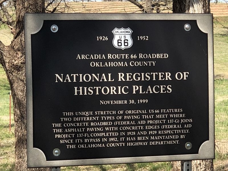
Arcadia Route 66 Roadbed
Oklahoma County
| — | Oklahoma U.S. 66 1926-1952 | — |
Photographed by Duane and Tracy Marsteller, April 10, 2025
1. Arcadia Route 66 Roadbed Marker
Historic Places
November 30, 1999
Topics and series. This historical marker is listed in this topic list: Roads & Vehicles. In addition, it is included in the National Register of Historic Places (NRHP), and the U.S. Route 66 series lists. A significant historical year for this entry is 1928.
Location. 35° 39.59′ N, 97° 17.52′ W. Marker is near Arcadia, Oklahoma, in Oklahoma County. It is on East Old Highway 66 west of U.S. 66, on the right when traveling west. Touch for map. Marker is at or near this postal address: 14600 E Old Hwy 66, Arcadia OK 73007, United States of America. Touch for directions.

Regionally, this marker is in Central Oklahoma — Frontier Country and in Greater Oklahoma City. It is also in the American South, specifically on the prairies,
this page online
Other nearby markers. At least 8 other markers are within 2 miles of this marker, measured as the crow flies: Paul McCartney (approx. half a mile away); Rock of Ages (approx. one mile away); Washington Irving's Camp (approx. 1½ miles away); a different marker also named Washington Irving's Camp (approx. 1½ miles away); Tuton's Drugstore (approx. 1.9 miles away); Route 66 (approx. 1.9 miles away); Beverly and Karl White (approx. 1.9 miles away); Frank and Katie Vrana (approx. 1.9 miles away). Touch for a list and map of all markers in Arcadia.
Regarding Arcadia Route 66 Roadbed. Excerpts from the National Register nomination:
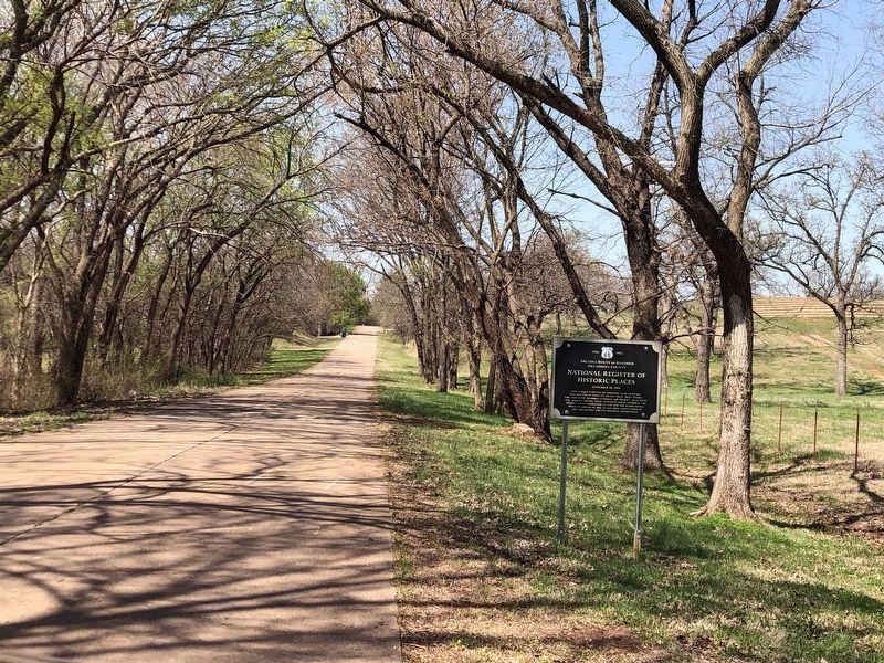
The initial right of way for the nominated property — 66 feet in width — was purchased in 1922 for use as a county road. In 1924, it became part of Oklahoma State Highway 7, which was one of several new, numbered state highways created to replace the OzarkTrail and other “named” roads. In 1926, SH7 was also designated U.S. 66 and in 1928, in preparation of paving, additional right of way was acquired, expanding the original sixty-six feet to eighty feet. Paving of the property's roadway, which involved two separate construction projects, began the same year …Photographed by Duane and Tracy Marsteller, April 10, 20252. Arcadia Route 66 Roadbed MarkerAlso noteworthy about this part of the famed highway: It's where singer/songwriter Paul McCartney stopped to ask a local resident if he was on the "old" Route 66. That 2008 encounter is detailed in a historical marker about a half-mile down the road.
As part of one of the key routes when the first system of interstate highways was designated in 1926, the nominated property is one of a relatively few remaining sections of original Route 66 paving, and has two unique and significant distinctions: It contains the only unaltered surviving specimen of the concrete/asphalt “Modified Bates Type” roadway built to the standards required by the State Highway Commission when U.S.66 was constructed in Oklahoma. It also contains the only surviving stretch of Route 66 paving that involves the adjoining of two different, original, unaltered road surface designs.
Also see . . . Arcadia Route 66 Roadbed (PDF). National Register nomination for the road segment, which was listed as part of the Route 66 and Associated Historic Resources in Oklahoma submission. (Prepared by Jim Ross; via National Archives) (Submitted on May 21, 2025, by Duane and Tracy Marsteller of Murfreesboro, Tennessee.)
Credits. This page was last revised on May 21, 2025. It was originally submitted on May 20, 2025, by Duane and Tracy Marsteller of Murfreesboro, Tennessee. This page has been viewed 187 times since then and 40 times this year. Photos: 1, 2. submitted on May 20, 2025, by Duane and Tracy Marsteller of Murfreesboro, Tennessee.
