Speyer, Rhineland-Palatinate, Germany — Central Europe
Speyerbach - Gießhübelbach
Photographed by James Hulse, May 20, 2025
1. Speyerbach - Gießhübelbach Marker

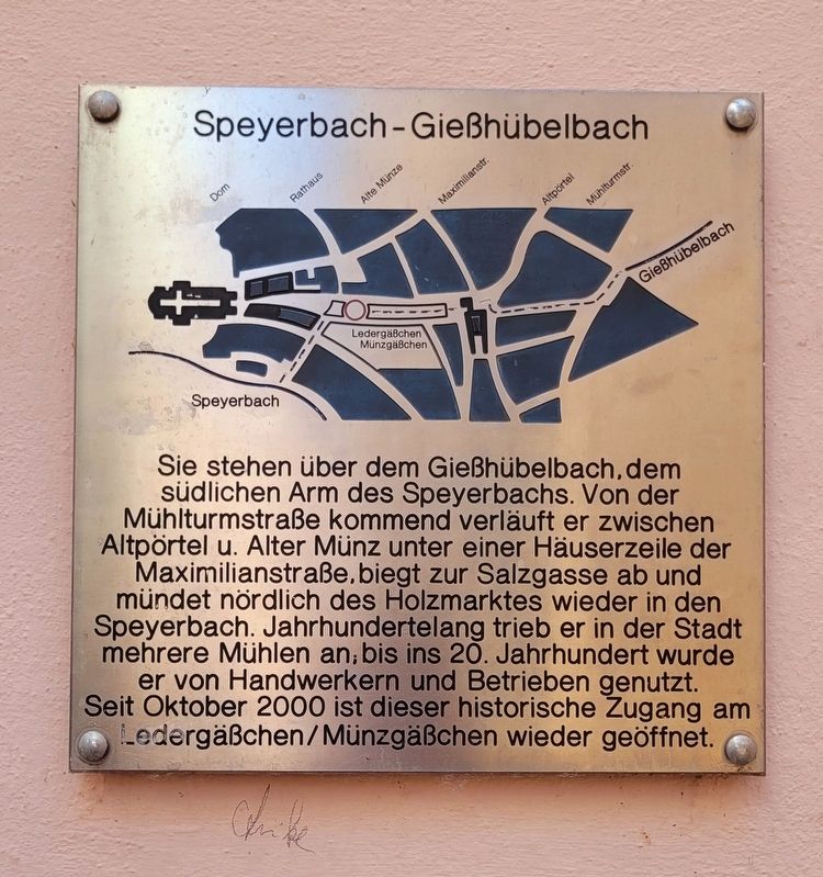
Sie stehen über dem Gießhübelbach, dem südlichen Arm des Speyerbachs. Von der Mühlturmstraße kommend verläuft er zwischen Altpörtel u. Alter Münz unter einer Häuserzeile der Maximilianstraße, biegt zur Salzgasse ab und mündet nördlich des Holzmarktes wieder in den Speyerbach. Jahrhundertelang trieb er in der Stadt mehrere Mühlen an, bis ins 20. Jahrhundert wurde er von Handwerkern und Betrieben genutzt. Seit Oktober 2000 ist dieser historische Zugang am Ledergäßchen/Münzgäßchen wieder geöffnet.
You are standing above the Gießhübelbach, the southern branch of the Speyerbach. Coming from Mühlturmstraße, it flows between the Altpörtel and the Alte Münz under a row of houses along Maximilianstraße, turns toward Salzgasse, and rejoins the Speyerbach north of Holzmarkt. For centuries, it powered several mills in the city and was used by craftsmen and businesses until the 20th century. Since October 2000, this historic access at Ledergäßchen/Münzgäßchen has been reopened.
Topics. This historical marker is listed in this topic list: Waterways & Vessels. A significant historical month for this entry is October 2000.
Location. 49° 19.053′ N,
this page online

Regionally, it is in Europe, the European Union, Atlantic Europe, Central Europe, the Schengen Area, Western Europe, and the Western World. Historically, it finds itself in what was once the Roman Empire and specifically also the Holy Roman Empire.
Other nearby markers. At least 8 other markers are within walking distance of this marker: Gedenk-Tafel / Memorial Plaque (within shouting distance of this marker); „Alte Münze" / Old Mint (within shouting distance of this marker); Konviktskirche St. Ludwig / Seminary Church St. Ludwig (within shouting distance of this marker); St. Georgsbrunnen / St. George’s Fountain (within shouting distance of this marker); Heilig-Geist-Kirche / Church of the Holy Spirit (about 90 meters away, measured in a direct line); Bücherverbrennung in Speyer 1933 / Book Burning in Speyer, 1933

Photographed by James Hulse, May 20, 2025
2. The Speyerbach - Gießhübelbach Marker is located on the right side of the walkway
Also see . . . Speyerbach. Wikipedia
The Speyerbach is a left tributary of the Rhine in the Palatinate part of Rhineland-Palatinate. In Speyer, the river split into Gießhübelbach and Woogbach. The Woogbach changes its name to Nonnenbach, then flows into Gießhübelbach shortly before the latter flows into the Rhine.(Submitted on May 22, 2025, by James Hulse of Medina, Texas.)
Credits. This page was last revised on May 23, 2025. It was originally submitted on May 21, 2025, by James Hulse of Medina, Texas. This page has been viewed 108 times since then and 19 times this year. Photos: 1, 2. submitted on May 22, 2025, by James Hulse of Medina, Texas.
