Marker Logo
THE HISTORICAL
MARKER DATABASE
“Bite-Size Bits of Local, National, and Global History”
Near Sharpsburg in Washington County, Maryland — The American Northeast (Mid-Atlantic)
 

Packhorse Ford
 
 
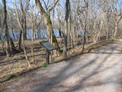
Packhorse Ford Marker image. Click for full size.
Photographed by Craig Swain, March 29, 2008
1. Packhorse Ford Marker
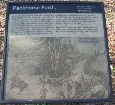
Inscription. A day after the Battle of Antietam, Confederate General Robert E. Lee retreated to the safety of the West Virginia (then Virginia) bluffs across the river from here. This was the only good crossing on the river for many miles upstream or downstream. Some of Lee's artillery units were already in place on the bluffs. Pursued by 700 soldiers from the 118th Pennsylvania Infantry, the Confederates reacted by opening fire. This was the Pennsylvania boys' first taste of battle; they soon discovered their new Enfield rifles were defective and useless. Pushed to the bluff's edge, some fell to their death, while others were killed or wounded trying to escape back across the river.

Only 431 Pennsylvania soldiers returned to the safety and cover of Maryland soil. Lee's troops then withdrew, ending the Maryland Campaign.
 
Erected by Chesapeake and Ohio Canal National Park, National Park Service and the US Deptartment of the Interior.
 
Topics and series. This historical marker is listed in this topic list: War, US Civil. In addition, it is included in the Chesapeake and Ohio (C&O) Canal series list.
 
Location. 39° 25.852′ N,
Paid Advertisement
Click or scan to see
this page online
77° 46.698′ W. Marker is near Sharpsburg, Maryland, in Washington County. It can be reached from Canal Road, on the right when traveling east. The marker is located on the Chesapeake and Ohio Canal Towpath, to the east of lock number 38, near mile stone 72. For accessing this marker without hiking or biking the trail, there is a small footpath between the south shoulder of Canal Road and the Towpath at 39°25'51.7"N 77°46'40.6"W. The marker is just to the right after reaching the towpath, and the ford itself is accessible by following the footpath down to the river's edge. Touch for map. Marker is in this post office area: Sharpsburg MD 21782, United States of America. Touch for directions.

Regionally, this marker is in the Baltimore Metro Region and in Western Maryland. It is also in the American Mid-Atlantic, in Appalachia, and specifically in Northern Appalachia. Globally, it is in North America, the Western Hemisphere, the Western World, and the Anglosphere. Historically, it finds itself in what was once one of the original Thirteen Colonies.

Other nearby markers. At least 8 other markers are within
Packhorse Ford Marker along the Towpath image. Click for full size.
Photographed by Craig Swain, March 29, 2008
2. Packhorse Ford Marker along the Towpath
walking distance of this marker: Shepherdstown Battlefield Preservation Association (approx. 0.2 miles away in West Virginia); Battle of Boteler's Ford (approx. 0.2 miles away in West Virginia); Boteler’s Ford Tablet B. F. 3 (approx. 0.2 miles away in West Virginia); Boteler’s Ford Tablet B. F. 2 (approx. 0.2 miles away in West Virginia); Pack Horse Ford (approx. 0.2 miles away in West Virginia); Boteler’s Ford Tablet B. F. 1 (approx. 0.2 miles away in West Virginia); Barnes' Brigade (approx. 0.2 miles away in West Virginia); 118th Pennsylvania Infantry (approx. 0.2 miles away in West Virginia).
 
More about this marker. The lower half of the marker is a drawing of the 118th Pennsylvania Infantry preparing to cross the Potomac River at Packhorse Ford. From Harper's Weekly, October 11, 1862.
 
Packhorse Ford image. Click for full size.
Photographed by Craig Swain, March 29, 2008
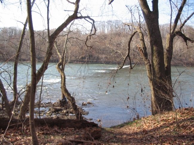
3. Packhorse Ford
The line of rapids here is the old dam built to support Boteler's Mill, which stood on the West Virginia side of the Potomac. The river is still shallow enough, particularly during the summer months, to cross downstream of the dam.
 
 
Credits. This page was last revised on May 22, 2025. It was originally submitted on April 9, 2008, by Craig Swain of Leesburg, Virginia. This page has been viewed 2,726 times since then and 56 times this year. Last updated on May 22, 2025, by Evan Dwyer of Richmond, Virginia. Photos:   1, 2, 3. submitted on April 9, 2008, by Craig Swain of Leesburg, Virginia. • J. Makali Bruton was the editor who published this page.

m=273112

CeraNet Cloud Computing sponsors the Historical Marker Database.
This website earns income from purchases you make after using our links to Amazon.com. We appreciate your support.
Paid Advertisement
Jul. 28, 2026