Whittier in Los Angeles County, California — The American West (Pacific Coastal)
Whittier Citrus Association - Big and Busy
| — | Whittier Greenway Trail | — |
Photographed by Tatiana Zavala, May 18, 2025
1. Whittier Citrus Association Marker
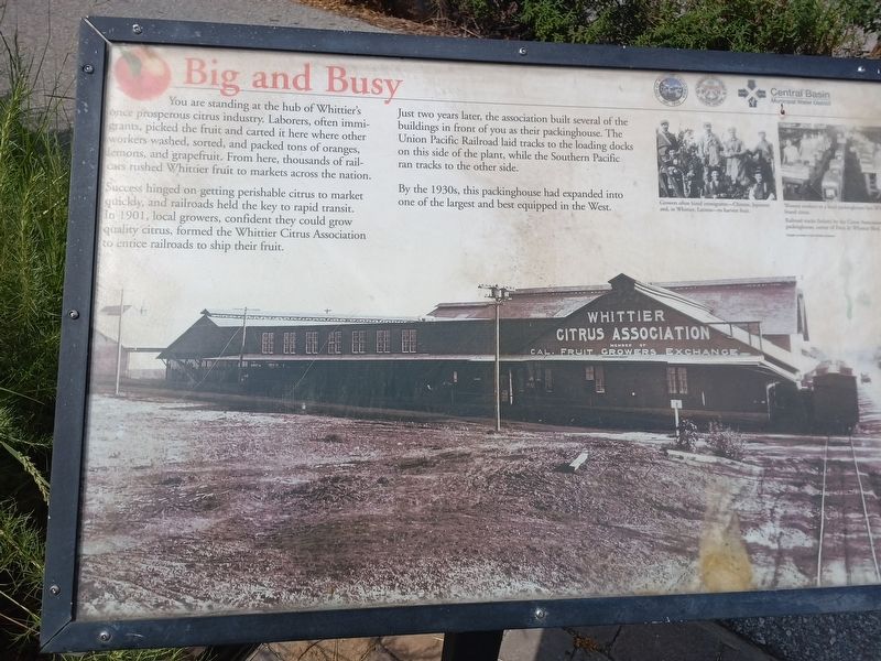
You are standing at the hub of Whittier's once prosperous citrus industry. Laborers, often immigrants, picked the fruit and carted it here where other workers washed, sorted, and packed tons of oranges, lemons, and grapefruit. From here, thousands of railcars rushed Whittier fruit to markets across the nation.
Success hinged on getting perishable citrus to market quickly, and railroads held the key to rapid transit. In 1901, local growers, confident they could grow quality citrus, formed the Whittier Citrus Association to entice railroads to ship their fruit.
Just two years later, the association built several of the buildings in front of you as their packinghouse. The Union Pacific Railroad laid tracks to the loading docks on this side of the plant, while the Southern Pacific ran tracks to the other side.
By the 1930s, this packinghouse had expanded into one of the largest and best equipped in the West.
Erected by Central Basin Municipal Water District.
Topics. This historical marker is listed in these topic lists: Agriculture • Industry & Commerce • Railroads & Streetcars. A significant historical year for this entry is 1903.
Location. 33° 58.512′ N,
this page online

Regionally, this marker is in Greater Los Angeles and in the Transverse Ranges. It is also on the American Pacific Coast. Globally, it is in North America, on the Ring of Fire, on the Pacific Rim, in the Western Hemisphere, in the Western World, and in the Anglosphere. Historically, it finds itself in what was once New Spain and also Mexico’s Alta California.
Other nearby markers. At least 8 other markers are within one mile of this marker, measured as the crow flies: Paradox Hybrid Walnut Tree (about 500 feet away, measured in a direct line); Reform School for Juvenile Offenders (approx. ¼ mile away); Architecture and Reform (approx. 0.3 miles away); Fred C. Nelles (approx. 0.3 miles away); Learning A Trade (approx. 0.4 miles away); President Nixon Law Office (approx. half a mile away); Greek George (approx. 0.8 miles away); Jonathan Bailey House (approx.
Photographed by Tatiana Zavala, May 18, 2025
2. Whittier Citrus Association - Big and Busy Marker
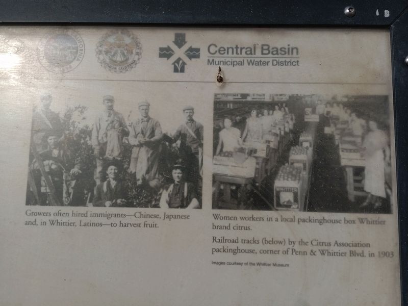
Photos of growers and women working in packing house
Another marker is no longer nearby. Reform School for Juvenile Offenders (was approx. 0.4 miles away but has been confirmed missing).
More about this marker. Whittier Greenway Trail, just east of King Richard's antique store
Also see . . .
1. Points of Interest - Whittier Former Citrus Association Packing House.
Located at 12327 Whittier Boulevard is the last remnant of the once-flourishing citrus industry in Whittier. Built in 1902 and enlarged in 1904, it became one of the largest packing plants in the State of California and included a main packing house, lemon curing plant and an office building. The development of the Citrus Association and packing houses was one of the main economic bases of the area for many years. The main structure is now used as an antiques mall. The Packing House is on the Local Official Register of Historic Resources.(Submitted on May 22, 2025, by Tatiana Zavala of Orange County, California.)
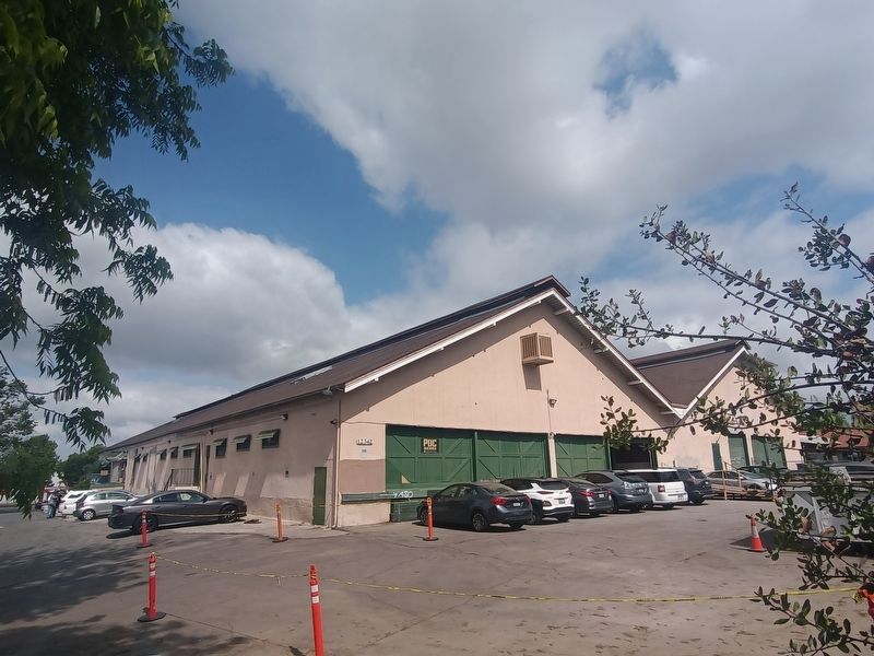
You can see historic photographs of the packing house and more information about early Whittier's agricultural industry at an interpretive display on the Whittier Greenway Trail immediately eastof the building. Enter the bicycle and pedestrian trail at Penn Street and head south to reach the Citrus Station exhibit.Photographed by Tatiana Zavala, May 18, 20253. South east side of building from Greenway TrailPacking house now contains several businesses today, including King Richard's Antique Center
2. King Richard's Antique Center: The Whittier Packing House History.
From 1902 until 1951, the building was dedicated to citrus production. In 1979, the building was converted into an Antique store.(Submitted on May 22, 2025, by Tatiana Zavala of Orange County, California.)
The Whittier Citrus Association packing house is located at the corner of Penn Street and Whittier Boulevard. It is the last remnant of the once-flourishing citrus industry in Whittier. Built in 1902 and enlarged in 1904 it became one of the largest packing plants in the State of California and included a main packing house, lemon curing plant and an office building. By 1906 650 carloads of oranges and 250 carloads of lemons were shipped annually by rail. The development of the Whittier Citrus Association and packing house was one of the main economic bases of the area for many years. The main structure is now occupied by King Richard's Antique Mall.
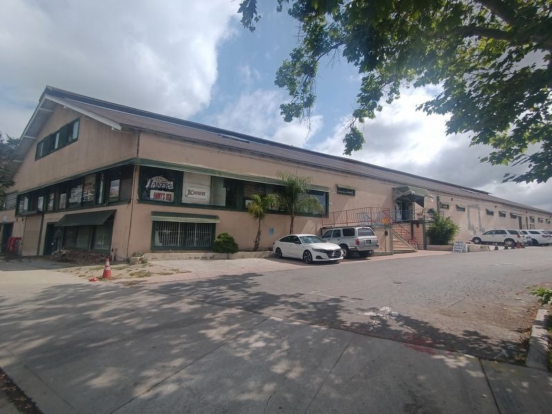
The first rail service to the Whittier Citrus Association was provided bythe SP [Southern Pacific] on the west side of the packing house, along what is now Whittier Blvd. The UP [Union Pacific] line ran just east of the packing house and the spur served the south side. [See 1948 map in link]Photographed by Tatiana Zavala, May 18, 20254. South west view of packing house
In its last configuration the packing house was actually a complex of seven buildings.
Additional keywords. King Richard's Antique Store
Credits. This page was last revised on May 23, 2025. It was originally submitted on May 22, 2025, by Tatiana Zavala of Orange County, California. This page has been viewed 192 times since then and 44 times this year. Photos: 1, 2, 3, 4. submitted on May 22, 2025, by Tatiana Zavala of Orange County, California. • Andrew Ruppenstein was the editor who published this page.
