
Paignton in Torbay, England, United Kingdom — Northwestern Europe (the British Isles)
Paignton Palace: The Medieval Bishop's Hall
Photographed by Ray Gurganus, April 6, 2025
1. Paignton Palace: The Medieval Bishop's Hall Marker
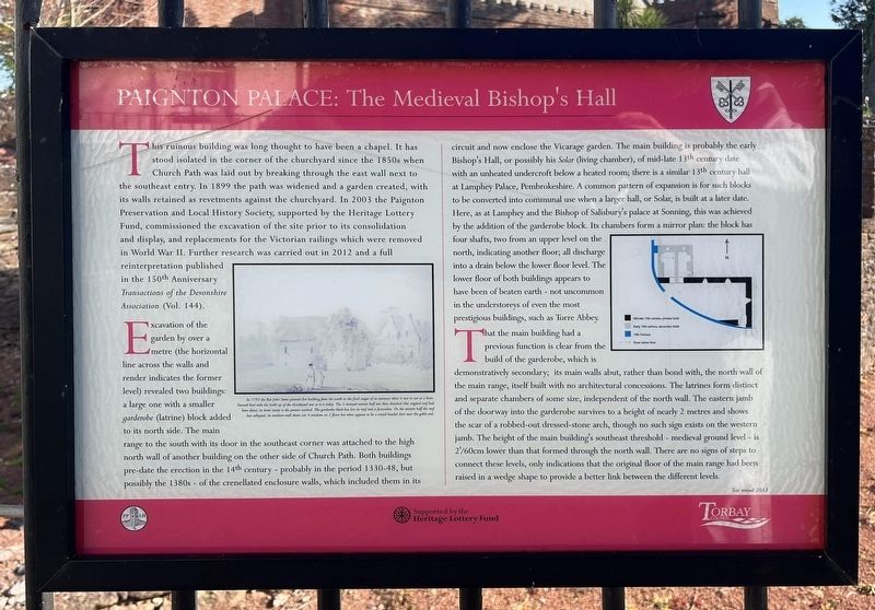
This ruinous building was long thought to have been a chapel. It has stood isolated in the corner of the churchyard since the 1850s when Church Path was laid out by breaking through the east wall next to the southeast entry. In 1899 the path was widened and a garden created, with its walls retained as revetments against the churchyard. In 2003 the Paignton Preservation and Local History Society, supported by the Heritage Lottery Fund, commissioned the excavation of the site prior to its consolidation. and display, and replacements for the Victorian railings which were removed in World War II. Further research was carried out in 2012 and a full reinterpretation published in the 150th Anniversary Transactions of the Devonshire Association (Vol. 144).
Excavation of the garden by over a metre (the horizontal line across the walls and render indicates the former level) revealed two buildings a large one with a smaller garderobe (latrine) block added to its north side. The main a range to the south with its door in the southeast corner was attached to the high north wall of another building on the other side of Church Path.
this page online
That the main building had a previous function is clear from the build
Photographed by Ray Gurganus, April 6, 2025
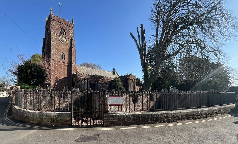
2. Medieval Bishop's Hall Marker, Church of St John the Baptist in the background
Erected by Torbay Council.
Topics and series. This historical marker is listed in these topic lists: Anthropology & Archaeology • Architecture • Religion & Religious Structures. In addition, it is included in the If You've Got to Go... series list.
Location. 50° 26.183′ N, 3° 34.19′ W. Marker is in Paignton, England, in Torbay. It is on Palace Place, on the right when traveling west. Touch for map. Marker is at or near this postal address: 7 Palace Pl, Paignton, England TQ3 3AG, United Kingdom. Touch for directions.

Regionally, this marker is in South West England. Globally, it is on the Atlantic Ocean, in the North Atlantic Region, in Europe, in Atlantic Europe, on one of the British Isles, in the Western World, and in the Anglosphere. Historically, it finds itself in what was once the Roman Empire.
Other nearby markers. At least 8 other markers are within 10 kilometers of this marker, measured as the crow flies: Paignton: Episcopal Manor, Town and Palace (here, next to this marker); Totnes Town Mill (approx. 8 kilometers away); The Posts of the Town Marsh Gate (approx. 8 kilometers away); The Shady Garden (approx. 8.2 kilometers away); Ann Ball (approx. 8.4 kilometers away); Welcome to The Market Square (approx. 8.5 kilometers away); The Medieval Town of Totnes (approx. 8.6 kilometers away); The Shell Keep (approx. 8.6 kilometers away).
Credits. This page was last revised on June 11, 2025. It was originally submitted on May 23, 2025, by Ray Gurganus of Washington, District of Columbia. This page has been viewed 106 times since then and 15 times this year. Photos: 1, 2. submitted on May 23, 2025, by Ray Gurganus of Washington, District of Columbia. • Andrew Ruppenstein was the editor who published this page.
