Near Andrews in Williamsburg County, South Carolina — The American South (South Atlantic)
Suttons Methodist Church
[Front]:
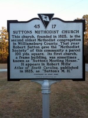
This church, founded in 1825, is the second oldest Methodist congregation in Williamsburg County. That year Robert Sutton gave the "Methodist Society" of this community a parcel 100 yds. square. Its first church, a frame building, was sometimes known as "Suttons Meeting House." It appears in Robert Mills' Atlas of South Carolina, published in 1825, as "Suttons M.H."
[Reverse]:
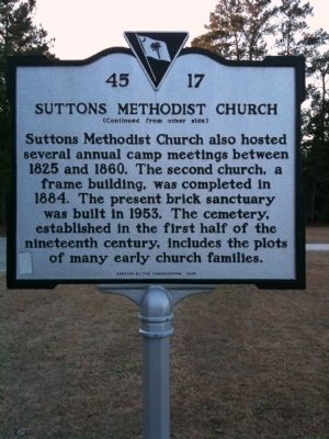
Suttons Methodist Church also hosted several annual camp meetings between 1825 and 1860. The second church, a frame building, was completed in 1884. The present brick sanctuary was built in 1953. The cemetery, established in the first half of the nineteenth century, includes the plots of many early church families.
Erected 2005 by Congregation of Suttons Methodist Church. (Marker Number 45-17.)
Topics. This historical marker is listed in these topic lists: Cemeteries & Burial Sites • Churches & Religion. A significant historical year for this entry is 1825.
Location. 33° 24.327′ N, 79° 46.261′ W. Marker is near Andrews, South Carolina, in Williamsburg County. Marker is at the intersection of Santee Road (County Road 45), on the right when traveling north on Santee Road. Touch for map. Marker is at or near this postal address: 3168 Santee Road, Andrews SC 29510, United States of America. Touch for directions.
Other nearby markers. At least 10 other markers are within 12 miles of this marker, measured as the crow flies. L. Mendel Rivers House (approx. 8.4 miles away); St. Stephen's Episcopal Church (approx. 8.4 miles away); St. Stephen Colored School / St. Stephen High School (approx. 9 miles away); Battle of Lenud's Ferry (approx. 9 miles away); Berkeley County (approx. 9.3 miles away); St. Stephens Veterans Monument (approx. 9.3 miles away); Jamestown Veterans Monument (approx. 9˝ miles away); DeWitt Williams Bridge (approx. 10.7 miles away); Old Jamestown (approx. 11.1 miles away); Union Presbyterian Church (approx. 11.8 miles away).
More about this marker. South Carolina Historical Markers program lists this marker as number 45-16.
Credits. This page was last revised on June 16, 2016. It was originally submitted on February 9, 2010, by David Bullard of Seneca, South Carolina. This page has been viewed 1,039 times since then and 34 times this year. Photos: 1, 2, 3. submitted on February 9, 2010, by David Bullard of Seneca, South Carolina. • Craig Swain was the editor who published this page.


