Ogden in Weber County, Utah — The American Mountains (Southwest)
The Development of 25th Street
Photographed by Jeremy Snow, May 20, 2025
1. The Development of 25th Street Marker
The Development of 25th Street
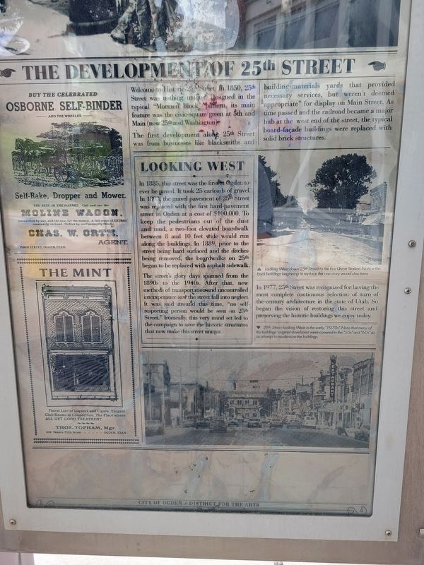
Welcome to Historic 25th Street. In 1850, 25th Street was nothing unique. Designed in the typical "Mormon Block" pattern, its main feature was the civic-square green at 5th and Main (now 25th and Washington).
The first development along 25th Street was from businesses like blacksmiths and building materials yards that provided necessary services, but weren't deemed "appropriate" for display on Main Street. As time passed and the railroad became a major hub at the west end of the street, the typical board-facade buildings were replaced with solid brick structures.
Looking West
In 1885, this street was the first in Ogden to ever he paved. It took 25 carloads of gravel. In 1893 the gravel pavement of 25th Street was replaced with the first hard-pavement street in Ogden at a cost of $100,000. To keep the pedestrians out of the dust and mud, a two-foot elevated boardwalk between 8 and 10 feet wide would run along the buildings. In 1889, prior to the street being hard surfaced and the ditches being removed, the boardwalks on 25th began to be replaced with asphalt sidewalk.
The street's
this page online
In 1977, 25th street was recognized for having the most complete continuous selection of turn-of-the-century architecture in the state of Utah. So began the vision of restoring this street and preserving the historic buildings we enjoy today.
(photo caption) Looking West down 25 Set to the first Union Station. Notice the brick building begining to replace the one story wood structures
(photo caption) 25th Street looking West in the early "1970s". Note that many of the buildings original storefronts were covered in the "50s" and "60s" as an attempt to modernize the buildings.
Erected by City of Ogden.
Topics. This historical marker is listed in these topic lists: Industry & Commerce • Roads & Vehicles. A significant historical year for this entry is 1885.
Location. 41° 13.247′ N, 111° 58.416′ W.

Photographed by Jeremy Snow, May 20, 2025
2. The Development of 25th Street Marker

Regionally, this marker is in the Wasatch Front and in Greater Salt Lake. It is also in the American Mountain West and on the Colorado Plateau. Globally, it is in North America, the Rocky Mountains, the Western Hemisphere, the Western World, and the Anglosphere. Historically, it finds itself in what was once New Spain and also Mexico’s Alta California.
Other nearby markers. At least 8 other markers are within walking distance of this marker: Lower 25th Street Historic District (here, next to this marker); Creston Hotel (a few steps from this marker); Gasberg Building (a few steps from this marker); James O. Stephens Building (within shouting distance of this marker); The Palace Billiard Hall (within shouting distance of this marker); The Livingston Confectionary (within shouting distance of this marker); Porter Block (within shouting distance of this marker); The Solomon C. Stephens Building (within shouting distance of this marker). Touch for a list and map of all markers in Ogden.
Credits. This page was last revised on May 24, 2025. It was originally submitted on May 23, 2025, by Jeremy Snow of Cedar City, Utah. This page has been viewed 159 times since then and 24 times this year. Photos: 1, 2. submitted on May 23, 2025, by Jeremy Snow of Cedar City, Utah. • Andrew Ruppenstein was the editor who published this page.
