Bernalillo in Sandoval County, New Mexico — The American Mountains (Southwest)
Kuaua

Photographed by James Hulse, April 9, 2025
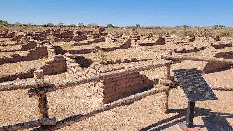
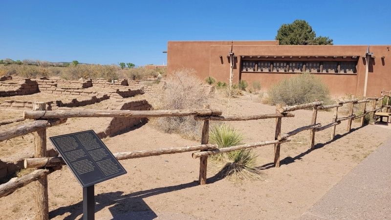
1. Kuaua Marker
 In northern New Mexico, many American Indians from the west and north moved toward permanent water sources during a drought period in the late 1200s. With their allies in existing communities along the Rio Grande, these people formed new and larger pueblos. Kuaua (Tiwa for "evergreen") was one of the numerous communities that developed along the Rio Grande at about AD 1300.
These were agricultural communities. The well-watered land near the Rio Grande provided excellent opportunities to produce the food necessary to feed an evergrowing population. These people flourished in their new environment.
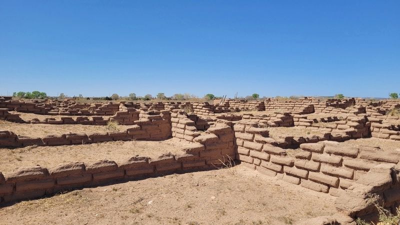
As you walk through these ruins, envision the construction of this pueblo, made from the earth on site. Rooms were added to this town until the early 1500s. More than 1500 rooms were constructed and then ultimately abandoned as the fluorescence of this culture waned and introduced disease took its toll.
En el norte de Nuevo México, muchos indígenas del oeste y el norte se dirigieron hacia fuentes permanentes de agua durante un periodo de sequía a finales del siglo XIII. Con sus aliados en comunidades existentes
this page online
Estas eran comunidades agrícolas. La tierra cercana al Río Grande, bien regada, daba excelentes oportunidades para producir la comida necesaria para alimentar a una población en constante crecimiento. Estas gentes florecieron en su nuevo ambiente.
Mientras camina tras estas ruinas, imagine la construcción de este pueblo, hecho de tierra de este mismo lugar. A este pueblo se le añadieron las habitaciónes hasta principios del siglo XVI. Más de 1,500 habitaciones fueron construidas y en última instancia abandonadas mientras el auge de esta cultura decaía y enfermedades introducidas en ella se cobraban su precio.
Topics. This historical marker is listed in these topic lists: Indigenous Peoples and Communities • Settlements & Settlers. A significant historical year for this entry is 1300.
Location. 35° 19.775′ N, 106° 33.422′ W. Marker is in Bernalillo, New Mexico, in Sandoval County. It is on Kuaua Road half
Photographed by James Hulse, April 9, 2025
2. The Kuaua archeological ruins and Marker

Regionally, this marker is in the San Juan Basin and in Greater Albuquerque. It is also in the American Southwest and at the Four Corners. Globally, it is in North America, the Western Hemisphere, the Western World, and the Anglosphere. Historically, it finds itself in what was once New Spain and also the Republic of Texas.
Other nearby markers. At least 8 other markers are within walking distance of this marker: Cultivos y animales no nativos / Non-Native Crops and Animals (within shouting distance of this marker); El Bosque / The Bosque (within shouting distance of this marker); Francisco Vasquez de Coronado (within shouting distance of this marker); Cultivos y animales nativas / Native Crops and Animals (within shouting distance of this marker); Las Montañas / The Mountains (within shouting distance of this marker); Recursos del desierto / Desert Resources (within shouting distance of this
Photographed by James Hulse, April 9, 2025
3. The view of the Kuaua Marker along the trail
More about this marker. There is a small fee to visit the Kuaua Ruins (Coronado Historic Site).
Also see . . . Coronado Historic Site. New Mexico Historic Sites
Coronado Historic Site and the ancient Kuaua Pueblo are located just minutes north of Albuquerque (off of I-25, Exit 242) in Bernalillo. In 1540, Francisco Vásquez de Coronado—with 500 soldiers and 2,000 Indigenous allies from New Spain—entered the Rio Grande valley somewhere near this site. Coronado was searching for the fabled Seven Cities of Gold.(Submitted on May 25, 2025, by James Hulse of Medina, Texas.)
Photographed by James Hulse, April 9, 2025
4. Kuaua Archeological Ruins
Credits. This page was last revised on May 25, 2025. It was originally submitted on May 24, 2025, by James Hulse of Medina, Texas. This page has been viewed 133 times since then and 24 times this year. Photos: 1, 2, 3, 4. submitted on May 25, 2025, by James Hulse of Medina, Texas.
