Middlebury in Addison County, Vermont — The American Northeast (New England)
Restoring Middlebury's Village Green

Photographed by Conrad Ward, November 30, 2024
1. Restoring Middlebury's Village Green Marker
The Middlebury Village Green was established around 1790 on land donated by village co-founder, Gamaliel Painter. In 1849, the construction of the Rutland and Burlington Railroad through Middlebury resulted in the truncation of the Village Green, leaving a triangular piece of land at its western point wherein the Allen Block stood.
After the fire of 1891, this land stood vacant until 1908, when Joseph Battell and the Century Club formally established Triangle Park.
The Middlebury Bridge & Rail Project, constructed from 2018 to 2021, replaced two 1920s-era bridges crossing the rail line on Main Street and Merchants Row with a tunnel, thus reconnecting Triangle Park with the Village Green.
The Allen Block
Constructed around 1821 by Samuel Sargent, the Allen Block was a two-story, gable-roofed brick commercial building that faced west down Main Street. Throughout its life, the Allen Block housed myriad businesses, including grocers, confectionaries, restaurants, a bookstore, tailors, hairdressers, a photographer, a dentist, a tinsmith, coffin and casket sellers, and a meat market. The post office,
this page online
The Fountain and the Park
The original three-tiered cast iron fountain, installed in 1908 and topped with figures of cranes, was unpopular to some because wind-driven spray from the fountain dampened the interiors of open cars parked around it; in 1938 it was removed. By the 1960s, Triangle Park was a neglected green space. Inspired by the upcoming 1976 United States Bicentennial, Doris Bowker and the Middlebury Garden Club revitalized Triangle Park. The current fountain urn—remarkably cast in the same foundry and with the same patterns as the 1908 original—was discovered in the gardens of Middlebury philanthropist Jessica Swift. It was purchased and donated to the Town by Middlebury business owners Tony Neri, Tom Langevin, and Neil Kvasnak. This fountain was temporarily removed during tunnel construction and restored before reinstallation. The new Triangle Park was designed and constructed as part of the 2018-2021 Bridge & Rail Project. The stone seats in Triangle Park are
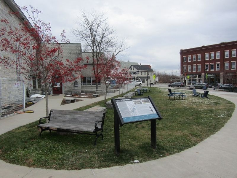
Photographed by Conrad Ward, November 30, 2024
2. Restoring Middlebury's Village Green Marker
1790s Land for Village Green donated by Gamaliel Painter
around 1821 Allen Block constructed
1826-1827 St. Stephen's Episcopal Church constructed
1849 Rutland & Burlington Railroad constructed, requiring bridges at Main St. and Merchants Row 1891 Allen Block burned in fire that consumed much of Merchants Row
1892-1898 Battel Block constructed
1908 Triangle Park established
1920-1921 New bridges built on Main Street and Merchants Row
1938 Fountain removed
1960s Triangle Park falls into disrepair
1976 Triangle Park revitalized by the Middlebury Garden Club for the United States bicentennial; fountain reinstalled
2018-2021 Construction of Middlebury Bridge & Rail Project
( photo captions )
— View of Main Street and Merchants Row following the fire of 1891. The Allen Block has been reduced to ruins. The railroad trench is visible between the ruins and St. Stephen's Episcopal Church. This area later became known as Triangle Park. Collection of the Henry Sheldon Museum, Middlebury, Vermont
— View of Triangle Park, around 1915. Behind Triangle Park and the hedges is the Rutland Railroad trench with St. Stephen's Episcopal Church on the other side of the trench. Collection of the Henry Sheldon Museum, Middlebury, Vermont
— The original fountain, installed in 1908, removed in 1938. Collection of the Henry Sheldon Museum, Middlebury, Vermont
This project was made possible by:
Federal Highway Administration
State of Vermont
Town of Middlebury
VHB (engineering/design firm)
Kubricky Construction (prime/lead contractor)
Engineers Construction, Inc. (support contractor)
Topics. This historical marker is listed in these topic lists: Industry & Commerce • Parks & Recreational Areas • Railroads & Streetcars • Settlements & Settlers.
Location. 44° 0.854′ N, 73° 10.073′ W. Marker is in Middlebury, Vermont, in Addison County. It is on Main Street (Vermont Route 30) north of Merchants Row, on the left when traveling south. Touch for map. Marker is in this post office area: Middlebury VT 05753, United States of America. Touch for directions.

Regionally, this marker is in the Champlain Valley and in Greater Burlington. It is also in the American Northeast and in New England. Globally, it is in North America, the Western Hemisphere, the Western World, and the Anglosphere. Historically, it finds itself in what was once the Viceroyalty of New France and also the Vermont Republic.
Other nearby markers. At least 8 other markers are within walking distance of this marker: The Duclos Building (within shouting distance of this marker); Lazarus Park (within shouting distance of this marker); From Two Bridges to One Tunnel (within shouting distance of this marker); The Battell Block (within shouting distance of this marker); Middlebury Community House (within shouting distance of this marker); Congregational Church (about 300 feet away, measured in a direct line); Ancient Paths (about 300 feet away); Into the Earth (about 300 feet away). Touch for a list and map of all markers in Middlebury.
Credits. This page was last revised on May 30, 2025. It was originally submitted on May 24, 2025, by Conrad Ward of Guilford, Connecticut. This page has been viewed 181 times since then and 43 times this year. Photos: 1, 2. submitted on May 24, 2025, by Conrad Ward of Guilford, Connecticut. • Michael Herrick was the editor who published this page.
