
Dawlish in Devon, England, United Kingdom — Northwestern Europe (the British Isles)
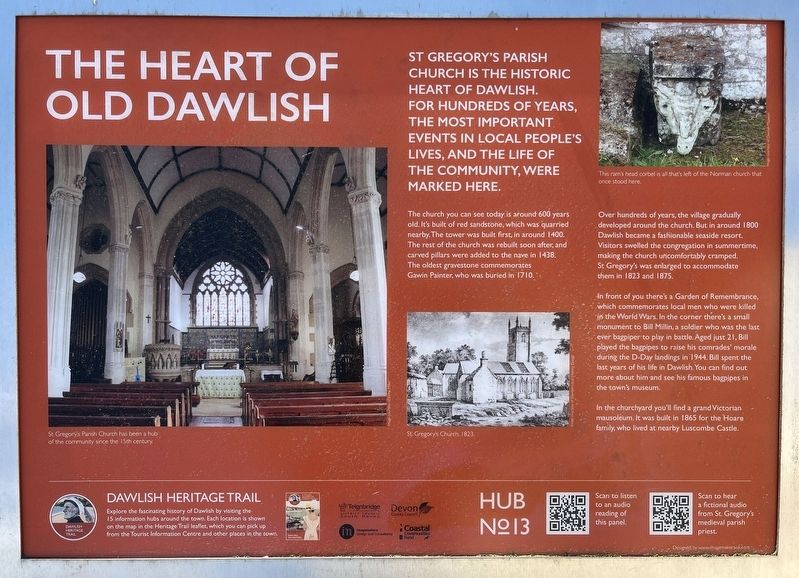
The Heart of Old Dawlish
| — | Dawlish Heritage Trail | — |
Photographed by Ray Gurganus, April 6, 2025
1. The Heart of Old Dawlish Marker
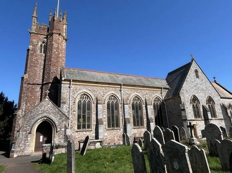
The church you can see today is around 600 years old. It's built of red sandstone, which was quarried nearby. The tower was built first, in around 1400. The rest of the church was rebuilt soon after, and carved pillars were added to the nave in 1438. The oldest gravestone commemorates Gawin Painter, who was buried in 1710.
Over hundreds of years, the village gradually developed around the church. But in around 1800 Dawlish became a fashionable seaside resort. Visitors swelled the congregation in summertime, making the church uncomfortably cramped. St Gregory's was enlarged to accommodate them in 1823 and 1875.
In front of you there's a Garden of Remembrance, which commemorates local men who were killed in the World Wars. In the corner there's a small monument to Bill Millin, a soldier who was the last ever bagpiper to play in battle. Aged just 21, Bill played the bagpipes to raise his comrades' morale during the D-Day landings in
this page online
In the churchyard you'll find a grand Victorian mausoleum. It was built in 1865 for the Hoare family, who lived at nearby Luscombe Castle.
Erected by Teignbridge District Council.
Topics. This historical marker is listed in these topic lists: Cemeteries & Burial Sites • Religion & Religious Structures. A significant historical year for this entry is 1400.
Location. 50° 34.799′ N, 3° 28.764′ W. Marker is in Dawlish, England, in Devon. It is on Church Street. Touch for map. Marker is at or near this postal address: 7 Church Street, Dawlish, England EX7, United Kingdom. Touch for directions.

Regionally, this marker is in South West England. Globally, it is on the Atlantic Ocean, in the North Atlantic Region, in Europe, in Atlantic Europe, on one of the British Isles, in the Western World, and in the Anglosphere. Historically, it finds itself in what was once the Roman Empire.
Other nearby markers. At least 8 other markers are within 18 kilometers of this marker, measured as the
Photographed by Ray Gurganus, April 6, 2025
2. St Gregory's Church
Credits. This page was last revised on May 28, 2025. It was originally submitted on May 24, 2025, by Ray Gurganus of Washington, District of Columbia. This page has been viewed 114 times since then and 17 times this year. Photos: 1, 2. submitted on May 24, 2025, by Ray Gurganus of Washington, District of Columbia. • Andrew Ruppenstein was the editor who published this page.
