Arlington in Calhoun County, Georgia — The American South (South Atlantic)
Hernando de Soto in Georgia
Photographed by David Seibert, January 24, 2010
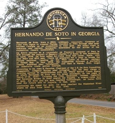
1. Hernando de Soto in Georgia Marker
De Soto’s success as a conquistador on Pizarro’s conquest of Peru in 1531 brought the support of Emperor Charles V of Spain in this expedition. In April, 1538, De Soto sailed for Cuba from San Lucar, Spain, with nine ships and 600 men. There he prepared for a year to invade the Florida mainland. Landing on the West Coast of Florida, perhaps at Tampa Bay, in May, 1539, the expedition followed a northerly course, wintered near Tallahassee, and then in March 1540, began an indefinite route across Georgia.
According to Dr. John R. Swanton, Chairman of the U.S. De Soto Expedition Commission, Alligator Spring, near Arlington, “has the best claims of existing springs to identification with the ‘White Spring’ (Fuente Blanca) at which Hernando de Soto and his army encamped on the night of March 17-18, 1540.” Crossing the Flint, Ocmulgee,
this page online
Continuing his quest for gold, De Soto reached the Mississippi river where he died from fever in May, 1542.
Erected 1966 by Georgia Historical Commission. (Marker Number 019-2.)
Topics and series. This historical marker is listed in these topic lists: Exploration • Indigenous Peoples and Communities. In addition, it is included in the Georgia Historical Society series list. A significant historical month for this entry is March 1540.
Location. 31° 26.503′ N, 84° 43.726′ W. Marker is in Arlington, Georgia, in Calhoun County. It is at the intersection of Morgan Road NW and Mayfair Road NW, on the right when traveling west on Morgan Road NW. The marker is located at the Lora Turner Bostwick Park. Touch for map. Marker is in this post office area: Arlington GA 39813, United States of America. Touch for directions.

Regionally, this marker is on the Coastal Plain. It is also in the American South and specifically in the Deep South. Globally,
Photographed by David Seibert, January 24, 2010
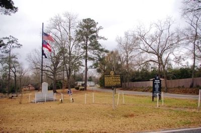
2. Hernando de Soto in Georgia Marker
Looking northwest, with Mayfair Road in the background
Other nearby markers. At least 8 other markers are within 13 miles of this marker, measured as the crow flies: Veterans Memorial (a few steps from this marker); The Lord's Acre (approx. 9.9 miles away); Weston C. Lee Veterans Memorial Park (approx. 10 miles away); Calhoun County (approx. 10.1 miles away); Milford Baptist Church Memorial (approx. 11.6 miles away); Kolomoki Mounds State Park 4 mi. (approx. 12 miles away); Oakland High School (approx. 12.4 miles away); Sutton's Crossroads (approx. 13 miles away).
Related markers. Click here for a list of markers that are related to this marker. To better understand the relationship, study each marker in the order shown.
Also see . . . De Soto. The New Georgia Encyclopedia article on De Soto. (Submitted on February 11, 2010, by David Seibert of Sandy Springs, Georgia.)
Photographed by David Seibert, January 24, 2010
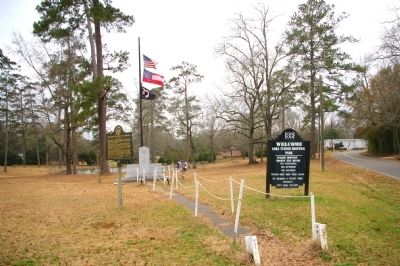
3. Hernando de Soto in Georgia Marker
Looking at the Lora Turner Bostwick Park, with the marker on the left on Morgan Road
Credits. This page was last revised on February 7, 2022. It was originally submitted on February 8, 2010, by David Seibert of Sandy Springs, Georgia. This page has been viewed 2,504 times since then and 80 times this year. Last updated on February 11, 2010, by David Seibert of Sandy Springs, Georgia. Photos: 1, 2, 3. submitted on February 8, 2010, by David Seibert of Sandy Springs, Georgia. • Kevin W. was the editor who published this page.
