
St Austell in Cornwall, England, United Kingdom — Northwestern Europe (the British Isles)
Charles Rashleigh

Photographed by Ray Gurganus, April 7, 2025
1. Charles Rashleigh Marker
Some years ago the slab was removed for safety reasons and erected on the opposite side of the cemetery. The lettering is now very worn but reads as follows: Underneath are deposited the remains of Charles Rashleigh Esquire who died 9th March 1823 aged 75 and of Grace his wife who died 19th May 1820 aged 75 and of Martha their daughter who died 24th Oct 1847 aged 66 years.
As founder of the port of Charlestown and a great benefactor to the town of St Austell and surrounding area, this plaque was placed here to mark the bicentenary of his death by St Austell Old Cornwall Society and the Charlestown History Group.
Erected 2023 by St Austell Old Cornwall Society.
Topics. This historical marker is listed in this
this page online
Location. 50° 20.338′ N, 4° 47.371′ W. Marker is in St Austell, England, in Cornwall. It can be reached from High Cross Street. Touch for map. Marker is at or near this postal address: 26 High Cross Street, St Austell, England PL25 4AN, United Kingdom. Touch for directions.

Regionally, this marker is in South West England. Globally, it is on the Atlantic Ocean, in the North Atlantic Region, on the Atlantic Arc, in Europe, on the Celtic Fringe, in Atlantic Europe, on one of the British Isles, in the Western World, and in the Anglosphere. Historically, it finds itself in what was once the Roman Empire.
Other nearby markers. At least 8 other markers are within 16 kilometers of this marker, measured as the crow flies: White Hart - Rashleigh's Town House (about 150 meters away, measured in a direct line); Bodmin Beacon (approx. 14.8 kilometers away); Bodmin Militia Stores Keep (approx. 15 kilometers away); U.S. Army 29th Infantry Division Memorial (approx. 15 kilometers away); Duke of Cornwall Light Infantry Memorial (approx. 15 kilometers
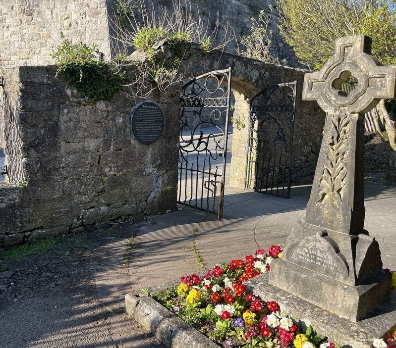
Photographed by Ray Gurganus, April 7, 2025
2. Charles Rashleigh Marker and the gate of the park
Credits. This page was last revised on May 27, 2025. It was originally submitted on May 27, 2025, by Ray Gurganus of Washington, District of Columbia. This page has been viewed 154 times since then and 29 times this year. Photos: 1, 2. submitted on May 27, 2025, by Ray Gurganus of Washington, District of Columbia. • Andrew Ruppenstein was the editor who published this page.
