Sharbot Lake in Central Frontenac in Frontenac County, Ontario — Central Canada (North America)
The K&P
The Railway Heritage Walkway Stop #4
Photographed by William Fischer, Jr.
1. The K&P Marker
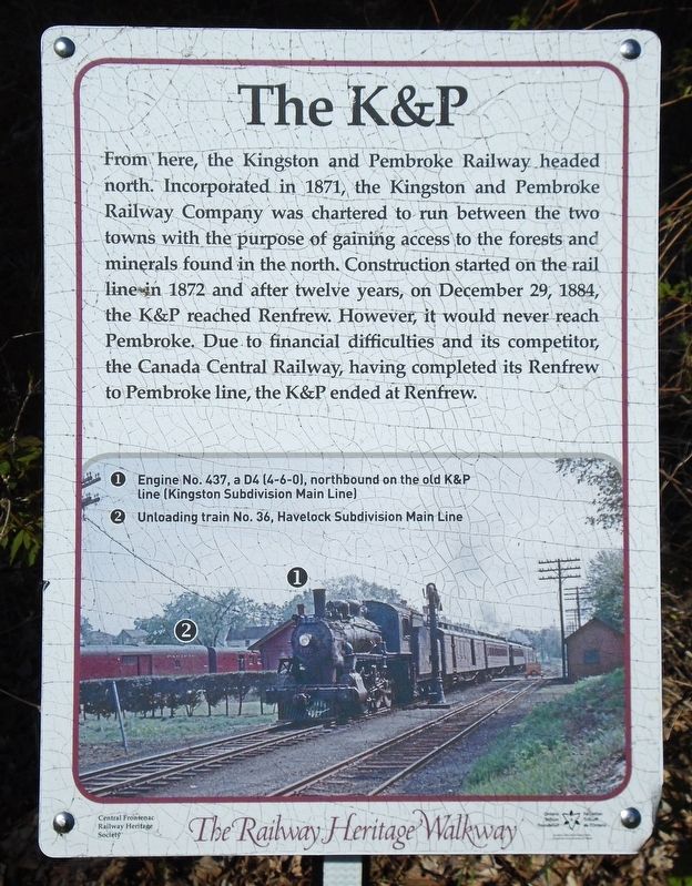
From here, the Kingston and Pembroke Railway headed north. Incorporated in 1871, the Kingston and Pembroke Railway Company was chartered to run between the two towns with the purpose of gaining access to the forests and minerals found in the north. Construction started on the rail line in 1872 and after twelve years, on December 29, 1884, the K&P reached Renfrew. However, it would never reach Pembroke. Due to financial difficulties and its competitor, the Canada Central Railway, having completed its Renfrew to Pembroke line, the K&P ended at Renfrew.
[Photo Legend reads]
①Engine No. 437, a D4 (4-6-0), northbound on the old K&P Line (Kingston Subdivision Main Line)
②Unloading [Canadian Pacific] train No. 36, Havelock Subdivision Main Line
Erected 2017 by Central Frontenac Railway Heritage Society and Ontario Trillium Foundation.
Topics and series. This historical marker is listed in these topic lists: Parks & Recreational Areas • Railroads & Streetcars. In addition, it is included in the Canada, Sharbot Lake ON Railway Heritage Walkway series list. A significant historical year for this entry is 1871.
Location. 44° 46.416′ N,
this page online

Regionally, this marker is in Eastern Ontario and specifically in Southeastern Ontario. It is also in Central Canada. Globally, it is in North America, on the Great Lakes, in the Western Hemisphere, in the Western World, and in the Anglosphere. Historically, it finds itself in what was once a British colony, the Viceroyalty of New France, the Haudenosaunee (Iroquois) Confederacy, and Rupert’s Land.
Other nearby markers. At least 8 other markers are within walking distance of this marker: The Station (a few steps from this marker); Section Car (within shouting distance of this marker); Iris versicolor (within shouting distance of this marker); Pump House (within shouting distance of this marker); Track Dolly (within shouting distance of this marker);
Photographed by William Fischer, Jr., May 12, 2025
2. The K&P Marker
Also see . . .
1. The Railway Heritage Walkway Tour. (Submitted on May 28, 2025, by William Fischer, Jr. of Reynoldsburg, Ohio.)
2. The Kingston and Pembroke Railway. (Submitted on May 28, 2025, by William Fischer, Jr. of Reynoldsburg, Ohio.)
Credits. This page was last revised on May 28, 2025. It was originally submitted on May 28, 2025, by William Fischer, Jr. of Reynoldsburg, Ohio. This page has been viewed 133 times since then and 27 times this year. Photos: 1, 2. submitted on May 28, 2025, by William Fischer, Jr. of Reynoldsburg, Ohio.
