Bernalillo in Sandoval County, New Mexico — The American Mountains (Southwest)
Las Montañas
⎯⎯⎯
The Mountains
Photographed by James Hulse, April 9, 2025
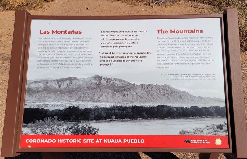
1. Las Montañas / The Mountains Marker

Las sierras sagradas Sandia y Manzano ofrecían muchos recursos para los Pueblos del Río Grande. Los enebros y los pinos crecían cerca de los picos. Se usaban los abetos para construir los tejados de los pueblos y las escaleras. También se podían encontrar alimentos como piñones y bayas ácidas del zumaque. Las montañas eran importantes para fines de defensa. Los Pueblos conocían las mejores fortalezas y escondites para evitar el ejército de Coronado en 1541 y 1542. Las sierras Sandia y Manzano todavía son importantes en la cultura Pueblo.
Seamos todos conscientes de nuestra responsabilidad de ser buenos administradores de la montaña y de estar atentos en nuestros esfuerzos para protegerla.
Subtítulos
(Foto #1) Una vista de las montañas Sandia desde el sitio histórico de Coronado, 1968. View of Sandia Mountains from Coronado Historic Site, 1968.
The sacred Sandia and Manzano mountains offered many resources for the Rio Grande Pueblos. Juniper and pine grew near the peaks; spruce trees were prized for making roofs and ladders. Foods included piñon nuts and the tangy berries of the three-leaf
this page online
"Let us all be mindful of our responsibility to be good stewards of the mountain and to be vigilant in our efforts to protect it."
Captions
(Photo #1) View of Sandia Mountains from Coronado Historic Site, 1968, Steven W. Donchue. Center for Southwest Research, University of New Mexico, PICT 2017-003-219
Erected by Coronado Historic Site Kuaua Pueblo and New Mexico Historic Sites.
Topics. This historical marker is listed in these topic lists: Horticulture & Forestry • Indigenous Peoples and Communities. A significant historical year for this entry is 1541.
Location. 35° 19.773′ N, 106° 33.403′ W. Marker is in Bernalillo, New Mexico, in Sandoval County. It is on Kuaua Road half a mile east of U.S. 550. The marker is located in the Kuaua Ruins (Coronado Historic Site. Touch for map. Marker is at or near this postal address: 485 Kuaua Rd, Bernalillo NM 87004, United States
Photographed by James Hulse, April 9, 2025
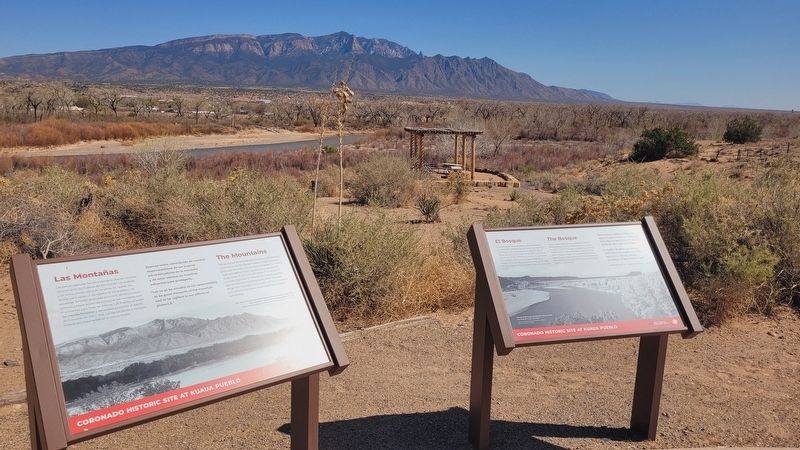
2. The Mountains Marker (left side)

Regionally, this marker is in the San Juan Basin and in Greater Albuquerque. It is also in the American Southwest and at the Four Corners. Globally, it is in North America, the Western Hemisphere, the Western World, and the Anglosphere. Historically, it finds itself in what was once New Spain, the territory of the Ancestral Puebloans, and the Republic of Texas.
Other nearby markers. At least 8 other markers are within walking distance of this marker: El Bosque / The Bosque (here, next to this marker); Recursos del desierto / Desert Resources (here, next to this marker); Cultivos y animales no nativos / Non-Native Crops and Animals (here, next to this marker); Cultivos y animales nativas / Native Crops and Animals (here, next to this marker); Agricultura Pueblo / Pueblo Agriculture (a few steps from this marker); Francisco Vasquez de Coronado (a few steps from this marker); Was Coronado Ever at Kuaua? (a few steps from this marker); El Pueblo de Kuaua / Kuaua Pueblo (a few steps from this marker). Touch for a list and map of all markers in Bernalillo.
More about this marker. There

Photographed by James Hulse, April 9, 2025
3. The view of the Rio Grande and Sandia Mountains
Also see . . . Coronado Historic Site. New Mexico Historic Sites
Coronado Historic Site and the ancient Kuaua Pueblo are located just minutes north of Albuquerque (off of I-25, Exit 242) in Bernalillo. In 1540, Francisco Vásquez de Coronado—with 500 soldiers and 2,000 Indigenous allies from New Spain—entered the Rio Grande valley somewhere near this site. Coronado was searching for the fabled Seven Cities of Gold.(Submitted on May 28, 2025, by James Hulse of Medina, Texas.)
Credits. This page was last revised on May 28, 2025. It was originally submitted on May 28, 2025, by James Hulse of Medina, Texas. This page has been viewed 104 times since then and 15 times this year. Photos: 1, 2, 3. submitted on May 28, 2025, by James Hulse of Medina, Texas.
