Mackinaw City in Cheboygan County, Michigan — The American Midwest (Great Lakes)
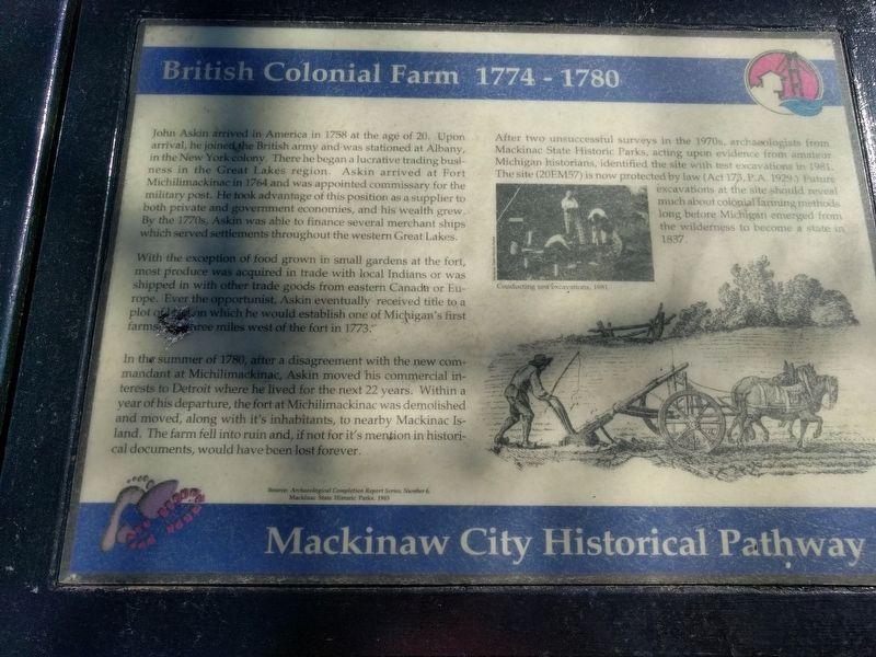
British Colonial Farm 1774 - 1780
Mackinaw City Historical Pathway
Photographed by Joel Seewald, June 7, 2019
1. British Colonial Farm 1774 - 1780 Marker
John Askin arrived in America in 1758 at the age of 20. Upon arrival, he joined the British army and was stationed at Albany, in the New York colony. There he began a lucrative trading business in the Great Lakes region. Askin arrived at Fort Michilimackinac in 1764 and was appointed commisary for the military post. He took advantage of this position as a supplier to both private and government economies, and his wealth grew. By the 1770s, Askin was able to finance several merchant ships which served settlements throughout the western Great Lakes.
With the exception of food grown in small gardens at the fort, most produce was acquired in trade with local Indians or was shipped in with other trade goods from eastern Canada or Europe. Ever the opportunist, Askin eventually received title to a plot of land on which he would establish one of Michigan's first farms...three miles west of the fort in 1773.
In the summer of 1780, after a disagreement with the new commandant at Michilimackinac, Askin moved his commercial interests to Detroit where he lived for the next 22 years. Within a year of his departure, the fort at
this page online
After two unsuccessful surveys in the 1970s, archaeologists from Mackinac State Historic Parks, acting upon evidence from amateur Michigan historians, identified the site with test excavations in 1981. The site (20EM57) is now protected by law (Act 173, P.A. 1929.) Future excavations at the site should reveal much about colonial farming methods long before Michigan emerged from the wilderness to become a state in 1837.
Source: Archaeological Completion Report Series, Number 6, Mackinac State Historic Parks, 1983 (Marker Number 39.)
Topics. This historical marker is listed in these topic lists: Colonial Era • Forts and Castles • Industry & Commerce. A significant historical year for this entry is 1758.
Location. This marker has been replaced by another marker nearby. It was located near 45° 46.904′ N, 84° 43.924′ W. Marker was in Mackinaw City, Michigan, in Cheboygan County. It was at the intersection of East Central
Photographed by Joel Seewald, June 7, 2019
2. British Colonial Farm 1774 - 1780 Marker
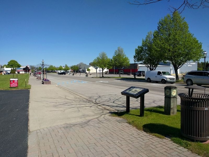
View looking east down East Central Avenue.

Regionally, this marker was in Northern Michigan Lower Peninsula, on the Straits of Mackinac, and in one of the Lake Huron Shore counties. It was also in the American Midwest. Globally, it was in North America, in the Great North Woods, on the Great Lakes, in the Western Hemisphere, in the Western World, and in the Anglosphere. Historically, it found itself in what was once the Northwest Territory.
Other nearby markers. At least 8 other markers are within walking distance of this location: British Colonial Farm, 1774 - 1780 (a few steps from this marker); Indians at the Straits (about 300 feet away, measured in a direct line); French House Ruin, 1765 - 1781 (about 300 feet away); a different marker also named French House Ruin (about 300 feet away); Hattie Stimpson 1875-1948 (about 500 feet away); Tourism at Mackinac (about 600 feet away); Missionaries at Mackinac (about 600 feet away); The Barnett Building (approx. 0.2 miles away). Touch for a list and map of all markers in Mackinaw City.
Another marker is no longer nearby. Tourism at Mackinac (was about 600 feet away but has been permanently removed).
Also see . . .
1. John Askin. Wikipedia article (Submitted on June 11, 2019, by Joel Seewald of Madison Heights, Michigan.)
2. Fort Michilimackinac. Wikipedia article (Submitted on June 11, 2019, by Joel Seewald of Madison Heights, Michigan.)
3. Archaeological Investigations at French Farm Lake in Northern Michigan 1981 – 1982. Internet Archive website entry:
Information about the report that is the source for the marker. (Submitted on June 11, 2019, by Joel Seewald of Madison Heights, Michigan.)
Credits. This page was last revised on May 28, 2025. It was originally submitted on June 11, 2019, by Joel Seewald of Madison Heights, Michigan. This page has been viewed 668 times since then and 45 times this year. Last updated on May 28, 2025, by Craig Doda of Napoleon, Ohio. Photos: 1, 2. submitted on June 11, 2019, by Joel Seewald of Madison Heights, Michigan. • Devry Becker Jones was the editor who published this page.
