
Jackson in Madison County, Tennessee — The American South (East South Central)
Union Occupations
Railroad Towns and Contrabands
| — | Forrest's First West Tennessee Raid | — |
Photographed by David Austin, May 29, 2025
1. Union Occupation Marker
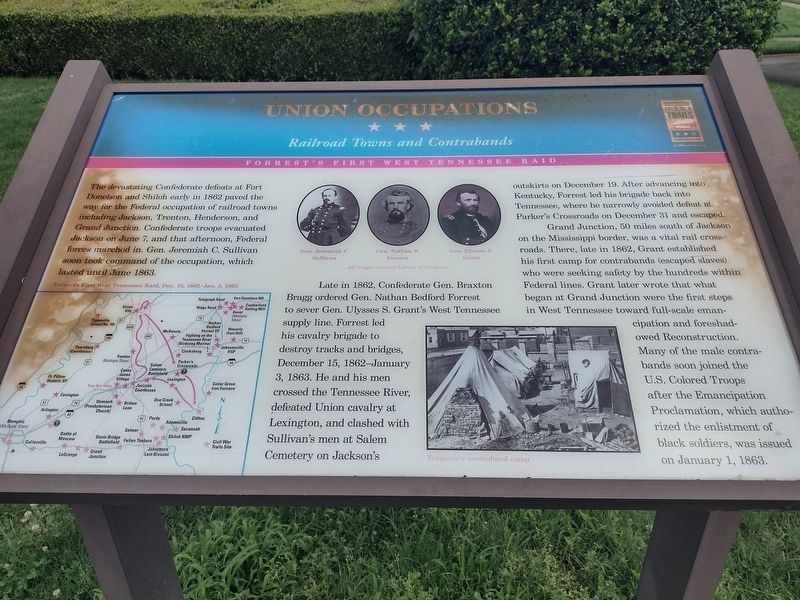
The devastating Confederate defeats at Fort Donelson and Shiloh early in 1862 paved the way for the Federal occupation of railroad towns including Jackson, Trenton, Henderson, and Grand Junction. Confederate troops evacuated Jackson on June 7, and that afternoon, Federal forces marched in. Gen. Jeremiah C. Sullivan soon took command of the occupation, which lasted until June 1863.
Late in 1862, Confederate Gen. Braxton Bragg ordered Gen. Nathan Bedford Forrest to sever Gen. Ulysses S. Grant's West Tennessee supply line. Forrest led his cavalry brigade to destroy tracks and bridges, December 15, 1862-January 3, 1863. He and his men crossed the Tennessee River, defeated Union cavalry at Lexington, and clashed with Sullivan's men at Salem Cemetery on Jackson's outskirts on December 19. After advancing into Kentucky, Forrest led his brigade back into Tennessee, where he narrowly avoided defeat at Parker's Crossroads on December 31 and escaped.
Grand Junction, 50 miles south of Jackson on the Mississippi border, was a vital rail crossroads. There, late in 1862, Grant established his first camp for contrabands (escaped
this page online
(captions)
Forrest's First West Tennessee Raid, Dec. 15,1862-Jan. 3, 1863
Gen. Jeremiah C. Sullivan • Gen. Nathan B. Forrest • Gen. Ulysses S. Grant All images courtesy Library of Congress
Temporary contraband camp
Erected by Tennessee Civil War Trails.
Topics and series. This historical marker is listed in this topic list: War, US Civil. In addition, it is included in the Tennessee Civil War Trails series list.
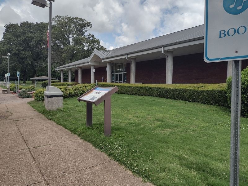
Location. 35° 37.691′ N, 88° 58.062′ W. Marker is in Jackson, Tennessee, in Madison County. It is on Interstate 40 1.1 miles west of Lower Brownsville Road, on the right when traveling west. Located at the I-40 West Rest Area. Touch for map. Marker is in this
Photographed by David Austin, May 29, 2025
2. Union Occupation Marker

Regionally, this marker is in West Tennessee. It is also in the American South, specifically in the Deep South, and specifically in the Upper South. Globally, it is in North America, the Western Hemisphere, the Western World, and the Anglosphere. Historically, it finds itself in what was once the territory of the Mississippian Culture, one of the Confederate States of America, and the Antebellum South.
Other nearby markers. At least 8 other markers are within 7 miles of this marker, measured as the crow flies: Holding The Railroads (approx. 0.6 miles away); John Murrell (approx. 2.3 miles away); Campbell's Levee Bridge (approx. 6.6 miles away); Jackson (approx. 6.6 miles away); Carl Lee Perkins (approx. 6.7 miles away); Home of Casey Jones (approx. 6.7 miles away); Haywood County / Madison County (approx. 6.7 miles away); Reelfoot and Laughing Eyes (approx. 6.7 miles away). Touch for a list and map of all markers in Jackson.
Another marker is no longer nearby. Port Jackson (was approx. 6.4 miles away but has been confirmed missing).
Credits. This page was last revised on June 2, 2025. It was originally submitted on May 29, 2025, by David Austin of Scotts Hill, Tennessee. This page has been viewed 160 times since then and 19 times this year. Photos: 1, 2. submitted on May 29, 2025, by David Austin of Scotts Hill, Tennessee. • Bernard Fisher was the editor who published this page.
