Cheboygan in Cheboygan County, Michigan — The American Midwest (Great Lakes)
Cabin at Indian Point

Photographed by Craig Doda, May 25, 2025
1. Cabin at Indian Point Marker
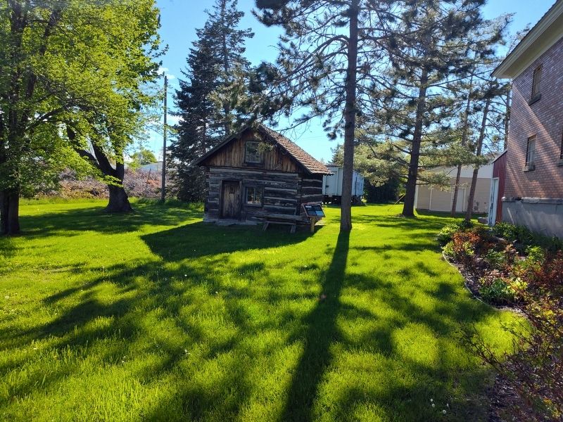
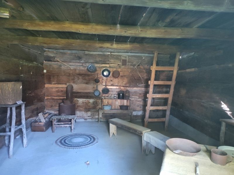
This style of home was taught to the Annishinaabe (Ottawa, Ojibway and Potawatomi) by the missionaries to help them assimilate into Western culture. Following the Burn-Out, Frank Mundt moved this cabin to his farm. He used it as an ice house, then later for storage. In 1972, the Mundts donated the cabin to the Cheboygan County Historical Society and it was moved to this location. it was renovated with a cement floor, and portions of it repaired so it could be properly displayed.
The cabin that you are looking at is believed to be one that survived the Burn-Out of the Burt Lake Band at Indian Point. On October 15, 1900 the Native community was removed from their property over tax disputes by Sheriff Fred Ming and ten deputies at the request of land developer, John McGinn.
Topics. This historical marker is listed in these topic lists: Architecture • Indigenous Peoples and Communities • Religion & Religious Structures. A significant historical date for this entry is October 15, 1900.
Location. 45° 38.356′ N, 84° 28.983′ W. Marker is in Cheboygan, Michigan, in Cheboygan County. It is at the intersection of South Huron Street
this page online

Regionally, this marker is in Northern Michigan Lower Peninsula, on the Straits of Mackinac, and in one of the Lake Huron Shore counties. It is also in the American Midwest. Globally, it is in North America, in the Great North Woods, on the Great Lakes, in the Western Hemisphere, in the Western World, and in the Anglosphere. Historically, it finds itself in what was once the Northwest Territory.
Other nearby markers. At least 8 other markers are within walking distance of this marker: Jail and Sheriff's Residence (within shouting distance of this marker); Old Cheboygan County Courthouse (within shouting distance of this marker); Jacob J. Post House (approx. 0.2 miles away); Gold Star Families (approx. 0.2 miles away); Veterans Memorial Park (approx. 0.2 miles away); Combat Wounded Veterans (approx. ¼ mile away); Inland Waterway (approx. 0.3 miles away); North Central State Trail (approx. 0.3 miles away). Touch for a list and map
Photographed by Craig Doda, May 25, 2025
2. Cabin at Indian Point Marker
Photographed by Craig Doda, May 25, 2025
3. Cabin at Indian Point
Credits. This page was last revised on May 29, 2025. It was originally submitted on May 29, 2025, by Craig Doda of Napoleon, Ohio. This page has been viewed 138 times since then and 19 times this year. Photos: 1, 2, 3. submitted on May 29, 2025, by Craig Doda of Napoleon, Ohio. • Devry Becker Jones was the editor who published this page.
