Sharbot Lake in Central Frontenac in Frontenac County, Ontario — Central Canada (North America)
The Causeway
The Railway Heritage Walkway Tour Stop #11
Photographed by William Fischer, Jr., May 12, 2025
1. The Causeway Marker
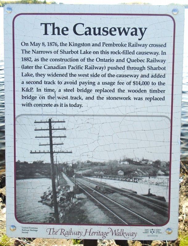
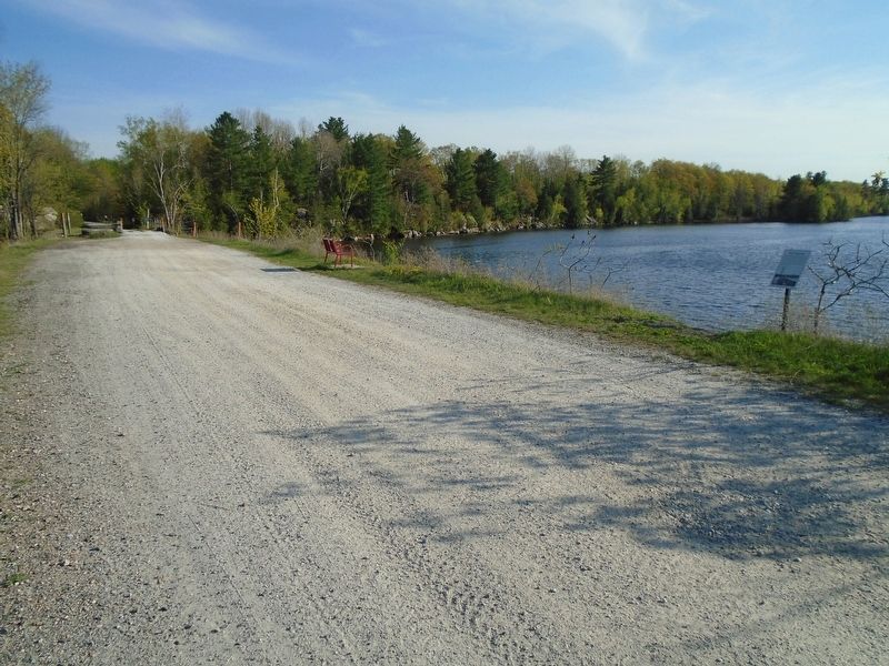
On May 8, 1876, the Kingston and Pembroke Railway crossed The Narrows of Sharbot Lake on this rock-filled causeway. In 1882, as the construction of the Ontario and Quebec Railway (later the Canadian Pacific Railway) pushed through Sharbot Lake, they widened the west side of the causeway and added a second track to avoid paying a usage fee of $14,000 to the K&P. In time, a steel bridge replaced the wooden timber bridge on the west track, and the stonework was replaced with concrete as it is today.
Erected 2017 by Central Frontenac Railway Heritage Society and Ontario Trillium Foundation.
Topics and series. This historical marker is listed in these topic lists: Railroads & Streetcars • Waterways & Vessels. In addition, it is included in the Canada, Sharbot Lake ON Railway Heritage Walkway series list. A significant historical date for this entry is May 8, 1876.
Location. 44° 46.001′ N, 76° 41.404′ W. Marker is in Central Frontenac, Ontario, in Frontenac County. It is in Sharbot Lake. It is on the K&P Trail, on the right when traveling south. Marker is along the Causeway, about 0.15 kms south of the health center. Touch for map.
this page online

Regionally, this marker is in Eastern Ontario and specifically in Southeastern Ontario. It is also in Central Canada. Globally, it is in North America, on the Great Lakes, in the Western Hemisphere, in the Western World, and in the Anglosphere. Historically, it finds itself in what was once a British colony, the Viceroyalty of New France, the Haudenosaunee (Iroquois) Confederacy, and Rupert’s Land.
Other nearby markers. At least 8 other markers are within walking distance of this marker: Benton's Cut (about 90 meters away, measured in a direct line); Simon Whitfield (about 180 meters away); First Station (about 210 meters away); St. Andrew's Anglican Church Wall Garden (approx. 0.4 kilometers away); Veterans Memorial (approx. half a kilometer away); The Railway's Influence (approx. half a kilometer away); The Final Journey (approx. half a kilometer away); Order Board (approx. 0.6 kilometers away). Touch for a list and map of all markers in Central Frontenac.
Also see . . . The Railway Heritage Walkway Tour.
Photographed by William Fischer, Jr., May 12, 2025
2. The Causeway and Marker

Photographed by William Fischer, Jr., May 12, 2025
3. The Causeway
Credits. This page was last revised on May 29, 2025. It was originally submitted on May 29, 2025, by William Fischer, Jr. of Reynoldsburg, Ohio. This page has been viewed 101 times since then and 23 times this year. Photos: 1, 2, 3. submitted on May 29, 2025, by William Fischer, Jr. of Reynoldsburg, Ohio.
