Pasadena in Los Angeles County, California — The American West (Pacific Coastal)
Eaton Canyon
| — | Eaton Fire | — |
Photographed by Craig Baker, May 26, 2025
1. Eaton Canyon Marker
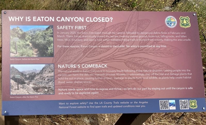
Why is Eaton Canyon Closed?
Safety First
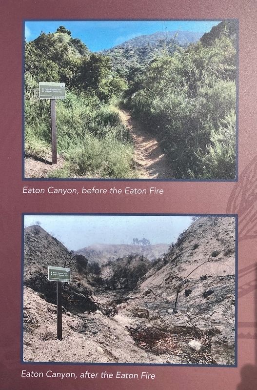
In January 2025, the Eaton Fire swept through the canyon, followed by dangerous debris flows in February and March. These forces dramatically altered the terrain, creating uneven ground, loose soil, falling rocks, and fallen trees. Mud, boulders, and debris have either reshaped hiking trails or buried them entirely, making the area unsafe.
For these reasons, Eaton Canyon is closed to the public. No entry is permitted at any time.
Nature’s Comeback
The natural world in Eaton Canyon is in recovery mode following these natural disasters. Letting people into the canyon can harm the delicate regrowth process. It's easy to unknowingly step off the trail and damage plants that hold the soil in place, causing further erosion. Damage to plants hurts local wildlife, as plants help create habitat (food, water, shelter, space).
Nature needs space and time to regrow and thrive — so let's do our part by staying out until the canyon is safe and ready to be explored again!
Want to explore safely? Use the LA County Trails website or the Angeles National
this page online
Erected 2025 by County of Los Angeles, and U.S. Forest Service.
Topics. This historical marker is listed in these topic lists: Disasters • Parks & Recreational Areas.
Location. 34° 10.588′ N, 118° 5.908′ W. Marker is in Pasadena, California, in Los Angeles County. It is on Altadena Drive 0.1 miles north of New York Drive, on the right when traveling north. Touch for map. Marker is at or near this postal address: 1750 N Altadena Dr, Pasadena CA 91107, United States of America. Touch for directions.

Regionally, this marker is in Greater Los Angeles and in the Transverse Ranges. It is also on the American Pacific Coast. Globally, it is in North America, on the Ring of Fire, on the Pacific Rim, in the Western Hemisphere, in the Western World, and in the Anglosphere. Historically, it finds itself in what was once New Spain and also Mexico’s Alta California.
Other nearby markers. At least 8 other markers are within 2 miles of this marker, measured as the crow flies: Many People of Eaton Canyon (about
Photographed by Craig Baker, May 26, 2025
2. Eaton Canyon
Before & After the Eaton Fire
More about this marker. Identical markers are located at other trailheads in the area.
Regarding Eaton Canyon. The Eaton Canyon Nature Center was destroyed by the 2025 Eaton Fire. It had been rebuilt in 1998 after it was destroyed by the 1993 Kinneloa Fire.
Also see . . .
1. L.A. County Trails. Website featured as a QR code on the marker. (Submitted on May 30, 2025.)
2. Angeles National Forest. Website featured as a QR code on the marker. (Submitted on May 30, 2025.)
Additional keywords. Southern California Wildfires, Eaton Fire
Photographed by Craig Baker, May 26, 2025
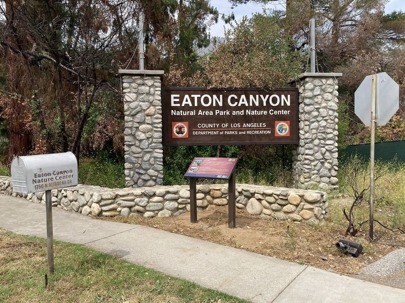
3. Eaton Canyon Marker
Photographed by Craig Baker, May 26, 2025
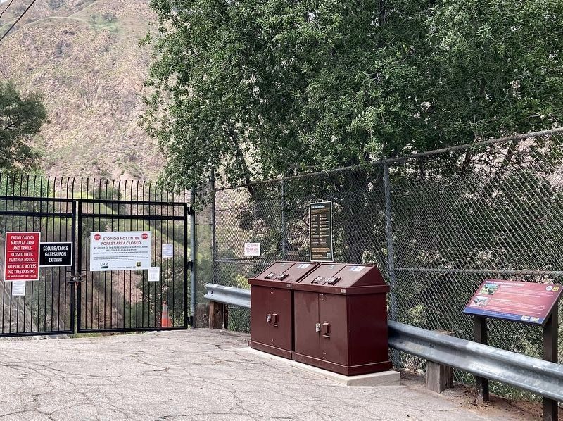
4. Identical Marker
Located 1¼ miles north, at Pinecrest Gate.
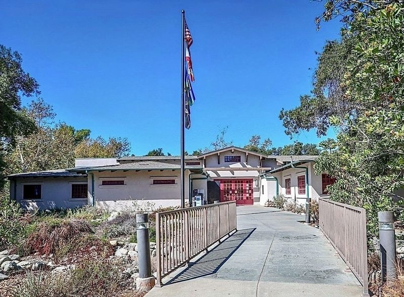
courtesy L.A. County Parks
5. Eaton Canyon Nature Center
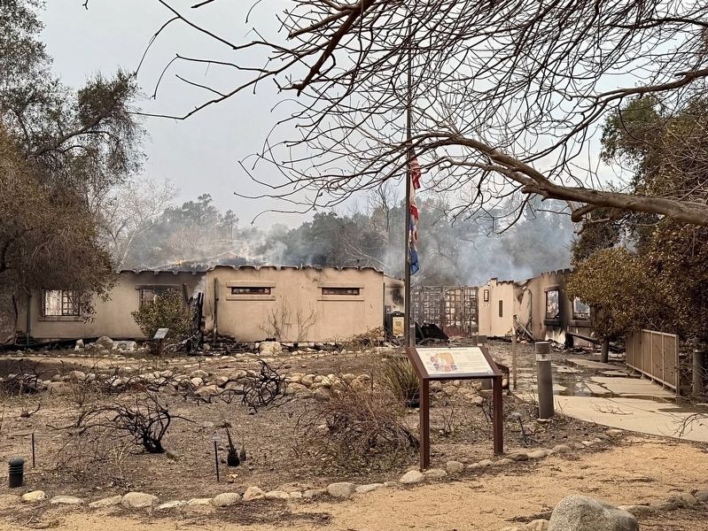
courtesy L.A. County, January 2025
6. Eaton Canyon Nature Center
Destroyed by the Eaton Fire in 2025.
Credits. This page was last revised on August 2, 2026. It was originally submitted on May 30, 2025, by Craig Baker of Sylmar, California. This page has been viewed 179 times since then and 28 times this year. Photos: 1, 2, 3, 4. submitted on May 30, 2025, by Craig Baker of Sylmar, California. 5. submitted on January 17, 2025, by Craig Baker of Sylmar, California. 6. submitted on January 22, 2025, by Craig Baker of Sylmar, California.
