
Mount Gretna in Lebanon County, Pennsylvania — The American Northeast (Mid-Atlantic)
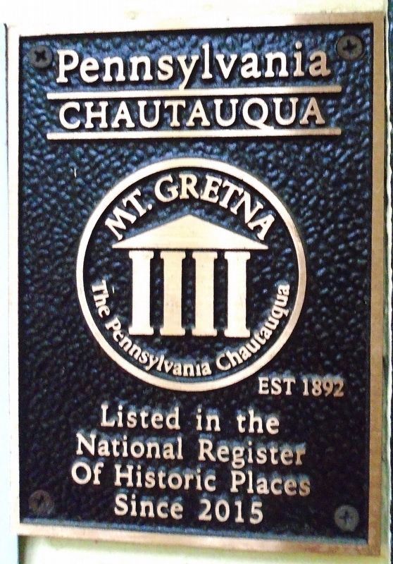
Chautauqua Literary and Scientific Circle Building 1902
The Pennsylvania Chautauqua, Est 1892
| — | Mount Gretna | — |
Photographed by William Fischer, Jr., May 24, 2025
1. Chautauqua Literary and Scientific Circle Building 1902 Marker
National Register of Historic Places Registration Form form the Pennsylvania Chautauqua Historic District
Click for more information.
Click for more information.
Listed in the
National Register
Of Historic Places
Since 2015
Topics and series. This historical marker is listed in these topic lists: Education • Parks & Recreational Areas • Religion & Religious Structures. In addition, it is included in the National Register of Historic Places (NRHP) series list. A significant historical year for this entry is 1892.
Location. 40° 14.863′ N, 76° 28.312′ W. Marker is in Mount Gretna, Pennsylvania, in Lebanon County. It is on Carnegie Avenue south of Mount Gretna Road (Pennsylvania Route 117), on the left when traveling north. Touch for map. Marker is at or near this postal address: 1 Carnegie Avenue, Mount Gretna PA 17064, United States of America. Touch for directions.

Regionally, this marker is in South-Central Pennsylvania, specifically in Pennsylvania Dutch Country, and in Greater Harrisburg. It is also in the American Northeast, in the Mid-Atlantic, in Appalachia, and specifically in Northern Appalachia. Globally, it is in North America, the Western Hemisphere, the Western World, and the Anglosphere. Historically, it finds itself in what was once the Haudenosaunee
this page online
Other nearby markers. At least 8 other markers are within walking distance of this marker: Original Post Office (within shouting distance of this marker); The Pennsylvania Chatauqua (about 300 feet away, measured in a direct line); Library (about 700 feet away); Mount Gretna Campmeeting (about 700 feet away); Site of the 1949 Campmeeting Fire (approx. ¼ mile away); Mt. Gretna Tabernacle (approx. ¼ mile away); 511 2nd Street (approx. ¼ mile away); 603 1st Street (approx. ¼ mile away). Touch for a list and map of all markers in Mount Gretna.
More about this marker. National Register Historic District Registration Form excerpt:
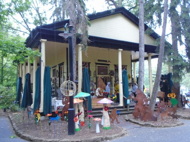
The third of Mount Gretna’s “trifecta” of still-in-use public buildings is known today as the Emporium (photo 27). Erected in 1902 it was once described by historian Jack Bitner as a “rustic Greek temple.”16 Actually it is a two-story Craftsman/Greek Revival building with a wide porch on two sides, a gable roof with pediment, and fourteen Ionic columns. Intended to provide classrooms and reading space for the Chautauqua Literary and
Photographed by William Fischer, Jr., May 24, 2025
2. Chautauqua Literary and Scientific Circle Building
Also see . . . Mt. Gretna, Pennsylvania. Wikipedia entry (Submitted on June 28, 2025, by Larry Gertner of New York, New York.)

Photographed by William Fischer, Jr., May 24, 2025
3. Chautauqua Literary and Scientific Circle Building Sign
Credits. This page was last revised on June 28, 2025. It was originally submitted on May 30, 2025, by William Fischer, Jr. of Reynoldsburg, Ohio. This page has been viewed 326 times since then and 139 times this year. Photos: 1, 2, 3. submitted on May 30, 2025, by William Fischer, Jr. of Reynoldsburg, Ohio.
