Near Marietta in Cobb County, Georgia — The American South (South Atlantic)
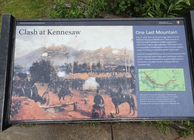
Clash at Kennesaw
One Last Mountain
| — | Kennesaw Mountain National Battlefield Park | — |
Photographed by Mark Parker, May 10, 2025
1. Clash at Kennesaw Marker
Today the National Park Service protects and maintains this hallowed ground where Union and Confederate soldiers battled — from the feint attack here against Big Kennesaw Mountain to the major assaults on Pigeon Hill and Cheatham Hill.
(caption) "The Battle of Kennesaw Mountain" (left) by Thure de Thulstrup, depicts Sherman's feint attack against Confederate positions on Big Kennesaw Mountain. Meanwhile, assaults at Pigeon Hill and Cheatham Hill attempted to split the Confederate line.
Erected by National Park Service, U.S. Department of the Interior.
Topics. This historical marker is listed in this topic list: War, US Civil. A significant historical date for this entry is June 27, 1864.
Location. 33° 58.992′ N, 84° 34.701′ W. Marker is near Marietta, Georgia, in Cobb County. It is at the intersection of Kennesaw
this page online

Regionally, this marker is in Georgia’s Piedmont and in Metro Atlanta. It is also in the American South and specifically in the Deep South. Globally, it is in North America, the Western Hemisphere, the Western World, and the Anglosphere. Historically, it finds itself in what was once the original Cherokee Nation, the territory of the Mississippian Culture, one of the original Thirteen Colonies, one of the Confederate States of America, and the Antebellum South.
Other nearby markers. At least 8 other markers are within walking distance of this marker: A Grim and Silent Kennesaw (a few steps from this marker); Lining Up for Death (within shouting distance of this marker); Eyes for the Armies (about 600 feet away, measured in a direct line); Georgia Monument (about
Photographed by Mark Parker, May 10, 2025
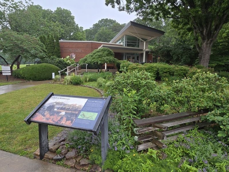
2. Clash at Kennesaw Marker at the Kennesaw Mountain National Battlefield Park Visitor's Center
Another marker is no longer nearby. Clash at Kennesaw (has been replaced with this marker).
Related marker. Click here for another marker that is related to this marker. Old Marker At This Location also titled "Clash at Kennesaw".
Also see . . .
1. Kennesaw Mountain National Battlefield Park. The Road Past Kennesaw: The 1864 Atlanta Campaign
The attacking brigades moved into position before dawn on June 27. At 8 am, after an artillery bombardment, they surged forward. Both attacks were brief, bloody failures. Astride Burnt Hickory Road three Union brigades totaling 5,500 men crossed swampy, heavily wooded terrain. Before they could reach their objective—a mountain spur today called Pigeon Hill—sheets of fire drove them under cover. From Little Kennesaw and Pigeon Hill, Confederates rolled rocks down on the Union soldiers. Sherman recalled the attack when he saw that it could not succeed.(Submitted on May 31, 2025, by Mark Parker of Hickory, North Carolina.)
Meanwhile, on a hill south of Dallas Road (now Dallas Highway), 8,000 Union infantrymen attacked two entrenched divisions of Johnston's army. Many in the assaulting waves were shot down. Some advanced to close quarters, and for a few minutes brutal hand-to-hand fighting occurred on top of the defenders' earthworks. Both sides grimly nicknamed this place the "Dead Angle."
2. Kennesaw Mountain National Battlefield Park. National Park Service (Submitted on June 2, 2025.)
Credits. This page was last revised on June 2, 2025. It was originally submitted on May 31, 2025, by Mark Parker of Hickory, North Carolina. This page has been viewed 213 times since then and 55 times this year. Photos: 1, 2. submitted on May 31, 2025, by Mark Parker of Hickory, North Carolina. • Bernard Fisher was the editor who published this page.
